Tandzaver
Տանձավեր | |
|---|---|
 Saint Hripsime Church in Tandzaver | |
 Tandzaver  Tandzaver | |
| Coordinates: 39°21′01″N 46°19′42″E / 39.35028°N 46.32833°E | |
| Country | |
| Province | Syunik |
| Municipality | Kapan |
| Area | |
• Total | 3.72 km2 (1.44 sq mi) |
| Population | |
• Total | 211 |
| • Density | 57/km2 (150/sq mi) |
| Time zone | UTC+4 (AMT) |
Tandzaver (Armenian: Տանձավեր) is a village in the Kapan Municipality of the Syunik Province in Armenia.
Demographics
[edit]The Statistical Committee of Armenia reported its population was 212 in 2010,[3] down from 263 at the 2001 census.[4]
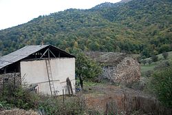
Gallery
[edit]-
 WWII memorial
 -
 Church


References
[edit]Wikimedia Commons has media related to Tandzaver.
- ^ "Syunik regional e-Governance System" (in Armenian). Syunik Province provincial government. Click on link entitled "Համայնքներ" (community) and search for the place by Armenian name.
- ^ Statistical Committee of Armenia. "The results of the 2011 Population Census of Armenia" (PDF).
- ^ "Marzes of Armenia and Yerevan City in Figures, 2010" (PDF). Statistical Committee of Armenia.
- ^ Report of the results of the 2001 Armenian Census, Statistical Committee of Armenia

This article about a location in Syunik Province, Armenia is a stub. You can help Wikipedia by expanding it. |