Thọ Xuân district
You can help expand this article with text translated from the corresponding article in Vietnamese. (May 2016) Click [show] for important translation instructions.
- View a machine-translated version of the Vietnamese article.
- Machine translation, like DeepL or Google Translate, is a useful starting point for translations, but translators must revise errors as necessary and confirm that the translation is accurate, rather than simply copy-pasting machine-translated text into the English Wikipedia.
- Consider adding a topic to this template: there are already 953 articles in the main category, and specifying
|topic=will aid in categorization. - Do not translate text that appears unreliable or low-quality. If possible, verify the text with references provided in the foreign-language article.
- You must provide copyright attribution in the edit summary accompanying your translation by providing an interlanguage link to the source of your translation. A model attribution edit summary is
Content in this edit is translated from the existing Vietnamese Wikipedia article at [[:vi:Thọ Xuân]]; see its history for attribution. - You may also add the template
{{Translated|vi|Thọ Xuân}}to the talk page. - For more guidance, see Wikipedia:Translation.
District in North Central Coast, Vietnam
Thọ Xuân district Huyện Thọ Xuân | |
|---|---|
 Statue of a tiger from the Lê Lợi mausoleum | |
| Country |  Vietnam Vietnam |
| Region | North Central Coast |
| Province | Thanh Hóa |
| Area | |
| • Total | 233 sq mi (603 km2) |
| Population (2018) | |
| • Total | 233,752 |
| Time zone | UTC+7 (UTC + 7) |
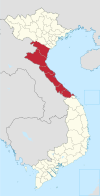
Thọ Xuân is a district (huyện) of Thanh Hóa province in the North Central Coast region of Vietnam.
As of 2003 the district had a population of 233,603.[1] The district covers an area of 603 km². The district capital lies at Lam Sơn.[1]
Climate
| Climate data for Bái Thượng, Thọ Xuân District | |||||||||||||
|---|---|---|---|---|---|---|---|---|---|---|---|---|---|
| Month | Jan | Feb | Mar | Apr | May | Jun | Jul | Aug | Sep | Oct | Nov | Dec | Year |
| Record high °C (°F) | 33.6 (92.5) | 36.2 (97.2) | 37.7 (99.9) | 40.5 (104.9) | 41.5 (106.7) | 41.5 (106.7) | 40.5 (104.9) | 39.0 (102.2) | 37.4 (99.3) | 35.4 (95.7) | 36.2 (97.2) | 34.3 (93.7) | 41.5 (106.7) |
| Mean daily maximum °C (°F) | 20.7 (69.3) | 21.5 (70.7) | 24.0 (75.2) | 28.3 (82.9) | 32.1 (89.8) | 33.4 (92.1) | 33.5 (92.3) | 32.3 (90.1) | 31.1 (88.0) | 28.9 (84.0) | 26.1 (79.0) | 22.6 (72.7) | 27.9 (82.2) |
| Daily mean °C (°F) | 16.9 (62.4) | 18.0 (64.4) | 20.4 (68.7) | 24.1 (75.4) | 27.0 (80.6) | 28.5 (83.3) | 28.5 (83.3) | 27.8 (82.0) | 26.7 (80.1) | 24.6 (76.3) | 21.5 (70.7) | 18.2 (64.8) | 23.6 (74.5) |
| Mean daily minimum °C (°F) | 14.3 (57.7) | 15.8 (60.4) | 18.2 (64.8) | 21.4 (70.5) | 23.8 (74.8) | 25.3 (77.5) | 25.3 (77.5) | 24.9 (76.8) | 23.9 (75.0) | 21.7 (71.1) | 18.4 (65.1) | 15.2 (59.4) | 20.7 (69.3) |
| Record low °C (°F) | 2.6 (36.7) | 5.7 (42.3) | 6.9 (44.4) | 12.3 (54.1) | 16.3 (61.3) | 19.9 (67.8) | 21.1 (70.0) | 21.5 (70.7) | 17.3 (63.1) | 13.5 (56.3) | 8.1 (46.6) | 1.0 (33.8) | 1.0 (33.8) |
| Average precipitation mm (inches) | 28.9 (1.14) | 27.2 (1.07) | 47.2 (1.86) | 87.6 (3.45) | 248.2 (9.77) | 249.0 (9.80) | 244.0 (9.61) | 338.7 (13.33) | 329.6 (12.98) | 219.0 (8.62) | 84.3 (3.32) | 24.7 (0.97) | 1,938.5 (76.32) |
| Average rainy days | 10.9 | 11.8 | 14.9 | 14.5 | 17.3 | 16.0 | 15.9 | 18.0 | 14.5 | 11.7 | 8.4 | 6.8 | 161.5 |
| Average relative humidity (%) | 86.6 | 87.6 | 88.9 | 88.4 | 85.2 | 83.7 | 83.7 | 86.5 | 86.0 | 84.8 | 83.1 | 83.5 | 85.7 |
| Mean monthly sunshine hours | 78.1 | 57.6 | 58.2 | 95.1 | 153.6 | 154.3 | 164.1 | 160.1 | 152.5 | 145.1 | 130.4 | 99.8 | 1,448.9 |
| Source: Vietnam Institute for Building Science and Technology[2] | |||||||||||||
References
- ^ a b "Districts of Vietnam". Statoids. Retrieved March 19, 2009.
- ^ "Vietnam Institute for Building Science and Technology" (PDF). Retrieved 16 August 2023.
19°55′01″N 105°30′00″E / 19.917°N 105.500°E / 19.917; 105.500
- v
- t
- e
Districts of Vietnam North Central Coast
- Đồng Hới city※
- Ba Đồn town
- Bố Trạch
- Lệ Thủy
- Minh Hóa
- Quảng Ninh
- Quảng Trạch
- Tuyên Hóa
- Huế city※
- Hương Thủy town
- Hương Trà town
- A Lưới
- Nam Đông
- Phong Điền
- Phú Lộc
- Phú Vang
- Quảng Điền
※ denotes provincial seat.
 | This article about a location in Thanh Hóa Province, Vietnam is a stub. You can help Wikipedia by expanding it. |
- v
- t
- e


