Vang, Hedmark
Former municipality in Hedmark, Norway
Former municipality in Hedmark, Norway
Vang Municipality Vang herred | |
|---|---|
 View of the local Vang Church | |
 Hedmark within Norway | |
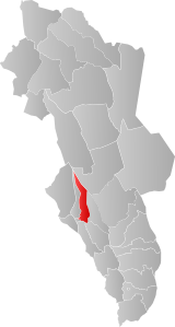 Vang within Hedmark | |
| Coordinates: 60°48′17″N 11°06′28″E / 60.8048°N 11.1078°E / 60.8048; 11.1078 | |
| Country | Norway |
| County | Hedmark |
| District | Hedmarken |
| Established | 1 Jan 1838 |
| • Created as | Formannskapsdistrikt |
| Disestablished | 1 Jan 1992 |
| • Succeeded by | Hamar Municipality |
| Administrative centre | Ridabu |
| Government | |
| • Mayor (1988-1991) | Odd Aspeli (Ap) |
| Area (upon dissolution) | |
| • Total | 327 km2 (126 sq mi) |
| Population (1992) | |
| • Total | 9,103 |
| • Density | 28/km2 (72/sq mi) |
| Demonym | Vangssokning[1] |
| Official language | |
| • Norwegian form | Bokmål |
| Time zone | UTC+01:00 (CET) |
| • Summer (DST) | UTC+02:00 (CEST) |
| ISO 3166 code | NO-0414[3] |
Data from Statistics Norway | |
Vang is a former municipality in the old Hedmark county, Norway. The 327-square-kilometre (126 sq mi) municipality existed from 1838 until its dissolution in 1992 when it became part of Hamar Municipality. The administrative centre of the municipality was at Fredvang. This site, however became part of the town of Hamar in 1946, so after that time, the municipal administration was actually located outside the municipal borders in the neighboring municipality. The main church for the municipality was Vang Church in the village of Ridabu.[4][5]
Gåsbu Ski Center lies in Vang Almenning, and has served as the backup venue for the Holmenkollrennene. This arena has been described as the cradle of all Nordic ski competition, with more than 112 years of international ski competition. The national cross-country skiing championship was last held here in 2002.
General information
The historic prestegjeld of Vang was established as a municipality on 1 January 1838 (see formannskapsdistrikt law). In 1848, the village of Hamar was granted kjøpstad status for a land area of about 400 decares (99 acres). This newly designated "town" (population: 1,025) was separated from Vang to become a separate municipality in 1849. This left Vang with 7,820 residents. On 1 January 1878, the town of Hamar was enlarged by annexing about 800 decares (200 acres) of land and 138 people from Vang to Hamar. In 1891, the western district of Vang (population: 3,790) was separated from Vang to become the new municipality of Furnes. This left Vang with 5,703 residents. In 1946, a large area in Vang that surrounded the town of Hamar (population: 4,087) was transferred out of Vang and into Hamar. On 13 July 1956, the parts of Vang located south of the Åkersvika bay (population: 24) were transferred to Stange Municipality.[6][4]
On 1 January 1964, the Hamarsberget and Vikersødegården exclave areas of Vang (population: 34) were transferred to the neighboring Ringsaker Municipality. On 1 January 1967 there was a municipal land swap between Vang and Ringsaker. The 500-decare (120-acre) Stav, Valsigsvea, and Arnkvern Nedre areas of Vang (population: 50) was transferred to Ringsaker Municipality and the 450-decare (110-acre) Stensby and Holmlund areas of Ringsaker (population: 114) was transferred to Vang. On 1 January 1992, the municipality of Vang (population: 9,103) was merged with the town of Hamar (population: 16,351) and parts of the Stensby, Hanstad, Viker, and Stammerud areas of Ringsaker (population: 224) to form the new Hamar Municipality.[7][4]
Name
The municipality (originally the parish) is named after the old Vang farm (Old Norse: Vangr) since the first Vang Church was built there. The name is identical to the word vangr which means "meadow" or "field". Since the municipal consolidation in 1992, the name Øvre Vang (meaning "upper Vang") is used locally as the common name for the area outside the town of Hamar that was once part of the old municipality of Vang.[5][8]
Churches
The Church of Norway had one parish (sokn) within the municipality of Vang. It is part of the Hamar domprosti (arch-deanery) in the Diocese of Hamar.
| Parish (sokn) | Church name | Location of the church | Year built |
|---|---|---|---|
| Vang | Vang Church | Ridabu | 1810 |
| Øvre Vang Church | Slemsrud | 1907 |
History
Early history
Archeological evidence provides ties between the Vendel era culture in Uppland and Vang in the period from 600 to 800 AD. Most notable is finding of a fine examples of a Vendel Culture style ring sword in Vang burial mounds; each sword's hilt is adorned with a heavy gold ring upon which oaths were sworn.[9] The use of the ring sword is also mentioned in Beowulf and the Eddas.
Åker gård (Aaker farm) in Vang was the site of an ancient Thing (ting) place; it was there that King Magnus I agreed to share power with his uncle Harald Hardråde and the two became co-rulers. In the 11th century the Thing was moved to Eidsvol.
Åker remained a king's farm during the Viking period, as well as a local headquarters for the military. At the end of the Hannibal War, General Georg von Reichwein was granted Åker gård as his residence. During the following years it continued to be the residence of senior military officers. Jørgen Otto Brockenhuus, founder of the Brockenhuss –Schack family, resided there in the early 18th century.[9]
19th-20th centuries
Vang municipality was established in 1837, when the municipality law came into effect. The municipality borders were those which had been established by a border commission in 1730. It was named after Vang church; since the early Iron Age the region had been known as Ridabu.
In 1847, the executive council majority agreed that Hamar should be restored to kjøpstad status, but the decision was controversial and some believed the basis for the decision was illogical. When Hamar achieved this status in 1849, about 0.4 square kilometres (0.15 sq mi) of land was reassigned to it from Vang. Vang gave up additional land to Hamar in 1878, 1946, 1947 and 1965. In 1891 the district of Furnes was separated from Vang to create a municipality of its own.
The earliest village was Hjellum - a contraction of «Hjellum-by`n». It was there that the train station for the Rørosbanen line between Elverum and Hamar stopped. In the same place Sanderud asylum (now hospital) was located.
During the Second World War, especially after 1944, many resistance fighters hid in Vangsåsa. About 70 persons found refuge in the Norwegian resistance Milorg's district 77 rural huts. On 26 October, German troops assaulted one of the huts and two resistance fighters were killed. A third escaped miraculously.
After 1947 the Østland District Commandos had their headquarters at Åker gård.
After the Second World War more villages developed: Ridabu, Ingeberg, Vangli, and Wik.
Merger with Hamar
The government had been debating merging Vang and Hamar (and sometimes Løten) for several decades. There was strong local opposition in Vang — a referendum held 22 and 23 April 1990 showed 95% of the Vang residents opposed incorporation into Hamar, with a 64.7% turnout rate.[10] Support in Hamar was stronger as Vang was a prosperous farming municipality, while Hamar suffered from urban decay. The Storting forced the merger which took place on 1 January 1992. The sponsor for the consolidation was Odd Aspeli (of the Arbeiderpartiet). He took over as Mayor in Hamar after consolidation and remained as Mayor until 1999. Another chief sponsor against consolidation, Einar Busterud, then assumed the position of Mayor.[4]
Government
While it existed, this municipality was responsible for primary education (through 10th grade), outpatient health services, senior citizen services, unemployment, social services, zoning, economic development, and municipal roads. During its existence, this municipality was governed by a municipal council of directly elected representatives. The mayor was indirectly elected by a vote of the municipal council.[11]
Municipal council
The municipal council (Kommunestyre) of Vang was made up of 29 representatives that were elected to four year terms. The party breakdown of the final municipal council was as follows:
| Party name (in Norwegian) | Number of representatives | |
|---|---|---|
| Labour Party (Arbeiderpartiet) | 20 | |
| Conservative Party (Høyre) | 5 | |
| Centre Party (Senterpartiet) | 2 | |
| Socialist Left Party (Sosialistisk Venstreparti) | 2 | |
| Total number of members: | 29 | |
| Party name (in Norwegian) | Number of representatives | |
|---|---|---|
| Labour Party (Arbeiderpartiet) | 19 | |
| Conservative Party (Høyre) | 5 | |
| Centre Party (Senterpartiet) | 3 | |
| Socialist Left Party (Sosialistisk Venstreparti) | 2 | |
| Total number of members: | 29 | |
| Party name (in Norwegian) | Number of representatives | |
|---|---|---|
| Labour Party (Arbeiderpartiet) | 19 | |
| Conservative Party (Høyre) | 4 | |
| Christian Democratic Party (Kristelig Folkeparti) | 1 | |
| Centre Party (Senterpartiet) | 3 | |
| Socialist Left Party (Sosialistisk Venstreparti) | 2 | |
| Total number of members: | 29 | |
| Party name (in Norwegian) | Number of representatives | |
|---|---|---|
| Labour Party (Arbeiderpartiet) | 20 | |
| Conservative Party (Høyre) | 3 | |
| Christian Democratic Party (Kristelig Folkeparti) | 1 | |
| Centre Party (Senterpartiet) | 3 | |
| Socialist Left Party (Sosialistisk Venstreparti) | 2 | |
| Total number of members: | 29 | |
| Party name (in Norwegian) | Number of representatives | |
|---|---|---|
| Labour Party (Arbeiderpartiet) | 21 | |
| Conservative Party (Høyre) | 2 | |
| Centre Party (Senterpartiet) | 4 | |
| Socialist People's Party (Sosialistisk Folkeparti) | 2 | |
| Total number of members: | 29 | |
| Party name (in Norwegian) | Number of representatives | |
|---|---|---|
| Labour Party (Arbeiderpartiet) | 21 | |
| Conservative Party (Høyre) | 3 | |
| Centre Party (Senterpartiet) | 4 | |
| Socialist People's Party (Sosialistisk Folkeparti) | 1 | |
| Total number of members: | 29 | |
| Party name (in Norwegian) | Number of representatives | |
|---|---|---|
| Labour Party (Arbeiderpartiet) | 20 | |
| Conservative Party (Høyre) | 3 | |
| Communist Party (Kommunistiske Parti) | 1 | |
| Centre Party (Senterpartiet) | 4 | |
| Socialist People's Party (Sosialistisk Folkeparti) | 1 | |
| Total number of members: | 29 | |
| Party name (in Norwegian) | Number of representatives | |
|---|---|---|
| Labour Party (Arbeiderpartiet) | 21 | |
| Conservative Party (Høyre) | 2 | |
| Communist Party (Kommunistiske Parti) | 2 | |
| Centre Party (Senterpartiet) | 4 | |
| Total number of members: | 29 | |
| Party name (in Norwegian) | Number of representatives | |
|---|---|---|
| Labour Party (Arbeiderpartiet) | 21 | |
| Conservative Party (Høyre) | 2 | |
| Communist Party (Kommunistiske Parti) | 2 | |
| Farmers' Party (Bondepartiet) | 4 | |
| Total number of members: | 29 | |
| Party name (in Norwegian) | Number of representatives | |
|---|---|---|
| Labour Party (Arbeiderpartiet) | 19 | |
| Conservative Party (Høyre) | 2 | |
| Communist Party (Kommunistiske Parti) | 2 | |
| Farmers' Party (Bondepartiet) | 4 | |
| Liberal Party (Venstre) | 1 | |
| Total number of members: | 28 | |
| Party name (in Norwegian) | Number of representatives | |
|---|---|---|
| Labour Party (Arbeiderpartiet) | 18 | |
| Conservative Party (Høyre) | 2 | |
| Communist Party (Kommunistiske Parti) | 3 | |
| Farmers' Party (Bondepartiet) | 5 | |
| Total number of members: | 28 | |
| Party name (in Norwegian) | Number of representatives | |
|---|---|---|
| Labour Party (Arbeiderpartiet) | 17 | |
| Conservative Party (Høyre) | 2 | |
| Communist Party (Kommunistiske Parti) | 5 | |
| Farmers' Party (Bondepartiet) | 4 | |
| Total number of members: | 28 | |
| Note: The municipal boundaries were changed in 1946, significantly changing the total population of the municipality, so a new election was held for a council for 1946-1947. | ||
| Party name (in Norwegian) | Number of representatives | |
|---|---|---|
| Labour Party (Arbeiderpartiet) | 17 | |
| Conservative Party (Høyre) | 2 | |
| Communist Party (Kommunistiske Parti) | 5 | |
| Christian Democratic Party (Kristelig Folkeparti) | 2 | |
| Farmers' Party (Bondepartiet) | 2 | |
| Total number of members: | 28 | |
| Note: The municipal boundaries were changed in 1946, significantly changing the total population of the municipality, so a new election was held for a council for 1946-1947. | ||
| Party name (in Norwegian) | Number of representatives | |
|---|---|---|
| Labour Party (Arbeiderpartiet) | 19 | |
| Conservative Party (Høyre) | 4 | |
| Communist Party (Kommunistiske Parti) | 2 | |
| Farmers' Party (Bondepartiet) | 3 | |
| Total number of members: | 28 | |
| Note: Due to the German occupation of Norway during World War II, no elections were held for new municipal councils until after the war ended in 1945. | ||
Mayors
The mayors of Vang:
- 1837–1839: Stenersen
- 1840–1842: Ole Nashaug
- 1843–1844: Ole Sæhlie
- 1845–1847: Henrik Christian Borchgrevink
- 1848–1848: C. Rabstad
- 1849–1850: Carl Krog
- 1851–1856: Ole Sæhlie
- 1857–1861: Even Vinsnes
- 1862–1862: Harald Heyerdahl
- 1863–1870: Andreas Olsen Sæhlie
- 1871–1874: Haagen Helstad
- 1875–1880: Ole Rømer Aagard Sandberg (H)
- 1881–1888: Nils Dørum (V)
- 1889–1894: Syver Aalstad (H)
- 1895–1896: Martinus Imerslund
- 1897–1898: Ole Imerslund
- 1899–1900: Syver Aalstad
- 1900–1903: Ole Imerslund
- 1904–1913: Andreas Karset (V)
- 1914–1916: Kristoffer Skraastad (H)
- 1917–1918: Ole Holmen (Ap)
- 1918–1922: Kristoffer Skraastad (H)
- 1923–1928: Ole Sjetne
- 1929-1931: Arne Juland (Ap)
- 1931-1965: Rudolf Hedemann (Ap)
- 1943-1945: Aksel Røhr (NS)
- 1965-1969: Arve Nysted (Ap)
- 1969-1984: Kåre Storsveen (Ap)
- 1984-1987: Ole Andreas Brodal (Ap)
- 1988-1991: Odd Aspeli (Ap)
Notable people
- Werner Hosewinckel Christie
- Werner Christie
- Mikkel Dobloug
- Olga Imerslund
- Abraham Pihl
- Matthias Stoltenberg
- Ralph Engelstad (1930-2002), an American whose grandfather Peter emigrated from Vang to Minnesota
See also
References
- ^ "Navn på steder og personer: Innbyggjarnamn" (in Norwegian). Språkrådet.
- ^ "Forskrift om målvedtak i kommunar og fylkeskommunar" (in Norwegian). Lovdata.no.
- ^ Bolstad, Erik; Thorsnæs, Geir, eds. (26 January 2023). "Kommunenummer". Store norske leksikon (in Norwegian). Kunnskapsforlaget.
- ^ a b c d "Vang kommunes grenser". Vang Historielag (in Norwegian). 25 November 2019. Retrieved 28 March 2022.
- ^ a b Thorsnæs, Geir, ed. (21 March 2021). "Vang (Hedmark)". Store norske leksikon (in Norwegian). Kunnskapsforlaget. Retrieved 17 March 2022.
- ^ Jukvam, Dag (1999). Historisk oversikt over endringer i kommune- og fylkesinndelingen (PDF) (in Norwegian). Statistisk sentralbyrå. ISBN 9788253746845.
- ^ Jukvam, Dag (1999). "Historisk oversikt over endringer i kommune- og fylkesinndelingen" (PDF) (in Norwegian). Statistisk sentralbyrå.
- ^ Rygh, Oluf (1900). Norske gaardnavne: Hedmarkens amt (in Norwegian) (3 ed.). Kristiania, Norge: W. C. Fabritius & sønners bogtrikkeri. pp. 82–84.
- ^ a b Stagg, Frank Noel (1956). East Norway and its Frontier. George Allen & Unwin, Ltd. ISBN none.
- ^ Noren, Erling (24 April 1990). "Overbevisende nei i Vang". Hamar Arbeiderblad (in Norwegian). p. 3.
- ^ Hansen, Tore; Vabo, Signy Irene, eds. (20 September 2022). "kommunestyre". Store norske leksikon (in Norwegian). Kunnskapsforlaget. Retrieved 1 January 2023.
- ^ "Kommunestyrevalget 1987" (PDF) (in Norwegian). Oslo-Kongsvinger: Statistisk sentralbyrå. 1988.
- ^ "Kommunestyrevalget 1983" (PDF) (in Norwegian). Oslo-Kongsvinger: Statistisk sentralbyrå. 1984.
- ^ "Kommunestyrevalget 1979" (PDF) (in Norwegian). Oslo: Statistisk sentralbyrå. 1979.
- ^ "Kommunevalgene 1975" (PDF) (in Norwegian). Oslo: Statistisk sentralbyrå. 1977.
- ^ "Kommunevalgene 1972" (PDF) (in Norwegian). Oslo: Statistisk sentralbyrå. 1973.
- ^ "Kommunevalgene 1967" (PDF) (in Norwegian). Oslo: Statistisk sentralbyrå. 1967.
- ^ "Kommunevalgene 1963" (PDF) (in Norwegian). Oslo: Statistisk sentralbyrå. 1964.
- ^ "Kommunevalgene og Ordførervalgene 1959" (PDF) (in Norwegian). Oslo: Statistisk sentralbyrå. 1960.
- ^ "Kommunevalgene og Ordførervalgene 1955" (PDF) (in Norwegian). Oslo: Statistisk sentralbyrå. 1957.
- ^ "Kommunevalgene og Ordførervalgene 1951" (PDF) (in Norwegian). Oslo: Statistisk sentralbyrå. 1952.
- ^ "Kommunevalgene og Ordførervalgene 1947" (PDF) (in Norwegian). Oslo: Statistisk sentralbyrå. 1948.
- ^ "Kommunevalgene og Ordførervalgene 1945" (PDF) (in Norwegian). Oslo: Statistisk sentralbyrå. 1947.
- ^ "Kommunevalgene og Ordførervalgene 1945" (PDF) (in Norwegian). Oslo: Statistisk sentralbyrå. 1947.
- ^ "Kommunevalgene og Ordførervalgene 1937" (PDF) (in Norwegian). Oslo: Statistisk sentralbyrå. 1938.
- v
- t
- e
- Main article: Innlandet
- Capitals: Hamar; Lillehammer
- County government: Innlandet County Municipality
- County lists:

| Gudbrandsdalen | |
|---|---|
| Valdres | |
| Vestoppland | |
| Glåmdal | |
| Hedmarka | |
| Østerdalen |
| |||||||||||


