Vir, Domžale
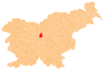
Place in Upper Carniola, Slovenia
46°8′58.18″N 14°36′21.36″E / 46.1494944°N 14.6059333°E / 46.1494944; 14.6059333 Slovenia
 (2020)
Vir (pronounced [ˈʋiːɾ]) is a settlement on the left bank of the Kamnik Bistrica River opposite Domžale in the Upper Carniola region of Slovenia.[2]
A new parish church dedicated to Saint Joseph is being built in the settlement.[3]
References
External links
 Media related to Vir at Wikimedia Commons
- Vir on Geopedia
- v
- t
- e
Administrative seat: Domžale
| Current |
|
|---|---|
| Former |
|
- Domžale Parish Church
- Iron Cave
- Jarše Parish Church
- Krumperk Castle
- St. Cunigunde's Church
Authority control databases | |
|---|---|
| International |
|
| National |
|


