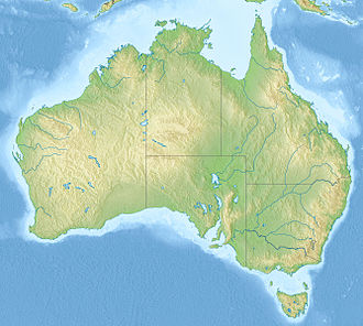
| Wallis Lake | |
|---|---|
 | |
| Location | Mid North Coast, New South Wales, Australia |
| Coordinates | 32°18′S 152°30′E / 32.300°S 152.500°E |
| Lake type | An open and trained wave dominated barrier estuary[1] |
| Primary inflows | Wallamba River, Coolongolook River, Pipers Creek |
| Primary outflows | Coolongolook River to the Tasman Sea |
| Catchment area | 1,196.9 square kilometres (462.1 sq mi)[2] |
| Basin countries | Australia |
| Managing agency | Mid-Coast Council |
| Max. length | 25 kilometres (16 mi)[3] |
| Max. width | 9 kilometres (5.6 mi)[4] |
| Surface area | 98.7 square kilometres (38.1 sq mi)[2] |
| Average depth | 2.3 metres (7 ft 7 in)[2] |
| Water volume | 217,951.5 megalitres (7,696.88×106 cu ft)[2] |
| Surface elevation | 0 m (0 ft) |
| Islands | Hadleys Island, Wallis Island |
| Settlements | Coomba Park, Forster, Green Point, Pacific Palms, Tuncurry |
| Website | NSW Environment & Heritage webpage |
| References | [5] |
Wallis Lake, an open and trained wave dominated barrier estuary,[1] is located within the Mid-Coast Council local government area in the Mid North Coast region of New South Wales, Australia. Wallis Lake is located adjacent to the towns of Forster and Tuncurry, and adjacent to the east coast, about 308 kilometres (191 mi) north of Sydney.
Features and location
[edit]Drawing its catchment from within Wallingat National Park and the Wallamba River, Coolongolook River, and Pipers Creek, Wallis Lake has a catchment area of 1,197 square kilometres (462 sq mi) and a surface area of 99 square kilometres (38 sq mi).[2] When full, Wallis Lake covers an area of around 10,000 hectares (25,000 acres),[5] is approximately 25 kilometres (16 mi) long,[3] with a width of 9 kilometres (5.6 mi).[4]
Hadleys Island lies within Wallis Lake, near the confluence of the Wallamba and Coolongolook rivers.
The waterways surrounding Wallis Lake are well known for oyster production.[6]
Lake Wallis was named in honour of James Wallis, an officer of the 46th Regiment.[4]
See also
[edit]References
[edit]- ^ a b Roy, P. S; Williams, R. J; Jones, A. R; Yassini, I; et al. (2001). "Structure and Function of South-east Australian Estuaries". Estuarine, Coastal and Shelf Science. 53: 351–384. doi:10.1006/ecss.2001.0796.
- ^ a b c d e "Estuaries of NSW: Smiths Lake". Office of Environment and Heritage. Government of New South Wales. Retrieved 20 March 2013.
- ^ a b "Wallis Lake". Great Lakes Tourism. Great Lakes Council. Retrieved 20 March 2013.
- ^ a b c "Wallis Lake". Geographical Names Register (GNR) of NSW. Geographical Names Board of New South Wales. Retrieved 20 March 2013.
- ^ a b "Map of Wallis Lake, NSW". Bonzle Digital Atlas of Australia. Retrieved 20 March 2013.
- ^ "Dredging planned for famous Wallis Lake oysters". Australia: ABC News. 27 June 2012. Retrieved 20 March 2013.
External links
[edit]- "Karuah River and Great Lakes catchments" (map). Office of Environment and Heritage. Government of New South Wales.
- "Wallis Lake Wetland Strategy: Vision, Guiding Principles and Actions" (PDF). Great Lakes Council. October 2010. Retrieved 20 March 2013.
- "2012 Waterway and catchment report card for Wallis & Myall Lakes & Karuah Estuary" (PDF). Great Lakes Council. 2012. Retrieved 20 March 2013.
- Moore, Stephanie (May 2005). "Wallis Lake Estuary Management Plan" (PDF). Wallis Lake Estuary Management Committee. Great Lakes Council. Retrieved 20 March 2013.

