Kabupaten Culpeper, Virginia

Culpeper County, Virginia
Culpeper County Courthouse
Flag of Culpeper County, Virginia
Bendera
Seal of Culpeper County, Virginia
Seal
Map of Virginia highlighting Culpeper County
Lokasi di negara bagian Virginia
Map of the United States highlighting Virginia
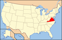
Lokasi negara bagian Virginia di Amerika Serikat
Didirikan1749
Asal namaThomas Colepeper
SeatCulpeper
town terbesarCulpeper
Wilayah
 • Keseluruhan383 sq mi (992 km2)
 • Daratan379 sq mi (982 km2)
 • Perairan33 sq mi (85 km2), 0.9%
Populasi
 • (2010)46,689
 • Kepadatan48/sq mi (18,7/km²)
Distrik kongres7th
Zona waktuTimur:
UTC-5 (EST) / -4 (EDT)
Situs webwww.culpepercounty.gov


Kabupaten Culpeper adalah sebuah kabupate yang terletak di wilayah tengah Persemakmuran Virginia. Menurut sensus 2010, penduduknya berjumlah 46,689 orang.[1] Kursi kabupatennya dan satu-satunya komunitas terinkorporasinya adalah Culpeper.[2]

Kabupaten Culpeper masuk dalam Wilayah Statistik Metropolitan Washington-Arlington-Alexandria, DC-VA-MD-WV.

Sejarah

Pada waktu kedatangan bangsa Eropa, para penduduk di wilayah yang menjadi Kabupaten Culpeper adalah sub-grup pemakai bahasa Siouan dari suku Manahoac yang disebut Tegninateo.[3] Kabupaten Culpeper didirikan pada 1749 dari Kabupaten Orange. Kabupaten tersebut dinamai dari nama Thomas Culpeper. Pada saat Perang Saudara, Pertempuran Gunung Cedar pada 9 Agustus 1862 dan Pertempuran Stasiun Brandy pada 9 Juni 1863, terjadi di Kabupaten Culpeper.

Referensi

  1. ^ "State & County QuickFacts". Biro Sensus Amerika Serikat. Diarsipkan dari versi asli tanggal 2011-07-09. Diakses tanggal 1 Januari 2014. 
  2. ^ "Find a County". National Association of Counties. Diakses tanggal 2011-06-07. 
  3. ^ Swanton, John R. (1952), The Indian Tribes of North America, Smithsonian Institution, hlm. 61–62, ISBN 0-8063-1730-2, OCLC 52230544 

Pranala luar

  • Culpeper County Government
  • Culpeper County Public Schools
  • Culpeper Regional Hospital Diarsipkan 2015-10-31 di Wayback Machine.
  • Culpeper Chamber of Commerce
  • Culpeper Restaurants
  • Culpeper County During the Civil War in Encyclopedia Virginia
Kabupaten Rappahannock Kabupaten Fauquier
Kabupaten Stafford
Barat
  Kabupaten Culpeper, Virginia  
Timur
Kabupaten Madison Kabupaten Orange Kabupaten Spotsylvania

Templat:Kabupaten Culpeper, Virginia

  • l
  • b
  • s
 Persemakmuran Virginia
Richmond (ibu kota)
Topik
  • Climate
  • Colleges and universities
  • Colony
  • Congressional Districts
  • Delegations
  • Demographics
  • Economy
  • Geography
  • Government
  • Governors
  • History
  • Historic Landmarks
  • Homes
  • Music
  • People
  • Police
  • Politics
  • Rights
  • Rivers
  • School divisions
  • Scouting
  • Slogan
  • Sports teams
  • State Fair
  • State parks
  • Symbols
  • Transportation
  • Tribes
  • Visitor Attractions
Wilayah
  • Allegheny Mountains
  • Atlantic Coastal Plain
  • Blue Ridge
  • Chesapeake Bay
  • Cumberland Mountains
  • Delmarva Peninsula
  • Eastern Shore
  • Hampton Roads
  • Middle Peninsula
  • Northern Neck
  • Northern Virginia
  • Piedmont
  • Ridge‑and‑valley Appalachians
  • Shenandoah Valley
  • South Hampton Roads
  • Southside
  • Southwest Virginia
  • Tennessee Valley
  • Tidewater
  • Tri-Cities
  • Virginia Peninsula
Wilayah
metro
  • Blacksburg-Christiansburg-Radford
  • Bluefield
  • Bristol
  • Charlottesville
  • Culpeper
  • Danville
  • Fredericksburg
  • Harrisonburg
  • Lynchburg
  • Martinsville
  • Richmond
  • Roanoke
  • Staunton
  • Virginia Beach-Norfolk-Newport News
  • Washington-Arlington-Alexandria
  • Waynesboro
  • Winchester
Kota besar
Kota kecil
  • Abingdon
  • Accomac
  • Alberta
  • Altavista
  • Amherst
  • Appalachia
  • Appomattox
  • Ashland
  • Berryville
  • Big Stone Gap
  • Blacksburg
  • Bluefield
  • Buchanan
  • Cedar Bluff
  • Chilhowie
  • Christiansburg
  • Clinchco
  • Clintwood
  • Coeburn
  • Culpeper
  • Dublin
  • Front Royal
  • Gate City
  • Grundy
  • Haysi
  • Herndon
  • Honaker
  • Lebanon
  • Leesburg
  • Marion
  • Orange
  • Pound
  • Pulaski
  • Richlands
  • Rural Retreat
  • Saltville
  • St. Paul
  • Stephens City
  • Tazewell
  • Warrenton
  • Wise
  • Wytheville
  • Vienna
  • Vinton
County
  • Accomack
  • Albemarle
  • Alleghany
  • Amelia
  • Amherst
  • Appomattox
  • Arlington
  • Augusta
  • Bath
  • Bedford
  • Bland
  • Botetourt
  • Brunswick
  • Buchanan
  • Buckingham
  • Campbell
  • Caroline
  • Carroll
  • Charles City
  • Charlotte
  • Chesterfield
  • Clarke
  • Craig
  • Culpeper
  • Cumberland
  • Dickenson
  • Dinwiddie
  • Essex
  • Fairfax
  • Fauquier
  • Floyd
  • Fluvanna
  • Franklin
  • Frederick
  • Giles
  • Gloucester
  • Goochland
  • Grayson
  • Greene
  • Greensville
  • Halifax
  • Hanover
  • Henrico
  • Henry
  • Highland
  • Isle of Wight
  • James City
  • King and Queen
  • King George
  • King William
  • Lancaster
  • Lee
  • Loudoun
  • Louisa
  • Lunenburg
  • Madison
  • Mathews
  • Mecklenburg
  • Middlesex
  • Montgomery
  • Nelson
  • New Kent
  • Northampton
  • Northumberland
  • Nottoway
  • Orange
  • Page
  • Patrick
  • Pittsylvania
  • Powhatan
  • Prince Edward
  • Prince George
  • Prince William
  • Pulaski
  • Rappahannock
  • Richmond
  • Roanoke
  • Rockbridge
  • Rockingham
  • Russell
  • Scott
  • Shenandoah
  • Smyth
  • Southampton
  • Spotsylvania
  • Stafford
  • Surry
  • Sussex
  • Tazewell
  • Warren
  • Washington
  • Westmoreland
  • Wise
  • Wythe
  • York

Templat:DCMetroArea

Koordinat: 38°29′N 77°58′W / 38.49°N 77.96°W / 38.49; -77.96