Orinda (California)
| Orinda | |||
|---|---|---|---|
 | |||
| Land |  USA USA | ||
| Delstat |  California California | ||
| Fylke | Contra Costa County | ||
| Postnummer | 94563 | ||
| Retningsnummer | 925 | ||
| Areal | 33,33 km²[1] | ||
| Vannfylt arealandel | 0,12 % | ||
| Befolkning | 19 514[2] (2020) | ||
| Bef.tetthet | 585,5 innb./km² | ||
| Antall husholdninger | 7 154 | ||
| Høyde o.h. | 151 meter | ||
| Nettside | www | ||
 Orinda 37°52′58″N 122°10′47″V | |||
Orinda på Commons | |||
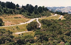
Orinda er en amerikansk by som ligger i Contra Costa County i California.
Byen hadde 19 514 innbyggere i 2020,[3] og dekker et areal på 33,33 km².
Historisk befolkningsdata
| Folketelling | Befolk. | %± | |
|---|---|---|---|
| 1960 | 5 568 | — | |
| 1970 | 6 790 | 21,9 % | |
| 1980 | 16 825 | 147,8 % | |
| 1990 | 16 642 | −1,1 % | |
| 2000 | 17 599 | 5,8 % | |
| 2010 | 17 643 | 0,3 % | |
| 2020 | 19 514 | 10,6 % | |
| U.S. Decennial Census[4] | |||
Referanser
- ^ United States. Bureau of the Census (2016) (på en), 2016 U.S. Gazetteer Files, Washington D.C.: Bureau of the Census, Wikidata Q32859555, https://www.census.gov/geographies/reference-files/time-series/geo/gazetteer-files.2016.html
- ^ https://data.census.gov/cedsci/table?t=Populations%20and%20People&g=0100000US,%241600000&y=2020; folketellingen i USA 2020; redaktør: Bureau of the Census; besøksdato: 1. januar 2022.
- ^ «Annual Estimates of the Resident Population for Incorporated Places in California: April 1, 2020 to July 1, 2022».
- ^ «Census of Population and Housing». Census.gov. Besøkt 4. juni 2015.
Eksterne lenker
- (en) Offisielt nettsted

- (en) Orinda, California – kategori av bilder, video eller lyd på Commons


