Dumfries and Galloway
| Dumfries and Galloway | |
| Kommun | |
 Dumfries | |
| Land |  Storbritannien Storbritannien |
|---|---|
| Riksdel | Skottland |
| Administrativ huvudort | Dumfries |
| Yta | 6 426 km²[1] |
| Folkmängd | 145 770 (2022)[2] |
| Befolkningstäthet | 23 invånare/km² |
| Tidszon | GMT (UTC+0) |
| - sommartid | BST (UTC+1) |
| ISO 3166-2-kod | GB-DGY |
| GSS-kod | S12000006 |
| Geonames | 2650797 |
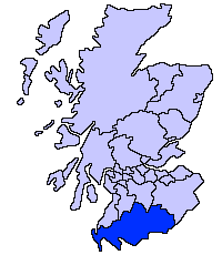 | |
Dumfries and Galloway är en av Skottlands kommuner. Kommunen gränsar mot South Ayrshire, East Ayrshire, South Lanarkshire och Scottish Borders samt Cumbria i England. Den ligger norr om Solway Firth och öster om Irländska sjön.
Kommunen täcker de traditionella grevskapen Wigtownshire, Kirkcudbrightshire och Dumfriesshire. Kurkcudbrightshire och Wigtownshire utgör tillsammans området Galloway.
Dumfries and Galloway upprättades som en region år 1975 med distrikten Annandale and Eskdale, Nithsdale, Stewartry och Wigtown. Dessa distrikt avskaffades år 1996 då regionen ombildades till en kommun.
Orter
- Ae, Annan
- Beattock
- Caerlaverock, Cairnryan, Carsphairn, Castle Douglas, Castle Kennedy, Creetown
- Dalbeattie, Dalton, Drumlanrig, Drummore, Dumfries
- Ecclefechan, Eskdalemuir
- Gatehouse of Fleet, Glenluce, Gretna Green
- Kirkcolm, Kirkcudbright
- Langholm, Lochmaben, Lockerbie
- Moffat, Moniaive, Mull of Galloway
- New Abbey, New Galloway, New Luce, Newton Stuart
- Portpatrick
- Ruthwell
- Sanquhar, St. Johns Town of Dalry, Stranraer
- Thornhill
- Wanlockhead, Whithorn, Wigtown
Källor
- ^ ”Estimates of the population for the UK, England, Wales, Scotland, and Northern Ireland (Mid-2022)” (på engelska) (xls). Landyta, avrundad till hela km². Office for National Statistics. 26 mars 2024. https://www.ons.gov.uk/peoplepopulationandcommunity/populationandmigration/populationestimates/datasets/populationestimatesforukenglandandwalesscotlandandnorthernireland. Läst 25 juni 2024.
- ^ ”Estimates of the population for the UK, England, Wales, Scotland, and Northern Ireland (Mid-2022)” (på engelska) (xls). Office for National Statistics. 26 mars 2024. https://www.ons.gov.uk/peoplepopulationandcommunity/populationandmigration/populationestimates/datasets/populationestimatesforukenglandandwalesscotlandandnorthernireland. Läst 25 juni 2024.
| |||||||


