Wiener-Neustadt-Insel
| Wiener-Neustadt-Insel | ||
|---|---|---|
 | ||
| Gewässer | Arktischer Ozean | |
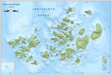
| Inselgruppe | Franz-Josef-Land | |
| Geographische Lage | 80° 48′ N, 58° 24′ O80.79527777777858.392222222222620Koordinaten: 80° 48′ N, 58° 24′ O | |
| ||
| Länge | 22 km | |
| Breite | 16 km | |
| Fläche | 237 km² | |
| Höchste Erhebung | Peak Parnass 620 m | |
| Einwohner | unbewohnt | |
 | ||


Die Wiener-Neustadt-Insel (russisch Остров Винер-Нейштадт, Ostrow Winer-Njoischtadt[1], auch Остров Винер-Нойштадт, Ostrow Winer-Noischtadt)[2] ist eine Insel im Franz-Josef-Land, Russische Föderation.
Die Wiener-Neustadt-Insel hat eine Fläche von 237 km² und ist fast zur Gänze vergletschert. Der höchste Punkt der Insel ist mit 620 m der Peak Parnass, die höchste Erhebung in Franz-Josef-Land.
Die Insel ist Teil der Untergruppe Zichy-Land des Franz-Josef-Archipels. Es ist von der Ziegler-Insel und der Salisbury-Insel durch die schmale Collinson-Meerenge (Proliw Kollinsona) getrennt.
Die Insel wurde von der Österreichisch-Ungarischen Nordpolexpedition unter Julius Payer und Carl Weyprecht nach der südlich von Wien gelegenen Stadt Wiener Neustadt benannt, deren Theresianische Militärakademie Payer absolviert hatte.[3]
Weblinks
Commons: Wiener-Neustadt-Insel – Sammlung von Bildern, Videos und Audiodateien
- Andreas Umbreit: Wiener Neustadt (Viner-Neyshtadt) Insel – Franz-Joseph-Land (Memento vom 29. Januar 2021 im Internet Archive)
Einzelnachweise
- ↑ Geography of the City of Arkhangelsk – Offizielle Website der Stadt Archangelsk (russisch)
- ↑ Geography of Russia, letter Ф (russisch)
- ↑ Julius Payer: Die österreichisch-ungarische Nordpol-Expedition in den Jahren 1872 - 1874. Hölder, Wien 1876, S. 297 (mdz-nbn-resolving.de).
Inseln des Franz-Josef-Landes
Aagaard-Insel | Adelaide-Insel | Alexandraland | Alger-Insel | Apollonow-Insel | Arthur-Insel | Becker-Insel | Bell-Insel | Berghaus-Insel | Bliss-Insel | Borisjak-Insel | Brady-Insel | Brosch-Insel | Brice-Insel | Bromwich-Insel | Brown-Inseln | Bruce-Insel | Champ-Insel | Coburg-Insel | David-Insel | Davis-Insel | Derewjanny-Insel | Dicks-Insel | Eaton-Insel | Etheridge-Inseln | Elizabeth-Insel | Eva-Liv-Insel | Freeden-Insel | Geddes-Insel | Gorbunow-Insel | Graham-Bell-Insel | Greely-Insel | Hall-Insel | Harley-Insel | Hayes-Insel | Hochstetter-Inseln | Hoffmann-Insel | Hohenlohe-Insel | Hooker-Insel | Houen-Insel | Iwanow-Insel | Jackson-Insel | Jefferson-Insel | Kane-Insel | Karl-Alexander-Insel | Klagenfurt-Insel | Kling-Insel | Knospe-Insel | Koettlitz-Insel | Koldewey-Insel | Komsomol-Inseln | Kupolok-Insel | Kutschin-Inseln | Kuhn-Insel | La-Ronciere-Insel | Lamont-Insel | Leigh-Smith-Insel | Lewanewski-Insel | Luigi-Insel | Lütke-Insel | Mabel-Insel | MacGee-Inseln | May-Insel | Maly-Insel | Marley-Insel | Mathilda-Insel | McClintock-Insel | McNulty-Insel | Nansen-Insel | Newcomb-Insel | Newton-Insel | Nitsch-Insel | Northbrook-Insel | Nowy-Insel | Ommanney-Insel | Payer-Insel | Perlmutt-Insel | Pontremoli-Inseln | Prinz-Georg-Land | Querini-Insel | Rainer-Insel | Robinson-Insel | Royal-Society-Insel | Rudolf-Insel | Salisbury-Insel | Salm-Insel | Schönau-Insel | Scott-Keltie-Insel | Solowjow-Insel | Stoliczka-Insel | Sub-Insel | Tillo-Insel | Torup-Insel | Tom-Insel | Trjochlutschewoi-Insel | Tschitschagow-Inseln | Udatschny-Insel | Ugolnoi-Kopi-Insel | Weyprecht-Insel | Windward-Insel | Wiener-Neustadt-Insel | Wilczek-Insel | Wilczek-Land | Ziegler-Insel


