Aiglun, Alpes-de-Haute-Provence
Commune in Provence-Alpes-Côte d'Azur, France

Coat of arms
Location of Aiglun

(2020–2026) Michel Audran[1]
1
(2021)[2]
04001 /04510
(avg. 700 m or 2,300 ft)
Aiglun (French pronunciation: [ɛɡlœ̃]) is a commune in the Alpes-de-Haute-Provence department in the Provence-Alpes-Côte d'Azur region in southeastern France.[3]
Geography
Aiglun is located about 6 km southeast of Digne following Route nationale N85, which runs mostly parallel to the Bléone river which forms the southeastern border of the commune. Highway N85 continues through the southern part of the commune towards the next town of Malijai. The village lies about 3 km north of the N85 along a country road, the Avenue Marius Autric, which loops through the commune to intersect with Highway D17 outside the southwestern border of the commune. No other major roads run through the commune, and access is via country roads and lanes. Much of the commune is forested, with patches of farmland.[4]
Hydrography
A large number of streams cover all parts of the commune, most of which flow into the Bléone river on the southeastern border, which is itself a tributary of the Durance river.[4]
Localities and hamlets
In addition to the village, the town has three other hamlets:
- Les Lavendes
- Les Grees
- Le Thoron
Neighbouring communes
Places adjacent to Aiglun, Alpes-de-Haute-Provence | ||||||||||||||||
|---|---|---|---|---|---|---|---|---|---|---|---|---|---|---|---|---|
| ||||||||||||||||


Natural and technological hazards
All of the 200 communes of the department are in some seismic risk. The canton of Digne-les-Bains-2, to which Aiglun belongs, is zoned 1b (low risk) according to the classification of 1991, based on historical earthquakes,[5] and in Zone 4 (medium risk) according to the probability classification EC8 of 2011.[6] The commune of Aiglun is exposed to three other natural hazards:[6]
- Forest fire
- Flooding (in the valley of the Bléone )
- Landslide: the community is almost entirely classified medium-to-high hazard.[7]
Aiglun is also exposed to a risk of technological origin: the transport of hazardous materials by rail, road and pipeline.[8] As regards the railway, the St. Auban to Digne line is closed and so there is no traffic. The National Highway 85 can be used for the road transport of dangerous goods.[9] Finally, the pipeline for feeding natural gas to Digne passes through the commune and is thus an additional risk factor.[10]
The prevention plan for foreseeable natural risks (PPR) of the commune was approved in 2006 for flood risk, landslide and earthquake[8] and the Dossier of communal information on major risks (DICRIM) has existed since 2011.[11]
The commune has been the site of several natural disasters: an earthquake in 1984, floods and mudslides in 1996 and 2001, drought in 1989, 1990, and 1998, and landslides in 1996.[6][12]
The earthquake of 19 June 1984 had its epicentre in Aiglun and a macro-seismic intensity of VI on the Medvedev–Sponheuer–Karnik scale (MSK).[12] On 25 July 2001 a storm with hail and rainfall of 150mm in three hours caused floods.[13]
Toponymy
The name of the town appears for the first time in texts of 1195 (according to Rostaing and Nègre) in the form: Aiglezino (and Aygladuno in 1319). The term is based on the Latin aquila meaning "eagle" and the Gallic dunum meaning "height" and would therefore mean "height of the eagle".[14][15] According to Fénié, it has two oronymic roots: *akw-il plus the Celtic dunum.[16]
History
In ancient times, the Bodiontiques (or Bodiontici) inhabited the valley of the Bléone, and so it was Gallic people who lived in what is now the commune of Aiglun. The Bodiontiques, who were defeated by Augustus Caesar at the same time as other people living in the area of the Tropaeum Alpium (from 14 BC to 14 AD), were attached to the Roman province of Alpes-Maritimes at its creation.[17] The Roman road linking Sisteron to Vence crossed the territory of the present commune.[18] Some Gallo-Roman tombs have been found.[19]
The community of Aiglun was under the Viguerie of Digne[18] and the church of the Bishop of Digne who received income related to the church. In return he provided his canons.[20] On the secular side, the village was divided between multiple lords (similar to feudal barons) which by 1315 had reached 22 in number.[21] The village was an ancient fortress called castrum de Aglenio in the Middle Ages.[19]

At the end of the Second World War, the Liberation of Aiglun was marked by the passage of a column of the U.S. 36th Infantry Division on 19 August 1944, coming from Malijai as reinforcements to secondary column stopped at Digne, to outflank the German garrison at Digne.[22]
Until the middle of the 20th century, grapevines were cultivated in the commune on 55 hectares of land for local consumption. Part of the production was sold to Digne. This activity has now disappeared.[23]
Heraldry
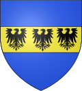 | Blazon: Azure, Fess of Or charged with three eagles of sable.[24]
|
Transport
The railway line from Saint-Auban to Digne passed through the town but has been closed since 1991.
Economy
In 2020, the labour force was 594 persons, with 49 unemployed (8.3%). The workers are mostly employed (85.5%).[25] Most inhabitants work outside the commune (82.9%).[26]
At 31 December 2020, companies based in the municipality were mainly shops and services (34 of 113 establishments) and 28 companies in the construction sector.[27]
Agriculture
The number of farms has increased only slightly in the 2000 decade, from 7 to 8 in 10 years, including four field crop farms, sheep farms, and polyculture farms.[28] From 1988 to 2000, the agricultural area has increased from 267 to 415 hectares, of which only 56 hectares are for cereals, and almost none for livestock.[29] During the course of this change the amount of agricultural land used doubled in the 2000s to 886 hectares.[28]
There were no olive trees in the commune at the beginning of the 19th century. Currently, there are a few small areas with olive groves with less than 1,000 plants.[30]
Industry
In late 2020, the secondary sector (industry and construction) had 30 different establishments.[27]
Two of the largest employers in the town within this sector are:
- Cosepi France, (Building and Public works), with 40 employees[31]
- Martin, (road transport), with 32 employees.[32]
Service activities

In December 2020, the tertiary sector (trades and services) had 52 establishments, plus 14 administrative establishments and public services.[27] There is no tourist accommodation in the commune.[33] As of 2020, 5.6% of the houses are holiday homes.[34]
Two of the largest employers in the commune are responsible for service activities:
- Office Centre, a secretarial service, which employs 10 people[35]
- IGH group, which is a Carmelite specialized clinic for rehabilitation[36]
Administration

List of mayors
The mayoral election was an innovation of the French Revolution of 1789. From 1790 to 1795, mayors were elected by suffrage for 2 years. From 1795 to 1800 there was no mayor, the town simply designated a municipal official who was delegated to the Municipality of the canton.
In 1799–1800, the Consulate returned to the election of mayors who were then appointed by the central government. This system was maintained by the following regimes, with the exception of the Second Republic (1848-1851). After maintaining the authoritarian system, the Third Republic by liberalizing the law for the administration of communes on 5 April 1884: the municipal council was to be elected by universal suffrage and they to elect the mayor from among their members.
This list is incomplete; you can help by adding missing items. (April 2021) |
List of Successive Mayors of Aiglun[37]
| From | To | Name | Party |
|---|---|---|---|
| 2001 | 2020[38] | Daniel Jugy | DVD |
| 2020 | 2026 | Michel Audran |
Intercommunality
Aiglun has been a member of the Agglomeration Community Provence-Alpes-Agglomération since 1 January 2017.
Budget and taxation
| Tax | Communal portion | Inter-communal portion | Departmental portion | Regional portion |
|---|---|---|---|---|
| Residential Tax (TH) | 11.07% | 0.00% | 5.53% | 0.00% |
| Property Tax on Buildings (TFPB) | 29.00% | 0.00% | 14.49% | 2.36% |
| Property Tax on Empty Land (TFPNB) | 60.00% | 0.00% | 47.16% | 8.85% |
| Business Tax (TP) | 13.87%* | 0.00% | 47.16% | 8.85% |
The regional share of the property tax is not applicable. The business tax was replaced in 2010 by:
- the land premium on companies (CFE) on the rental value of their property and
- the contribution of the added value of enterprises (CAVE)
(both of these form the territorial economic contribution).
Education
The town has a primary school.[40]
Population
|
| |||||||||||||||||||||||||||||||||||||||||||||||||||||||||||||||||||||||||||||||||||||||||||||||||||||||||||||||
| Source: EHESS[41] and INSEE[42] | ||||||||||||||||||||||||||||||||||||||||||||||||||||||||||||||||||||||||||||||||||||||||||||||||||||||||||||||||
Sights
The town hall has a vase (19th century)![]() [43] which is listed as an historical object.
[43] which is listed as an historical object.
The Romanesque church of Saint Mary Magdalene, whose nave is dated to 1555,[44] is at Old Aiglun. Its construction used anachronistic techniques such as:
- a semicircular portal
- the nave is vaulted with a broken support
- the choir has a flat apse, vaulted lower than the nave[45]
The church contains many items which have been listed as historical objects:
- A baptismal font (16th century)
 [46]
[46] - A painting of the Virgin and child with a bishop and a clerk in a scene of healing (17th century)[47]
- A statue of Saint Joseph (19th century)[48]
- A retable (17th century)[49]
- A cope (19th century)[50]
- A chasuble, stole, and maniple (19th century)[51]
- A huméral veil (19th century)[52]
- A painting with frame: Bishop (17th century)[53]
The cemetery church contains many items that are listed as historical objects:
- A statue of Saint Joseph (17th century)[54]
- A retable on the main altar and its painting of the crucifixion (16th century)[55][56] in an archaic style.[57]
- A processional cross (16th century)[58]
- A crucifix (16th century)[59]
- A crucifix (18th century)[60]
-
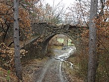
 North facade of the church of St. Mary Magdalene without openings, typical of the alpine style
 -
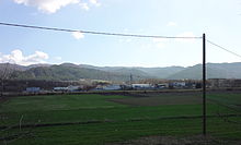
 Panoramic view of the Saint Mary Magdelene Church (The conical hill is in Champtercier.)
 -
 Chapel at the modern cemetery
 -
 The facade of the chapel


The chapel of Saint John is on the road leading to Saint John, connecting the town centre to Old Aiglun. This was probably the first parish church in the community during the High Middle Ages.[18] It was abandoned in the second half of the 19th century.[18]
The modern village had a new church in 1974, whose patron saint is Saint Delphine.[18]

The chateau of Villeneuve in Aiglun dates to the 17th century. It is a large rectangular building with turrets at each corner. A clinic was installed there in 1935. In the village, the old castle is in a state of disrepair.[61]
In the village, a few houses date to the 17th century.[62]
See also
References
- ^ "Répertoire national des élus: les maires". data.gouv.fr, Plateforme ouverte des données publiques françaises (in French). 2 December 2020.
- ^ "Populations légales 2021". The National Institute of Statistics and Economic Studies. 28 December 2023.
- ^ Commune d'Aiglun (04001), INSEE (in French)
- ^ a b Google Maps
- ^ Préfecture des Alpes-de-Haute-Provence, Départmental Dossier on Major Risks in Alpes-de-Haute-Provence] (DDRM), 2008, p. 39 (in French)
- ^ a b c Minister of Ecology, development, transport, and lodgings, Communal Notice Archived 2014-02-21 at the Wayback Machine on the Gaspar database created on 7 February 2012, consulted on 25 June 2012 (in French)
- ^ Préfecture, DDRM, p. 37 (in French)
- ^ a b Préfecture of Alpes-de-Haute-Provence, Départmental Dossier on major risks in Alpes-de-Haute-Provence, op. cit., p. 95 (in French)
- ^ Préfecture, DDRM, p. 80 (in French)
- ^ Préfecture, DDRM, p. 81 (in French)
- ^ Dicrim for Aiglun, base Dicrim, consulted on 25 June 2011 (in French)
- ^ a b BRGM,Fiche 40176 Archived 2015-04-13 at the Wayback Machine, Sisfrance, consulted on 10 May 2013 (in French)
- ^ Préfecture des Alpes-de-Haute-Provence, DDRM, op. cit., p. 62
- ^ Charles Rostaing, Essay on the toponymy of Provence since its beginning until the barbarian invasions, Laffite Reprints, Marseille, 1973 (1st edition 1950), p 39-40 (in French)
- ^ TGF1, § 2725, p 173 (in French)
- ^ Bénédicte Fénié, Jean-Jacques Fénié, Provincial Toponymy, Éditions Sud-Ouest, 2002 (réédition), ISBN 978-2-87901-442-5, p. 40 (in French)
- ^ Brigitte Beaujard, The Cities of Southern Gaul of the 3rd to 7th centuries, Gallia, 63, 2006, CNRS éditions, p. 22 (in French)
- ^ a b c d e Daniel Thiery, Aiglun Archeo Provence, published on 22 December 2011, consulted on 25 June 2012 (in French)
- ^ a b Michel de La Torre, Alpes-de-Haute-Provence : The complete Guide to 200 communes, Paris, Deslogis-Lacoste, coll. "Towns and Villages of France", 1989, Relié, 72 p. (non-paginated), ISBN 2-7399-5004-7 (in French)
- ^ Daniel Thiery, Dating Essay Archived 2013-11-02 at the Wayback Machine », Archeo Provence, published on 7 February 2012, consulted on 25 June 2012 (in French)
- ^ Thierry Pécout, Provincial Nobility and the power of the Lords, North Mediterranean Coast, Aspects of baronial power from Catalonia to Italy (9th–14th centuries), put online on 22 July 2005. Consulted on 26 January 2008 (in French)
- ^ Henri Julien (Director of publication), Guide to the invasion of Provence, 15 August 1944, Digne-les-Bains, Éditions de Haute-Provence, 1994, ISBN 2-909800-68-7, p. 126 (in French)
- ^ André de Réparaz, p. 56 and 59 (in French)
- ^ Louis de Bresc Arms of the communes of Provence 1866. Re-edited - Marcel Petit CPM - Raphèle-lès-Arles 1994 (in French)
- ^ Population active, emploi et chômage au sens du recensement en 2020, INSEE
- ^ Caractéristiques de l'emploi au sens du recensement en 2020, INSEE
- ^ a b c Nombre d’unités légales et d’établissements en 2021, INSEE
- ^ a b Minister of Agriculture, "Technical-economic Orientation of cultivation", Agricultural Census 2010 and 2000. (lien: N.B. Fiche done on 4,4 Mio) (in French)
- ^ Insee, Agricultural Cultivation in 1988 and 2000, Insee, 2012 (Fiche of 24,6 Mio) (in French)
- ^ Réparaz, Land lost, Land unchanged, Land won: grapevines and olives in Haute-Provence 19th-21st centuries, Mediterranean, 109p, 2007, p. 58 (in French)
- ^ Chamber of Commerce and industry of Alpes-de-Haute-Provence, Cosepi France, consulted on 20 September 2012 (in French)
- ^ Chamber of Commerce and industry of Alpes-de-Haute-Provence, SARL Transports Martin, consulted on 24 September 2012 (in French)
- ^ Tourisme en 2023, INSEE
- ^ Logement en 2020, INSEE
- ^ Chamber of Commerce and industry of Alpes-de-Haute-Provence, Office Centre, consulted on 24 September 2012 (in French)
- ^ Groupe IGH Official site Archived 2013-06-03 at the Wayback Machine (in French)
- ^ List of Mayors of France (in French)
- ^ Préfecture des Alpes-de-Haute-Provence, List of Communes Aiglun to Braux (List 1), consulted on 10 March 2013 (in French)
- ^ Local Taxes at Aiglun, Ed. taxes.com
- ^ Academic Inspection of Alpes-de-Haute-Provence, List of Schools in the district of Digne Archived 2011-07-20 at the Wayback Machine, published on 6 April 2010, consulted on 31 October 2010 (in French)
- ^ Des villages de Cassini aux communes d'aujourd'hui: Commune data sheet Aiglun, EHESS (in French).
- ^ Population en historique depuis 1968, INSEE
- ^ Ministry of Culture, Palissy PM04002872 Vase (in French)
- ^ Collier-Haute-Provence, p 151 (in French)
- ^ Raymond Collier, p 180-181 (in French)
- ^ Ministry of Culture, Palissy PM04002868 Baptismal font (in French)
- ^ Ministry of Culture, Palissy PM04002867 Painting: Virgin and child with a bishop and a clerk in a scene of healing (in French)
- ^ Ministry of Culture, Palissy PM04002866 Statue: Saint Joseph (in French)
- ^ Ministry of Culture, Palissy PM04002865 Retable (in French)
- ^ Ministry of Culture, Palissy PM04002871 Cope (in French)
- ^ Ministry of Culture, Palissy PM04002870 Chasuble, Stole, and Maniple (in French)
- ^ Ministry of Culture, Palissy PM04002869 Huméral Veil (in French)
- ^ Ministry of Culture, Palissy PM04000887 Painting with frame: Bishop (in French)
- ^ Ministry of Culture, Palissy PM04000886 Statue: Saint Joseph (in French)
- ^ Ministry of Culture, Palissy PM04000885 Statue: Retable on the main altar and its painting: the Crucifixion (in French)
- ^ Raymond Collier, p 470 (in French)
- ^ Raymond Collier, p 477 (in French)
- ^ Ministry of Culture, Palissy PM04000884 Processional Cross (in French)
- ^ Ministry of Culture, Palissy PM04000883 Crucifix (in French)
- ^ Ministry of Culture, Palissy PM04000888 Crucifix (in French)
- ^ Raymond Collier, p 258 (in French)
- ^ Raymond Collier, p 362 (in French)
External links
- Aiglun on Géoportail, National Geographic Institute (IGN) website (in French)
- Ayglun on the 1750 Cassini Map
Wikimedia Commons has media related to Aiglun (Alpes-de-Haute-Provence).
- v
- t
- e

- Aiglun
- Allemagne-en-Provence
- Allons
- Allos
- Angles
- Annot
- Archail
- Aubenas-les-Alpes
- Aubignosc
- Authon
- Auzet
- Banon
- Barcelonnettesubpr
- Barles
- Barras
- Barrême
- Bayons
- Beaujeu
- Beauvezer
- Bellaffaire
- Bevons
- Beynes
- Blieux
- Bras-d'Asse
- Braux
- La Brillanne
- Brunet
- Le Brusquet
- Le Caire
- Castellanesubpr
- Le Castellard-Mélan
- Le Castellet
- Castellet-lès-Sausses
- Céreste-en-Luberon
- Le Chaffaut-Saint-Jurson
- Champtercier
- Château-Arnoux-Saint-Auban
- Châteaufort
- Châteauneuf-Miravail
- Châteauneuf-Val-Saint-Donat
- Châteauredon
- Chaudon-Norante
- Clamensane
- Claret
- Clumanc
- Colmars
- La Condamine-Châtelard
- Corbières-en-Provence
- Cruis
- Curbans
- Curel
- Dauphin
- Demandolx
- Digne-les-Bainspref
- Draix
- Enchastrayes
- Entrages
- Entrepierres
- Entrevaux
- Entrevennes
- L'Escale
- Esparron-de-Verdon
- Estoublon
- Faucon-de-Barcelonnette
- Faucon-du-Caire
- Fontienne
- Forcalquiersubpr
- Le Fugeret
- Ganagobie
- La Garde
- Gigors
- Gréoux-les-Bains
- Hautes-Duyes
- L'Hospitalet
- Jausiers
- La Javie
- Lambruisse
- Lardiers
- Le Lauzet-Ubaye
- Limans
- Lurs
- Majastres
- Malijai
- Mallefougasse-Augès
- Mallemoisson
- Mane
- Manosque
- Marcoux
- Méailles
- Les Mées
- Melve
- Méolans-Revel
- Mézel
- Mirabeau
- Mison
- Montagnac-Montpezat
- Montclar
- Montfort
- Montfuron
- Montjustin
- Montlaux
- Montsalier
- Moriez
- La Motte-du-Caire
- Moustiers-Sainte-Marie
- La Mure-Argens
- Nibles
- Niozelles
- Noyers-sur-Jabron
- Les Omergues
- Ongles
- Oppedette
- Oraison
- La Palud-sur-Verdon
- Peipin
- Peyroules
- Peyruis
- Piégut
- Pierrerue
- Pierrevert
- Pontis
- Prads-Haute-Bléone
- Puimichel
- Puimoisson
- Quinson
- Redortiers
- Reillanne
- Revest-des-Brousses
- Revest-du-Bion
- Revest-Saint-Martin
- Riez
- La Robine-sur-Galabre
- La Rochegiron
- La Rochette
- Rougon
- Roumoules
- Saint-André-les-Alpes
- Saint-Benoît
- Sainte-Croix-à-Lauze
- Sainte-Croix-du-Verdon
- Saint-Étienne-les-Orgues
- Sainte-Tulle
- Saint-Geniez
- Saint-Jacques
- Saint-Jeannet
- Saint-Julien-d'Asse
- Saint-Julien-du-Verdon
- Saint-Jurs
- Saint-Laurent-du-Verdon
- Saint-Lions
- Saint-Maime
- Saint-Martin-de-Brômes
- Saint-Martin-les-Eaux
- Saint-Martin-lès-Seyne
- Saint-Michel-l'Observatoire
- Saint-Paul-sur-Ubaye
- Saint-Pierre
- Saint-Pons
- Saint-Vincent-sur-Jabron
- Salignac
- Saumane
- Sausses
- Selonnet
- Senez
- Seyne
- Sigonce
- Sigoyer
- Simiane-la-Rotonde
- Sisteron
- Soleilhas
- Sourribes
- Tartonne
- Thèze
- Thoard
- Thorame-Basse
- Thorame-Haute
- Les Thuiles
- Turriers
- Ubaye-Serre-Ponçon
- Ubraye
- Uvernet-Fours
- Vachères
- Valavoire
- Valbelle
- Val-de-Chalvagne
- Val-d'Oronaye
- Valensole
- Valernes
- Vaumeilh
- Venterol
- Verdaches
- Vergons
- Le Vernet
- Villars-Colmars
- Villemus
- Villeneuve
- Volonne
- Volx
- pref: prefecture
- subpr: subprefecture
Authority control databases | |
|---|---|
| International |
|
| National |
|
| Other |
|


