Aizkraukle District
District of Latvia
District in Latvia
Aizkraukle District Aizkraukles rajons | |
|---|---|
District | |
 | |
| Country | Latvia |
| Area | |
| • Total | 2,566.8 km2 (991.0 sq mi) |
| Population | |
| • Total | 39,971 |
| • Density | 16/km2 (40/sq mi) |
| Website | aizkrauklesrajons.lv |
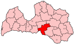
Aizkraukle District (Latvian: Aizkraukles rajons, [aizkraukles rajuons]) was an administrative division of Latvia from 1967 to 2009. It was located in Vidzeme and Selonia regions, in the country's centre.
Districts were eliminated during the administrative-territorial reform in 2009.
References
- ^ "RESIDENT POPULATION BY REGION, CITY AND DISTRICT AT THE BEGINNING OF THE YEAR". Centrālās statistikas pārvaldes datu bāzes. Archived from the original on 2009-01-10. Retrieved 2009-01-23.
- v
- t
- e
Cities, Municipalities and Parishes of the defunct Aizkraukle District
- Aizkraukle
- Jaunjelgava
- Pļaviņas
- Aizkraukle
56°39′N 25°15′E / 56.650°N 25.250°E / 56.650; 25.250
 | This Vidzeme location article is a stub. You can help Wikipedia by expanding it. |
- v
- t
- e


