Al-Masriyah

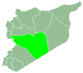
Village in Homs, Syria
Al-Masriyah
المصرية
Village
34°27′52″N 36°29′0″E / 34.46444°N 36.48333°E / 34.46444; 36.48333
CountrySyria
GovernorateHoms
DistrictQusayr
SubdistrictQusayr
Population
 (2004)
 • Total618
Time zoneUTC+2 (EET)
 • Summer (DST)UTC+3 (EEST)

Al-Masriyah (Arabic: المصرية) is a village in central Syria, administratively part of the Homs Governorate, located southwest of Homs and immediately north and south of the border with Lebanon. Nearby localities include Zita al-Gharbiyah to the north, al-Qusayr to the northeast, Zira'a and Rablah. According to the Central Bureau of Statistics (CBS), Al-Masriyah had a population of 618 in the 2004 census.[1] Its inhabitants are predominantly Shia Muslims.[2]

References

  1. ^ "General Census of Population 2004". Retrieved 2014-07-10.
  2. ^ Hodeib, Mirella (2012-10-13). "Lebanese in Syrian villages gear up". The Daily Star. Lebanon Wire. Archived from the original on 2016-03-03. Retrieved 2015-08-31.
  • v
  • t
  • e
Homs
Subdistrict
Ayn al-Niser
Subdistrict
Furqlus
Subdistrict
Hisyah
Subdistrict
Khirbet Tin Nur
Subdistrict
Mahin
Subdistrict
Qabu
Subdistrict
Qaryatayn
Subdistrict
Riqama
Subdistrict
Sadad
Subdistrict
Shin
Subdistrict
Taldou
Subdistrict
Homs Governorate within Syria
Homs Governorate
Mukharram
Subdistrict
Jubb al-Jarrah
Subdistrict
  • Jubb al-Jarrah
  • Abu Qatur
  • Aliyat al-Alyan
  • Duwayr al-Gharbiyah
  • Duwayr al-Sharqiyah
  • Ghuzayliyah
  • Maksar al-Hisan
  • Masaadah
  • Masudiyah
  • Mughayzil
  • Muntar al-Abal
  • Mushayrifah al-Qibliyah
  • Rasm Humaydah
  • Shiha
  • Taladi
  • Talaqtah
  • Tarfawi
  • Tawil
  • Umm al-Rif (al-Rish)
  • Umm Tuwaynah al-Shamali
  • Usmud
Qusayr
Subdistrict
Rastan
Subdistrict
Talbiseh
Subdistrict
Tadmur
Subdistrict
Sukhnah
Subdistrict
Talkalakh
Subdistrict
Hadidah
Subdistrict
Hawash
Subdistrict
Nasirah
Subdistrict
Stub icon

This article about a location in Homs Governorate, Syria is a stub. You can help Wikipedia by expanding it.

  • v
  • t
  • e