B2 road (Namibia)
National highway of Namibia
You can help expand this article with text translated from the corresponding article in German. (June 2023) Click [show] for important translation instructions.
- Machine translation, like DeepL or Google Translate, is a useful starting point for translations, but translators must revise errors as necessary and confirm that the translation is accurate, rather than simply copy-pasting machine-translated text into the English Wikipedia.
- Do not translate text that appears unreliable or low-quality. If possible, verify the text with references provided in the foreign-language article.
- You must provide copyright attribution in the edit summary accompanying your translation by providing an interlanguage link to the source of your translation. A model attribution edit summary is
Content in this edit is translated from the existing German Wikipedia article at [[:de:Nationalstraße B2]]; see its history for attribution. - You may also add the template
{{Translated|de|Nationalstraße B2}}to the talk page. - For more guidance, see Wikipedia:Translation.
 | ||||
|---|---|---|---|---|
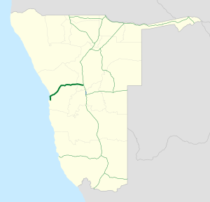 Map of the B2. | ||||
| Route information | ||||
| Maintained by Roads Authority Namibia | ||||
| Length | 320 km (200 mi) | |||
| Major junctions | ||||
| East end |   A1 / B1 near Okahandja A1 / B1 near Okahandja | |||
| West end |  C14 in Walvis Bay C14 in Walvis Bay | |||
| Location | ||||
| Country | Namibia | |||
| Towns | Okahandja, Karibib, Usakos, Arandis, Swakopmund, Walvis Bay | |||
| Highway system | ||||
| ||||
| ||||


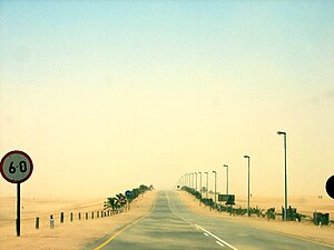
B2 is a major road in Namibia. The highway runs east–west between the major sea port of Walvis Bay and the nation's capital Windhoek.
The B2's entire route forms the first section of both the Trans-Kalahari Corridor and the Walvis Bay-Ndola-Lubumbashi Development Road.
Route
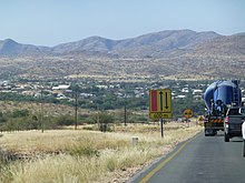
B2 begins in Walvis Bay at a roundabout intersection with C14 and heads north along the coast of the South Atlantic Ocean for about 35 kilometers to Swakopmund. The route then heads northeast & east through inland Namibia for 291 kilometers where it ends at an intersection with B1 near Okahandja. The route passes through the Namib-Naukluft National Park and the Namib Desert. Major towns along the route are Arandis, Usakos, and Karibib.
- v
- t
- e
 Highways in Namibia
- A1
- A2

- B1
- B2
- B3
- B4
- B6
- B8
- B10
- B11
- B14
- B15
- C10
- C11
- C12
- C13
- C14
- C15
- C16
- C17
- C18
- C19
- C20
- C21
- C22
- C23
- C24
- C25
- C26
- C27
- C28
- C29
- C30
- C31
- C32
- C33
- C34
- C35
- C36
- C37
- C38
- C39
- C40
- C41
- C42
- C43
- C44
- C45
- C46
- C47
- C48
- C49
 | This Namibia-related article is a stub. You can help Wikipedia by expanding it. |
- v
- t
- e


