Bahadurpur, Raebareli
Village in Uttar Pradesh, India
Bahadurpur | |
|---|---|
Village | |
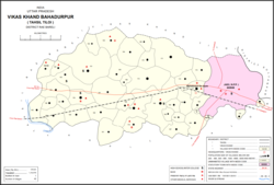 Map of Bahadurpur CD block | |
| Country India |  India India |
| State | Uttar Pradesh |
| District | Raebareli |
| Area | |
| • Total | 24.44 km2 (9.44 sq mi) |
| Population (2011)[1] | |
| • Total | 17,595 |
| • Density | 720/km2 (1,900/sq mi) |
| Languages | |
| • Official | Hindi |
| Time zone | UTC+5:30 (IST) |
| PIN | 229308[1] |
| Vehicle registration | UP-35 |
Bahadurpur, also called Bahadurpur Da Jayas, is a village and corresponding community development block in Tiloi tehsil of Rae Bareli district, Uttar Pradesh, India.[1] It is located 3 km from the town of Jais.[2] As of 2011, its population is 17,595, in 2,951 households.[1] The main staple foods are wheat and rice.[2]
The 1961 census recorded Bahadurpur as comprising 4 hamlets, with a total population of 539 people (315 male and 224 female), in 135 households and 133 physical houses. [3] The area of the village was given as 592 acres.[3]
The 1981 census recorded Bahadurpur as having a population of 969 people, in 332 households, and having an area of 62.32 hectares.[2]
Villages
Bahadurpur CD block has the following 42 villages:[1]
| Village name | Total land area (hectares) | Population (in 2011) |
|---|---|---|
| Kotwar Mau | 198.9 | 1,616 |
| Mahmoodpur | 177.9 | 1,510 |
| Pidhi | 1,296.1 | 8,580 |
| Khalispur | 469.3 | 3,554 |
| Jamalpur Rampur | 301.6 | 2,792 |
| Brahmani | 572 | 6,163 |
| Kisunpur Kewae | 327 | 2,515 |
| Saimbasi | 163.5 | 1,371 |
| Tarauna | 143.6 | 1,077 |
| Sarwan | 359 | 3,009 |
| Mohaiya Kesariya | 503.9 | 3,247 |
| Bhadaiya Mahmoodpur | 405.4 | 3,483 |
| Khairahana | 413.4 | 2,829 |
| Bhadehara | 177.2 | 938 |
| Nawawan | 486.4 | 3,543 |
| Urwa | 566.1 | 4,071 |
| Kesariya Salimpur | 307.4 | 2,539 |
| Chak Dahira Mau | 68.6 | 532 |
| Nigohan | 330.5 | 3,584 |
| Basauni | 198.7 | 1,898 |
| Daulatpur Sidhariya | 188.6 | 895 |
| Fareedpur Parwar | 268.4 | 1,917 |
| Mohana | 963.4 | 8,073 |
| Pure Badyrai | 295.9 | 1,769 |
| Mubarakpur Mukhatiya | 219.1 | 2,263 |
| Sarai Mahesha | 777.8 | 5,706 |
| Nakdaiyapur | 84.5 | 1,375 |
| Kasimpur | 118.5 | 1,860 |
| Bahadurpur Da Jayas (block headquarters) | 2,444 | 17,595 |
| Tendva | 1,476.2 | 5,137 |
| Fatehpur Mawaiya | 358.4 | 2,133 |
| Odaree | 5,991 | 1,054 |
| Chak Baisana | 55.6 | 0 |
| Mawai Alampur | 261.4 | 3,069 |
| Kharauli | 165.3 | 1,946 |
| Baghail | 182.3 | 1,373 |
| Chak Bhoor | 74.6 | 670 |
| Chak Mamha | 83.2 | 663 |
| Bojhi Mula Mau | 471.9 | 1,468 |
| Behta Murtajapur | 110.6 | 1,856 |
| Chak Malehra | 7.1 | 41 |
| Tahirpur | 26.1 | 327 |
References
- ^ a b c d e f "Census of India 2011: Uttar Pradesh District Census Handbook - Rae Bareli, Part A (Village and Town Directory)" (PDF). Census 2011 India. pp. 159–67. Retrieved 28 July 2021.
- ^ a b c Census 1981 Uttar Pradesh: District Census Handbook Part XIII-A: Village & Town Directory, District Rae Bareli (PDF). 1982. pp. 198–9. Retrieved 28 July 2021.
- ^ a b Census 1961: District Census Handbook, Uttar Pradesh (39 - Raebareli District) (PDF). Lucknow. 1965. pp. cxix-cxx of section "Salon Tahsil". Retrieved 28 July 2021.
{{cite book}}: CS1 maint: location missing publisher (link)
- v
- t
- e
Populated places in Raebareli district
 | This Raebareli district location article is a stub. You can help Wikipedia by expanding it. |
- v
- t
- e


