Marhamau
Village in Uttar Pradesh, India
Marhamau Marhāmau | |
|---|---|
Village | |
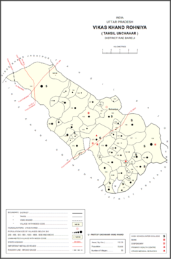 Map showing Marhamau (#157) in Rohaniya CD block | |
| 25°56′53″N 81°24′42″E / 25.948181°N 81.41169°E / 25.948181; 81.41169[1] | |
| Country |  India India |
| State | Uttar Pradesh |
| District | Raebareli |
| Area | |
| • Total | 2.133 km2 (0.824 sq mi) |
| Population (2011)[2] | |
| • Total | 0 |
| • Density | 0.0/km2 (0.0/sq mi) |
| Languages | |
| • Official | Hindi |
| Time zone | UTC+5:30 (IST) |
| Vehicle registration | UP-35 |
Marhamau is an abandoned village in Rohaniya block of Rae Bareli district, Uttar Pradesh, India.[2] It is located 44 km from Raebareli, the district headquarters.[3] As of 2011, Marhamau is uninhabited, although the land is used for agricultural purposes.[2] The village lands cover 213.3 hectares, all of which was used as farmland in 2011.[2]
The 1961 census recorded Marhamau as comprising 1 hamlet, with a total population of 59 people (26 male and 33 female), in 21 households and 20 physical houses.[4] The area of the village was given as 527 acres.[4]
The 1981 census recorded Marhamau as having a population of 0 and an area of 213.26 hectares.[3]
References
- ^ "Geonames Search". Do a radial search using these coordinates here.
- ^ a b c d e "Census of India 2011: Uttar Pradesh District Census Handbook - Rae Bareli, Part A (Village and Town Directory)" (PDF). Census 2011 India. pp. 365–74. Retrieved 10 October 2021.
- ^ a b Census 1981 Uttar Pradesh: District Census Handbook Part XIII-A: Village & Town Directory, District Rae Bareli (PDF). 1982. pp. 230–1. Retrieved 10 October 2021.
- ^ a b Census 1961: District Census Handbook, Uttar Pradesh (39 - Raebareli District) (PDF). Lucknow. 1965. pp. cxii-cxiii of section "Salon Tahsil". Retrieved 10 October 2021.
{{cite book}}: CS1 maint: location missing publisher (link)
- v
- t
- e
Populated places in Raebareli district
 | This Raebareli district location article is a stub. You can help Wikipedia by expanding it. |
- v
- t
- e


