Balangkas, Valenzuela
Barangay in Valenzuela City, Metro Manila, Philippines
Barangay in National Capital Region, Philippines

Seal
Valenzuela may Disiplina

 Philippines
 (2020[1])
1445
Balangkas is one of the barangays of Valenzuela, Metro Manila, Philippines. Balangkas, translated to English means framework.
Balangkas is also known as the barangay with two fiestas.[citation needed] Residents who live in Brgy. Balangkas celebrate the feast day of San Jose every May 1. The fiesta of San Isidro is celebrated every May 15 for residents living in Sitio Bilog.
Demographics
The area is 0.7330 km2 (0.2830 sq mi) with a population of 10,663 with 1,828 households.[2][3]
Schools
- A. Deato Elementary School
- Nuestra Señora de Guia Academy (The Guian's Academy)
Religion
- Roman Catholic Chapel, P. Deato Street
- Balangkas Christian Baptist Church
Gallery
-
 Residents of Kasoy Street, Barangay Balangkas meeting with then-Representative Rex Gatchalian.
 -
 Barangay Balangkas map generated by OpenStreetMap
 -
 Welcome Arch
 -
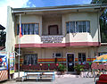 Balangkas Barangay Hall


References
Wikimedia Commons has media related to Balangkas, Valenzuela City.
14°44′17″N 120°59′52″E / 14.73806°N 120.99778°E / 14.73806; 120.99778
- v
- t
- e
Valenzuela

- Arkong Bato
- Bagbaguin
- Balangkas
- Bignay
- Bisig
- Canumay East
- Canumay West
- Coloong
- Dalandanan
- Gen. T. de Leon
- Isla
- Karuhatan
- Lawang Bato
- Lingunan
- Mabolo (San Roque)
- Malanday
- Malinta
- Mapulang Lupa
- Marulas
- Maysan
- Parada
- Palasan
- Pariancillo Villa
- Paso de Blas
- Pasolo
- Poblacion
- Polo
- Punturin
- Rincon
- Tagalag
- Ugong
- Veinte Reales
- Wawang Pulo
This article about a location in Metropolitan Manila (NCR) is a stub. You can help Wikipedia by expanding it. |
- v
- t
- e


