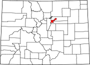
Belcaro, Denver

Belcaro is a neighborhood of Denver, Colorado. According to the Piton Foundation, in 2007, the population of the neighborhood was 4,394, and there were 2,343 housing units. The neighborhood is a wealthy one, and Piton Foundation data from 2000 indicates the neighborhood's average household income was $163,553.[1]
Boundaries
- North: Cherry Creek East Exposition Avenue
- East: Colorado Boulevard, which is also the border with Glendale
- South: East Tennessee Avenue
- West: South University Boulevard
History
The neighborhood gets its name from the mansion of Lawrence C. Phipps (1862-1958) who was a United States Senator who represented Colorado from 1919-1931. Phipps chose “Belcaro” as the name of the mansion, yet today it is more commonly known as the Phipps Mansion. Phipps developed much of the neighborhood, and today it is dominated by many large ranch-style houses on large lots and tree-lined streets. A large gated community called the Polo Grounds occupies a section of the northern part of the neighborhood.
References
- ^ Piton Foundation, Neighborhood summary, Belcaro., retrieved 2009-07-02
39°42′14″N 104°57′00″W / 39.70389°N 104.95000°W / 39.70389; -104.95000
- v
- t
- e
- Auraria
- Capitol Hill
- Civic Center (aka Golden Triangle)
- Central Business District
- Five Points (RiNo)
- Lincoln Park
- North Capitol Hill
- Union Station

- Clayton
- Cole
- Elyria-Swansea
- Globeville
- Whittier
- Central Park
- City Park West
- Denver International Airport
- Gateway
- Green Valley Ranch
- Montbello
- North Park Hill
- Northeast Park Hill
- South Park Hill
- Skyland
- Berkeley
- Chaffee Park
- East Highlands
- Highland
- Jefferson Park
- Regis
- Sunnyside
- West Highlands
- Baker
- College View
- Overland
- Platte Park
- Rosedale
- Ruby Hill
- Southmoor Park
- Speer
- University
- University Hills
- University Park
- Washington Park
- Washington Park West
- Wellshire
- Country Club
- Goldsmith
- Hampden
- Hampden South
- Kennedy
- Belcaro
- Cherry Creek
- Cheesman Park
- City Park
- Congress Park
- Cory-Merrill
- Crestmoor
- East Colfax
- Hale
- Hilltop
- Indian Creek
- Lowry
- Montclair
- Virginia Village
- Washington Virginia Vale
- Windsor
- Athmar Park
- Barnum
- Barnum West
- Harvey Park
- Mar Lee
- Sloan Lake
- Sun Valley
- Valverde
- Villa Park
- West Colfax
- Westwood
- Alamo Placita
- Curtis Park
- LoDo
- List
- Category


