Sunnyside, Denver
Neighborhood in Denver, Colorado

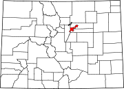
Sunnyside is a city-center neighborhood in Denver, Colorado, located in the Northside of Denver, west of Interstate 25.
The neighborhood is bounded by Union Pacific Railroad lines on the east, Interstate 70 on the north, Federal Boulevard on the West and 38th Avenue on the south.[1] It is bordered by the Highland neighborhood on the south and the Chaffee Park neighborhood on the north.
The neighborhood has a community group named Sunnyside United Neighbors, Inc (SUNI).[citation needed]
References
- ^ "Sunnyside neighborhood in Denver, Colorado (CO), 80211 subdivision profile - real estate, apartments, condos, homes, community, population, jobs, income, streets".
External links
- Sunnyside United Neighbors Inc (SUNI)
- v
- t
- e
Neighborhoods of the City and County of Denver
- Auraria
- Capitol Hill
- Civic Center (aka Golden Triangle)
- Central Business District
- Five Points (RiNo)
- Lincoln Park
- North Capitol Hill
- Union Station

- Clayton
- Cole
- Elyria-Swansea
- Globeville
- Whittier
- Central Park
- City Park West
- Denver International Airport
- Gateway
- Green Valley Ranch
- Montbello
- North Park Hill
- Northeast Park Hill
- South Park Hill
- Skyland
- Berkeley
- Chaffee Park
- East Highlands
- Highland
- Jefferson Park
- Regis
- Sunnyside
- West Highlands
- Baker
- College View
- Overland
- Platte Park
- Rosedale
- Ruby Hill
- Southmoor Park
- Speer
- University
- University Hills
- University Park
- Washington Park
- Washington Park West
- Wellshire
- Country Club
- Goldsmith
- Hampden
- Hampden South
- Kennedy
- Belcaro
- Cherry Creek
- Cheesman Park
- City Park
- Congress Park
- Cory-Merrill
- Crestmoor
- East Colfax
- Hale
- Hilltop
- Indian Creek
- Lowry
- Montclair
- Virginia Village
- Washington Virginia Vale
- Windsor
- Athmar Park
- Barnum
- Barnum West
- Harvey Park
- Mar Lee
- Sloan Lake
- Sun Valley
- Valverde
- Villa Park
- West Colfax
- Westwood
- Alamo Placita
- Curtis Park
- LoDo
- List
- Category
39°46′36″N 105°00′57″W / 39.77655°N 105.01586°W / 39.77655; -105.01586
 | This Colorado state location article is a stub. You can help Wikipedia by expanding it. |
- v
- t
- e


