Candlewood Knolls, Connecticut
Census-designated place in Connecticut, United States
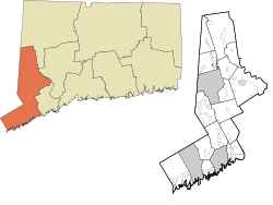
Location within the Western Connecticut Planning Region and the state of Connecticut
41°28′45″N 73°27′48″W / 41.47917°N 73.46333°W / 41.47917; -73.46333
 United States
 Connecticut
06812 (New Fairfield)
Candlewood Knolls is a census-designated place (CDP) in the town of New Fairfield, Fairfield County, Connecticut, United States. It is in the southeast part of the town, on the western shore of Candlewood Lake.
Candlewood Knolls was first listed as a CDP prior to the 2020 census.
References
- ^ "2020 U.S. Gazetteer Files – Connecticut". United States Census Bureau. Retrieved April 12, 2021.
- ^ a b "Candlewood Knolls Census Designated Place". Geographic Names Information System. United States Geological Survey, United States Department of the Interior.
- v
- t
- e
Municipalities and communities of Fairfield County, Connecticut, United States
County seat: Bridgeport

- Newtown
- Ball Pond
- Bethel
- Bigelow Corners
- Bogus Hill
- Botsford
- Branchville
- Brookfield Center
- Byram
- Candlewood Isle
- Candlewood Knolls
- Candlewood Lake Club‡
- Candlewood Orchards
- Candlewood Shores
- Cannondale
- Coleytown
- Compo
- Cos Cob
- Daniels Farm
- Darien Downtown
- Dodgingtown
- East Village
- Fairfield University
- Georgetown
- Glenville
- Greens Farms
- Greenwich
- Hawleyville
- Indian Field
- Inglenook
- Kellogg Point
- Knollcrest
- Lakes East
- Lakes West
- Lakeside Woods
- Long Hill
- Lordship
- Mamanasco Lake
- Mill Plain
- Murray
- New Canaan
- Noroton
- Noroton Heights
- Old Greenwich
- Old Hill
- Oronoque
- Pemberwick
- Plattsville
- Poplar Plains
- Redding Center
- Ridgebury
- Ridgefield
- Riverside
- Rock Ridge
- Route 7 Gateway
- Sacred Heart University
- Sail Harbor
- Sandy Hook
- Saugatuck
- Sherman
- South Wilton
- Southport
- Staples
- Stepney
- Stratford Downtown
- Tashua
- Taylor Corners
- Tokeneke
- Topstone
- Trumbull Center
- West Mountain
- Weston
- Westport Village
- Wilton Center
communities
‡This populated place also has portions in an adjacent county or counties
- Connecticut portal
- United States portal
 | This Connecticut state location article is a stub. You can help Wikipedia by expanding it. |
- v
- t
- e


