Cleveland Street, Sydney
Road in Sydney, New South Wales, Australia


West end
East end
- 33°53′16″S 151°11′35″E / 33.887684°S 151.193140°E / -33.887684; 151.193140 (West end)
- 33°53′43″S 151°13′18″E / 33.895199°S 151.221556°E / -33.895199; 151.221556 (East end)
route number
 Metroad 4 (1992–2000)
 State Route 11 (1974–1992)
 Ring Road 1 (1964–1974)
- (Chippendale–Surry Hills)


 City Road
Camperdown, Sydney
- Regent Street
- Elizabeth Street
- South Dowling Street
- Anzac Parade
Moore Park, Sydney
Cleveland Street is a busy thoroughfare located to the south of the central business district of Sydney in New South Wales, Australia. The street is named after Captain Cleveland, an officer of the 73rd regiment.[citation needed]
Route
Cleveland Street commences at its intersection with City Road in Chippendale and heads in an easterly direction as a four-lane, single carriageway road through Darlington, over the railway lines between Central and Redfern stations and east through Surry Hills, crossing the Eastern Distributor and South Darling Street, to eventually terminate at the intersection with Anzac Parade and Lang Road, Moore Park.
History
Governor Macquarie granted a substantial parcel of land in the Surry Hills and Redfern area to Charles Smith in 1809, who established Cleveland Gardens, as either a market garden or nursery in the area.[3][4] Daniel Cooper purchased approximately five hectares (twelve acres) from Smith and built the heritage-listed Cleveland House in the early 1820s. The decision in 1850 to build Redfern terminus brought industry to the area and resulted in the subdivision of many of the gentlemen's estates in the neighbouring suburb of Surry Hills.[5]
Prior to the 1840s, maps marked Cleveland Street, from Chippendale to Moore Park, as the unsurveyed 'Government Road'.[6]
The passing of the Main Roads Act of 1924[7] through the Parliament of New South Wales provided for the declaration of Main Roads, roads partially funded by the State government through the Main Roads Board (later the Department of Main Roads, and eventually Transport for NSW). With the subsequent passing of the Main Roads (Amendment) Act of 1929[8] to provide for additional declarations of State Highways and Trunk Roads, the Department of Main Roads (having succeeded the MRB in 1932) declared Main Road 330 from the intersection with City Road to the intersection with Dowling Street (today South Dowling Street) in Surry Hills on 21 February 1933,[2] and extended east to the intersection with Anzac Parade on 2 December 1964.[9]
The passing of the Roads Act of 1993[10] updated road classifications and the way they could be declared within New South Wales. Under this act, Cleveland Street retains its declaration as Main Road 330.[11]
The route was part of Sydney's first Ring Roads, and was allocated Ring Road 1 between Abercrombie Street and South Dowling Street in 1964; this was replaced by State Route 11 in 1974, and then Metroad 4 in 1992. Metroad 4 was later re-aligned along City West Link on its completion in 2000; Cleveland Street has remained without an allocation since.
Education
In 1851, some land was reserved in the "Cleveland Paddocks" for a school to be established.[12] Located on the corner of Cleveland and Chalmers Streets, the Cleveland Street Public School was established in prefabricated iron buildings in 1856, as a model school. New sandstone Gothic buildings were constructed in 1867-68, which remain, along with later buildings on the site. The school became an intermediate school in 1913 and later a high school.[13] In 1977 the site was repurposed as an intensive English language tuition centre for migrant students. In 2001 the Cleveland Street site became a dedicated high school for intensive English tuition and was named the Cleveland Street Intensive English High School.[14] A $110-million redevelopment of the site was completed in late 2020 and the Inner Sydney High School was opened in 2021 to accommodate 1,200 students in a 14-storey vertical high school building.[15]
Towards the eastern terminus of Cleveland Street, in Moore Park, Sydney Girls High School and Sydney Boys High School are co-located on adjacent sites.[16]
Transport
Until 1958, electric trams ran down the length of Cleveland Street, when they were replaced by motor buses.[17] The area between Crown and Bourke Streets is home to several pubs and an increasing number of restaurants.
Traffic volumes vary, depending on the segment of Cleveland Street. Near Prince Alfred Park the average traffic movements in 2016 for both east and west-bound vehicles was 17,500. Further east, between South Dowling Street and Anzac Parade, 2016 average traffic volumes peaked at 20,000 vehicles west-bound.[18]
Major intersections
Cleveland Street is entirely contained within the City of Sydney local government area.
| Location | km[1] | mi | Destinations | Notes | |
|---|---|---|---|---|---|
| Camperdown–Chippendale–Darlington tripoint | 0.0 | 0.0 | City Road (A36) – Ultimo, Newtown | Western terminus of street | |
| Chippendale–Darlington–Redfern tripoint | 0.5 | 0.31 | Abercrombie Street – Ultimo, Darlington | One-way into Abercrombie Street northbound | |
| Chippendale–Redfern–Surry Hills tripoint | 0.8 | 0.50 | Regent Street – Ultimo, Redfern | ||
| Main Suburban railway line | |||||
| Redfern–Surry Hills boundary | 1.2 | 0.75 | Chalmers Street – Waterloo, Haymarket | One-way northbound only | |
| 1.4 | 0.87 | Elizabeth Street – Waterloo, Sydney CBD | One-way southbound only | ||
| 1.9 | 1.2 | Crown Street – Woolloomooloo, Surry Hills | |||
| 2.0 | 1.2 | Bourke Street – Woolloomooloo, Alexandria | |||
| Redfern–Surry Hills–Moore Park tripoint | 2.3 | 1.4 | South Dowling Street – Darlinghurst, Zetland to   Eastern Distributor (M1) – Wahroongah, North Sydney, Kogarah, Heathcote, Sydney Airport Eastern Distributor (M1) – Wahroongah, North Sydney, Kogarah, Heathcote, Sydney Airport | ||
| Moore Park | 2.8 | 1.7 | Anzac Parade – Paddington, Kingsford, La Perouse | ||
| Lang Road – Woollahra | Eastern terminus of street | ||||
| |||||
Gallery
-
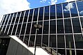 Seymour Centre, Cleveland Street, Chippendale
 -
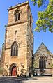 Cathedral of the Annunciation of Our Lady, Cleveland Street, Surry Hills
 -
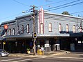
 Former Art Deco cinema in Cleveland Street, Redfern
 -
 Norfolk Hotel, Cleveland Street, Redfern
 -
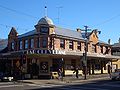
 Alfred Park Hotel, Cleveland Street, Redfern
 -
 Australia Post New South Wales head office, Cleveland Street, Redfern
 -
 Facade of Inner Sydney High School, formerly the Central Sydney Intensive English High School, and originally the Cleveland Street Model School, Cleveland Street, Surry Hills
 -
 The Kirk, Cleveland Street, Surry Hills
 -
 Former facade of the Surry Hills Shopping Village, Cleveland Street, Redfern
 -
 Bar Cleveland, Cleveland Street, Redfern


See also
 Australian Roads portal
References
- ^ a b Google (9 September 2021). "Cleveland Street, Sydney" (Map). Google Maps. Google. Retrieved 9 September 2021.
- ^ a b "Main Roads Act, 1924-1931". Government Gazette of the State of New South Wales. No. 34. National Library of Australia. 3 March 1933. p. 884. Archived from the original on 14 May 2023. Retrieved 21 June 2023.
- ^ Annable, Rosemary (1991). Cleaveland House; An Archaeological Assessment. p. 12.
- ^ Lawrence, Joan (2011). Cleveland House, Surry Hills, Sydney (a history).
- ^ "Cleveland House". New South Wales State Heritage Register. Department of Planning & Environment. H00065. Retrieved 13 October 2018.
 Text is licensed by State of New South Wales (Department of Planning and Environment) under CC-BY 4.0 licence.
 - ^ "Sydney's Streets: A guide to Sydney street names" (Downloadable Excel). City of Sydney. n.d. Retrieved 23 March 2023.
- ^ State of New South Wales, An Act to provide for the better construction, maintenance, and financing of main roads; to provide for developmental roads; to constitute a Main Roads Board Archived 11 August 2022 at the Wayback Machine 10 November 1924
- ^ State of New South Wales, An Act to amend the Main Roads Act, 1924-1927; to confer certain further powers upon the Main Roads Board; to amend the Local Government Act, 1919, and certain other Acts; to validate certain payments and other matters; and for purposes connected therewith. Archived 12 August 2022 at the Wayback Machine 8 April 1929
- ^ "Main Roads Act, 1924-1963". Government Gazette of the State of New South Wales. No. 137. National Library of Australia. 4 December 1964. p. 3910. Archived from the original on 15 May 2023. Retrieved 21 June 2023.
- ^ State of New South Wales, An Act to make provision with respect to the roads of New South Wales; to repeal the State Roads Act 1986, the Crown and Other Roads Act 1990 and certain other enactments; and for other purposes. Archived 11 August 2022 at the Wayback Machine 10 November 1924
- ^ Transport for NSW (August 2022). "Schedule of Classified Roads and Unclassified Regional Roads" (PDF). Government of New South Wales. Archived from the original (PDF) on 25 August 2022. Retrieved 1 August 2022.
- ^ "CSIEHS Website-History". Archived from the original on 17 December 2003. Retrieved 22 February 2015.
- ^ "Cleveland Street Public School". Dictionary of Sydney. State Library of New South Wales. 2021. Retrieved 23 March 2023.
- ^ "CSIEHS Website-History-Memorabilia". Archived from the original on 22 February 2015. Retrieved 22 February 2015.
- ^ "Inner Sydney High School – Cleveland and Chalmers Street, Surry Hills". Northrop Engineering. 2022. Retrieved 23 March 2023.
- ^ Proctor, H, Sriprakash, A., "Selective schools' long and tangled history with race and class", Sydney Morning Herald, 29 March 2017
- ^ Keenan, D. (1979). Tramways of Sydney. Transit Press.
- ^ "Cleveland Street: 02038". Traffic volume viewer. Roads & Maritime Services. 2016. Retrieved 3 October 2016.
- v
- t
- e
Streets of Sydney, New South Wales, Australia
- Albion Street
- Alfred Street
- Bathurst Street
- Bridge Street
- Bayswater Road
- Broadway
- Castlereagh Street
- Chalmers Street
- City Road
- Clarence Street
- Cleveland Street
- College Street
- Crown Street
- Eddy Avenue
- Elizabeth Street
- George Street
- Glebe Point Road
- Goulburn Street
- Grosvenor Street
- Harris Street
- Hay Street
- Hunter Street
- Kent Street
- King Street
- Lime Street
- Liverpool Street
- Macquarie Street
- Market Street
- Martin Place
- Oxford Street
- Park Street
- Phillip Street
- Pitt Street
- Queen's Square
- Rowe Street
- Stanley Street
- Sussex Street
- Victoria Street
- Whitlam Square
- William Street
- York Street
- Anzac Parade
- Appian Way
- Bangor Bypass
- Barrenjoey Road
- Blacktown Road
- Bondi Road
- Burnt Bridge Creek Deviation
- City West Link
- Cumberland Highway
- Darling Street
- Epping Road
- General Holmes Drive
- Gore Hill Freeway
- Great North Road
- Great Western Highway
- Heathcote Road
- Henry Lawson Drive
- The Horsley Drive
- Hume Highway
- James Ruse Drive
- Jeffrey Street
- King Georges Road
- King Street
- Lane Cove Road
- New South Head Road
- Norton Street
- Old South Head Road
- Old Windsor Road
- Parramatta Road
- Pennant Hills Road
- Pittwater Road
- Princes Highway
- Prospect Highway
- Richmond Road
- Ryde Road
- Southern Cross Drive
- Syd Einfeld Drive
- Taren Point Road
- Victoria Road
- Windsor Road
- Wolseley Road
KML file (edit • help)
Template:Attached KML/Cleveland Street, Sydney
KML is from Wikidata


