Colusa Rancheria, California
Unincorporated community in California, United States
39°15′01″N 122°01′33″W / 39.25028°N 122.02583°W / 39.25028; -122.02583
Unincorporated community in California, United States


Colusa Rancheria
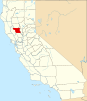
Location in California
Show map of California
Colusa Rancheria
Colusa Rancheria (the United States)
Show map of the United StatesColusa Rancheria (also, Cachildehe Rancheria) is an unincorporated community in Colusa County, California. It lies at an elevation of 59 feet (18 m). The inhabitants belong to the Wintun tribe. It was established in 1907.[citation needed] As of the 2010 Census the population was 76.[2]
References
- U.S. Geological Survey Geographic Names Information System: Colusa Rancheria, California
- v
- t
- e
Municipalities and communities of Colusa County, California, United States
County seat: Colusa
- Colusa
- Williams
- Arbuckle
- College City
- Grimes
- Lodoga
- Maxwell
- Princeton
- Stonyford
communities
reservations
- Colusa Rancheria
- Kletsel Dehe Wintun Nation of the Cortina Rancheria
‡This populated place also has portions in an adjacent county or counties
- California portal
- United States portal
 | This Colusa County, California-related article is a stub. You can help Wikipedia by expanding it. |
- v
- t
- e


