Leesville, California
Unincorporated community in California, United States
39°11′22″N 122°25′25″W / 39.18944°N 122.42361°W / 39.18944; -122.42361
Unincorporated community in California, United States


Leesville
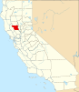
Location in California
Show map of California
Leesville
Leesville (the United States)
Show map of the United StatesLeesville is an unincorporated community in Colusa County, California. It lies at an elevation of 1434 feet (437 m). It had a post office from 1874 to 1920.[2] The town is named for Lee Harl, a pioneer landowner.[2]
Climate
According to the Köppen Climate Classification system, Leesville has a warm-summer Mediterranean climate, abbreviated "Csa" on climate maps.[3]
References
- ^ U.S. Geological Survey Geographic Names Information System: Leesville, California
- ^ a b Durham, David L. (1998). California's Geographic Names: A Gazetteer of Historic and Modern Names of the State. Clovis, Calif.: Word Dancer Press. p. 511. ISBN 1-884995-14-4.
- ^ Climate Summary for Leesville, California
- U.S. Geological Survey Geographic Names Information System: Leesville, California
- v
- t
- e
Municipalities and communities of Colusa County, California, United States
County seat: Colusa
- Colusa
- Williams
- Arbuckle
- College City
- Grimes
- Lodoga
- Maxwell
- Princeton
- Stonyford
communities
- Delevan
- Fouts Springs
- Genevra
- Grand Island
- Leesville
- Sites
- Sycamore
reservations
‡This populated place also has portions in an adjacent county or counties
- California portal
- United States portal
 | This Colusa County, California-related article is a stub. You can help Wikipedia by expanding it. |
- v
- t
- e


