County of Minburn No. 27
Municipal district in Alberta, Canada
Municipal district in Alberta, Canada
53°29′34″N 112°03′8″W / 53.49278°N 112.05222°W / 53.49278; -112.05222 (2021)[2]
(2021)[2]
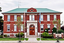
The County of Minburn No. 27 is a municipal district in east central Alberta, Canada. Its municipal office is located in the Town of Vegreville. Located in Census Division No. 10, the County of Minburn No. 27 was formed as a county on January 1, 1965, from the former Municipal District of Minburn No. 72.
Geography
Communities and localities
| The following urban municipalities are surrounded by the County of Minburn No. 27.[3]
The following hamlets are located within the County of Minburn No. 27.[3] | The following localities are located within the County of Minburn No. 27.[5]
|
Demographics
In the 2021 Census of Population conducted by Statistics Canada, the County of Minburn No. 27 had a population of 3,014 living in 1,138 of its 1,337 total private dwellings, a change of -5.5% from its 2016 population of 3,188. With a land area of 2,850.37 km2 (1,100.53 sq mi), it had a population density of 1.1/km2 (2.7/sq mi) in 2021.[2]
In the 2016 Census of Population conducted by Statistics Canada, the County of Minburn No. 27 had a population of 3,188 living in 1,184 of its 1,380 total private dwellings, a -5.8% change from its 2011 population of 3,383. With a land area of 2,913.02 km2 (1,124.72 sq mi), it had a population density of 1.1/km2 (2.8/sq mi) in 2016.[6]
See also
References
- ^ "Municipal Officials Search". Alberta Municipal Affairs. May 9, 2019. Retrieved October 1, 2021.
- ^ a b c "Population and dwelling counts: Canada, provinces and territories, and census subdivisions (municipalities)". Statistics Canada. February 9, 2022. Retrieved February 9, 2022.
- ^ a b "Specialized and Rural Municipalities and Their Communities" (PDF). Alberta Municipal Affairs. January 12, 2022. Retrieved January 21, 2022.
- ^ "O.C. 152/2015". Government of Alberta. June 24, 2015. Retrieved June 30, 2015.
- ^ "Standard Geographical Classification (SGC) 2006, Economic Regions: 4810026 - Minburn County No. 27, geographical codes and localities, 2006". Statistics Canada. March 5, 2010. Archived from the original on May 25, 2013. Retrieved August 11, 2012.
- ^ "Population and dwelling counts, for Canada, provinces and territories, and census subdivisions (municipalities), 2016 and 2011 censuses – 100% data (Alberta)". Statistics Canada. February 8, 2017. Retrieved February 8, 2017.
External links
- County of Minburn
Places adjacent to County of Minburn No. 27 | |
|---|---|


- v
- t
- e
Subdivisions of Alberta
service areas
municipalities
municipalities
- Crowsnest Pass, Municipality of
- Jasper, Municipality of
- Lac La Biche County
- Mackenzie County
- Strathcona County
- Wood Buffalo, Regional Municipality of
 Category
 Canada portal
 WikiProject


