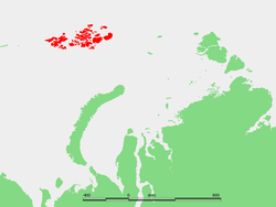
Hofmann Island (Остров Гофмана; Ostrov Gofmana) is an island in Franz Josef Land, Russian Arctic.
Hofmann Island is 13 kilometres (8 miles) long and its maximum width is 5 km (3 miles). It is located 8.6 km (5.3 mi) further east from Rainer Island and it has three small islets on its northeastern shores.
Hofmann island is the site of a snow runway.
This island is said to have been named after Freiherr Leopold von Hoffmann, a member of the Austro-Hungarian North Pole Society,[1] though a differing claim attributes the namesake to be Russian geologist Ernst Reinhold von Hofmann.[2]
Northeast of Hofmann Island runs a 45-kilometre-broad (28 mi) channel known as Proliv Severo Vostochnyy, beyond which lies Belaya Zemlya.
References
[edit]- ^ Günther Hamann (1975): "Das Zeitalter Kaiser Franz Josefs im Spiegel der Topographie des Franz-Josefs-Landes". Publikationen aus dem Archiv der Universität Graz 4, pp. 139–151, (p. 146, german)
- ^ "ГОФМАН ЭРНСТ КАРЛОВИЧ. НАСЛЕДИЕ КАРТОГРАФОВ УРАЛА". Russian Geographical Society (in Russian). Retrieved 16 November 2020.
External links
[edit]81°17′N 60°13′E / 81.283°N 60.217°E
This Arkhangelsk Oblast location article is a stub. You can help Wikipedia by expanding it. |