Hueston Woods State Park
Park in Ohio, US
39°34′21″N 84°44′29″W / 39.57250°N 84.74139°W / 39.57250; -84.74139[1]
| Acton Lake | |
|---|---|
 Acton Lake | |
  Acton Lake | |
| Location | Southwestern Ohio |
| Coordinates | 39°34′19″N 84°44′53″W / 39.57194°N 84.74806°W / 39.57194; -84.74806 (Acton Lake)[3] |
| Lake type | Reservoir |
| Basin countries | United States |
| Max. length | 2.3 mi (3.7 km) |
| Max. width | 0.5 mi (0.80 km) |
| Surface area | 625 acres (253 ha)[4] |
| Surface elevation | 860 ft (260 m)[3] |
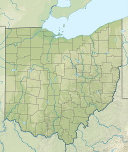
Hueston Woods State Park is a state park located in Butler and Preble counties of the U.S. state of Ohio, about five miles (8 km) northeast of Oxford in the southwestern part of the state. The park lies in Oxford Township, Butler County, and Israel Township, Preble County. It has nearly 3,000 acres (1,200 ha), including a man-made lake of 625 acres (253 ha).[4] The park's beech-maple climax forest has been designated a National Natural Landmark.[5]
History
The state bought the land in 1941, but the park did not open until 1957. The state used the land initially as a prison camp.[citation needed] In 1956, Four Mile Creek was dammed to form Acton Lake, named for Clyde Acton, the member of the Ohio General Assembly who persuaded the legislature to buy the property.[4] Hueston Woods was designated as a National Natural Landmark by the National Park Service in 1967.[5]
The park was temporarily named after former Cincinnati Bengals player Ickey Woods prior to Super Bowl LVI.[6]
Features
"The limestone and shale bedrock of the Hueston Woods area provides evidence of the ancient shallow sea that once covered Ohio. Fossilized remains of ancient marine animals are so abundant that visitors from around the world are drawn to Hueston Woods to collect them."[4] Fossils found at this State Park include:
- Bryozoans, brachiopods, pelecypods, horn corals, cephalopods, gastropods, crinoids, trilobites and mollusks.[7][8]
The Hueston Woods Covered Bridge in Preble County was completed and opened for traffic in June 2012. The $2.0 million Burr arch truss structure spans 108 feet over Four Mile Creek north and west of the park. The structure supports 40 ton tractor trailer traffic and has a life expectancy of over 100 years.[9]
The Doty Homestead is a mid 19th-century brick farmhouse that is operated by the Oxford Museum Association as a historic house museum. It is open on Sunday afternoons in the summer season.[10]
Mammals that call the park home include beaver, mink, white-tail deer, foxes, eastern coyotes, bobcats, opossums, muskrats, cottontail rabbits, skunks, and more.[11]
Activities and amenities
The park offers boating, camping, fishing, swimming, 12 miles (19 km) of hiking trails, 18 miles (29 km) of bridle trails, 20 miles (32 km) of mountain biking trails, cabins, 96-room lodge, and golf course.[4]
References
- ^ a b "Hueston Woods State Park". Geographic Names Information System. United States Geological Survey, United States Department of the Interior.
- ^ "Hueston Woods State Park". Ohio Department of Natural Resources. Archived from the original on December 31, 2008.
- ^ a b "Acton Lake". Geographic Names Information System. United States Geological Survey, United States Department of the Interior.
- ^ a b c d e "Hueston Woods State Park". Ohio Department of Natural Resources. Retrieved October 22, 2020.
- ^ a b "Hueston Woods". National Natural Landmarks. National Park Service. Retrieved June 6, 2019.
...a noteworthy example of beech-maple climax forest that has never been cut.
- ^ "Ickey Woods State Park: 3 Ohio parks renamed ahead of Bengals' Super Bowl appearance". WHIO TV 7 and WHIO Radio. February 7, 2022. Retrieved February 16, 2022.
- ^ "The Fossils of Hueston Woods" (PDF). Ohio Department of Natural Resources. January 1, 2009. Archived (PDF) from the original on January 1, 2009. Retrieved November 6, 2019.
Portions adapted from "Ohio Fossils," Bulletin 54, by permission of the Division of the Geological Survey, Ohio Department of natural Resources
- ^ La Rocque, Aurèle; Marple, Mildred Fisher; Ohio. Division of Geological Survey (1955). Ohio Fossils. University of Connecticut Libraries. Columbus : Ohio Dept. of Natural Resources, Division of Geological Survey.
- ^ "Hueston Woods Covered Bridge" (PDF) (Press release). Hueston Woods Lodge.
- ^ "Doty Homestead". Oxford Museum Association. Retrieved September 30, 2017.
- ^ "Division of Wildlife". Retrieved August 26, 2020.
External links
Wikimedia Commons has media related to Hueston Woods State Park.
Wikivoyage has a travel guide for Ohio State Parks
which includes
Hueston Woods State Park.
which includes
Hueston Woods State Park.
- Hueston Woods State Park Ohio Department of Natural Resources
- Hueston Woods State Park Map Ohio Department of Natural Resources
- Doty Homestead Oxford Museum Association
- v
- t
- e
| National parks | |
|---|---|
| National historical parks and sites | |
| National monuments | |
| National memorials | |
| National trails | |
| National forests | |
| National Wild and Scenic Rivers |
|
| National Wildlife Refuges | |
| National estuarine research reserve | |
| National Natural Landmarks |
| State parks |
|
|---|---|
| State forests | |
| State nature preserves |
|
| State scenic rivers |
|
| Metro Parks |
|
|---|
Authority control databases | |
|---|---|
| International |
|
| National |
|


