Lac des Bouillouses
Reservoir in Pyrénées-Orientales
42°34′13″N 1°59′58″E / 42.570225°N 1.999426°E / 42.570225; 1.999426Lac des Bouillouses or Llac de la Bollosa is a lake in Pyrénées-Orientales, France. At an elevation of 2017 m, its surface area is 1.49 km².[1]
It is an artificial lake, the 20-metre high dam of which was built between 1903 and 1910 as a key part of a hydro-electricity project in the Têt valley.[2]
-
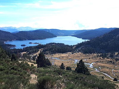 The lake is fed by River Têt (below, on the right).
 -
 The dam at the southern end of the lake.


References
- ^ Topographical map extract (in Géoportail).
- ^ "Les Bouillouses", on les-pyrenees-orientales.com (in French).
- v
- t
- e


