Lassan, Germany
Town in Mecklenburg-Vorpommern, Germany
Town in Mecklenburg-Vorpommern, Germany

Coat of arms
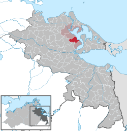
Location of Lassan within Vorpommern-Greifswald district
53°56′N 13°50′E / 53.933°N 13.833°E / 53.933; 13.833
(2021-12-31)[1]
17440
Lassan is a town in the Vorpommern-Greifswald district, in Mecklenburg-Western Pomerania, Germany.
Etymology
The name possibly derives from an Old Polabian word, Lěšane, meaning "forest dweller" or "forest dwelling".[2]
Location

The town is situated on the Peenestrom river, a branch of the Oder, between the larger towns of Anklam and Wolgast. Both Anklam in the southwest and Wolgast in the north are approximately 15 kilometres (9.3 mi) from Lassan. Part of the municipality are also the villages of Pulow, Papendorf, Klein Jasedow and Waschow.[2]
Lassan has a small marina for sailboats and yachts.[3] There is also a campsite for visitors in the town.[4] A museum dedicated to the town is housed in a former watermill in the town.[5]
History
Lassan was mentioned in written sources for the first time in 1136, when it was a German settlement with a castle. However this settlement was predated by a Polabian fishing village with a fortification. The Dukes of Pomerania regulated the layout of the town around 1200. Lassan received town privileges in 1274. The town still retains much of its medieval character, with the old street grid and the remains of a town wall.[2] The town church, St. Johannis zu Lassan, is also medieval. Construction started around 1300 and the oldest parts are in a transitional style between Romanesque and Gothic. With its spire, it is 57 metres (187 ft) tall, 37 metres (121 ft) long and 24 metres (79 ft) broad. The church was renovated during the 1990s.[6]
Notable people
- Bernt Notke (c. 1440 – c. 1509), late Gothic artist
- Johann Joachim Spalding (1714 – 1804), Protestant theologian and philosopher, living and working as pastor in Lassan from 1749 to 1757
- Balzer Peter Vahl (1718 – 1792), merchant and mayor of Greifswald
- Theodor Bartus (1858 – 1941), sailor, museum technician, and conservator
- Alfred Roloff (1879 – 1951), painter and illustrator of dime novels
References
- ^ "Bevölkerungsstand der Kreise, Ämter und Gemeinden 2021" (XLS) (in German). Statistisches Amt Mecklenburg-Vorpommern. 2022.
- ^ a b c "Geschichte". www.lassan.eu (in German). Stadt Lassan. Retrieved 9 November 2016.
- ^ "Hafen Lassan". www.lassan.eu (in German). Stadt Lassan. Retrieved 9 November 2016.
- ^ "Naturcampingplatz am Peenestrom". www.lassan.eu (in German). Stadt Lassan. Retrieved 9 November 2016.
- ^ "Museum Lassaner Mühle". Museum Lassaner Mühle. Retrieved 9 November 2016.
- ^ "Geschichte von St. Johannis zu Lassan" (in German). Evangelische Kirchgemeinde im Pfarrsprengel Lassan. Retrieved 9 November 2016.
External links
- 750 years of Lassan Official website for the 750th city anniversary
- Lassaner-Winkel.de
- Lassaner Türen (Doors of Lassan)
Wikimedia Commons has media related to Lassan.
- v
- t
- e
Towns and municipalities in Vorpommern-Greifswald
- Ahlbeck
- Alt Tellin
- Altwarp
- Altwigshagen
- Anklam
- Bandelin
- Bargischow
- Behrenhoff
- Bentzin
- Benz
- Bergholz
- Blankensee
- Blesewitz
- Boldekow
- Boock
- Brietzig
- Brünzow
- Bugewitz
- Buggenhagen
- Butzow
- Daberkow
- Dargelin
- Dargen
- Dersekow
- Ducherow
- Eggesin
- Fahrenwalde
- Ferdinandshof
- Garz
- Glasow
- Görmin
- Grambin
- Grambow
- Greifswald
- Gribow
- Groß Kiesow
- Groß Luckow
- Groß Polzin
- Gützkow
- Hammer an der Uecker
- Hanshagen
- Heinrichswalde
- Heringsdorf
- Hinrichshagen
- Hintersee
- Iven
- Jarmen
- Jatznick
- Kamminke
- Karlsburg
- Karlshagen
- Katzow
- Kemnitz
- Klein Bünzow
- Koblentz
- Korswandt
- Koserow
- Krackow
- Krien
- Kröslin
- Kruckow
- Krugsdorf
- Krummin
- Krusenfelde
- Lassan
- Leopoldshagen
- Levenhagen
- Liepgarten
- Löcknitz
- Loddin
- Loissin
- Loitz
- Lubmin
- Lübs
- Luckow
- Lütow
- Medow
- Meiersberg
- Mellenthin
- Mesekenhagen
- Mölschow
- Mönkebude
- Murchin
- Nadrensee
- Neetzow-Liepen
- Neu Boltenhagen
- Neu Kosenow
- Neuenkirchen, Anklam-Land
- Neuenkirchen, Landhagen
- Nieden
- Papendorf
- Pasewalk
- Peenemünde
- Penkun
- Plöwen
- Polzow
- Postlow
- Pudagla
- Ramin
- Rankwitz
- Rollwitz
- Rossin
- Rossow
- Rothemühl
- Rothenklempenow
- Rubenow
- Rubkow
- Sarnow
- Sassen-Trantow
- Sauzin
- Schmatzin
- Schönwalde
- Spantekow
- Stolpe an der Peene
- Stolpe auf Usedom
- Strasburg
- Torgelow
- Trassenheide
- Tutow
- Ückeritz
- Ueckermünde
- Usedom
- Viereck
- Vogelsang-Warsin
- Völschow
- Wackerow
- Weitenhagen
- Wietstock
- Wilhelmsburg
- Wolgast
- Wrangelsburg
- Wusterhusen
- Zemitz
- Zempin
- Zerrenthin
- Ziethen
- Zinnowitz
- Zirchow
- Züssow

Authority control databases | |
|---|---|
| International |
|
| National |
|


