Laukkaing Township
Township in Shan State, Myanmar
Laukkaing Township လောက်ကိုင်မြို့နယ် | |
|---|---|
Township | |
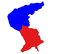 Location in Laukkaing district (Kokang SAZ) | |
| |
| Time zone | UTC+6.30 (MMT) |
Laukkaing Township or Laukkai Township (Burmese: လောက်ကိုင်မြို့နယ်, Chinese: 老街区) is a township located within Laukkaing District, Shan State, Myanmar. It is the principal township of the Kokang Self-Administered Zone. The principal town is Laukkai (Burmese: လောက်ကိုင်မြို့). The township is divided into 137 villages organized into 8 village tracts and 2 towns, each with 3 urban wards. Besides Laukkai, the other town is Chinshwehaw in the southeast of the township.[1]
Geography
Laukkaing shares a border with Kongyan Township in the north, with the People's Republic of China in the north and east, with Kunlong Township in the south and with Kutkai Township in the west. It has 31 border posts, and is situated at 3,100 feet (940 m) above sea level. Few plains can be seen in Laukkai, Mangtonpa, Yanlongkyaing, Pasinkyaw and Namhuhtan. The remaining area is mountainous and from 3,000 to 8,317 feet (2,535 m) above sea level. The total area is 316.96 square miles (820.9 km2) and the population is over 70,000.[2][1]
Rubber, lychee, mango, walnut and pear are grown in the area as poppy substitutes. Sugarcane, pineapple, corn, buckwheat, soybean and various vegetables are also grown.
There are 4 high schools and 17 primary schools. There is a 50 bedded hospital.
Further reading
- Topo Map of Kokang Self-Administered Zone - Mimu
- Shan (North) State, Myanmar - Mimu
- Laukkaing Township - Shan State - Mimu
References
- ^ a b c d Myanmar Information Management Unit (September 2019). Laukkaing Myone Daethasaingyarachatlatmya လောက်ကိုင်မြို့နယ် ဒေသဆိုင်ရာအချက်လက်များ [Laukkaing Township Regional Information] (PDF) (Report). MIMU. Retrieved 18 November 2023.
- ^ "Archived copy" (PDF). Archived from the original (PDF) on 2011-10-02. Retrieved 2011-06-18.
{{cite web}}: CS1 maint: archived copy as title (link)
- v
- t
- e
Capital: Taunggyi
| Kengtung District |
|
|---|---|
| Mong Hpayak District |
|
| Mong Hsat District |
|
| Tachileik District |
|


| Kyaukme District |
|
|---|---|
| Lashio District | |
| Laukkaing District | see Kokang Self-Administered Zone |
| Mu Se District |
|
| Hopang District | see Wa Self-Administered Division |
| Matman District | see Wa Self-Administered Division |
| Mongmit District | |
| Kokang Self-Administered Zone |
|
| Pa Laung Self-Administered Zone1 | |
| Wa Self-Administered Division |
|
| Langkho District |
|
|---|---|
| Loilen District |
|
| Taunggyi District |
|
| Danu Self-Administered Zone | |
| Pa-O Self-Administered Zone |
- Taunggyi
- Aungban
- Ayetharyar
- Chinshwehaw
- Hong Pai
- Hopang
- Hopong
- Hseni
- Hsi Hseng
- Hsipaw
- Kalaw
- Kengtung
- Kunhing
- Kunlong
- Kutkai
- Kyaukme
- Kyethi
- Lai-Hka
- Langkho
- Lashio
- Laukkaing
- Lawksawk
- Loilen
- Mabein
- Mantong
- Mawkmai
- Mong Hpayak
- Mong Hsat
- Mong Hsu
- Mong Khet
- Mong Kung
- Mong Nai
- Mong Pan
- Mong Ping
- Mong Ton
- Mong Yang
- Mong Yawng
- Mongko
- Mongmit
- Mongyai
- Muse
- Nanhkan
- Namhsan
- Namtu
- Nansang
- Nawnghkio
- Nyaungshwe
- Panglong
- Pekon
- Pinlaung
- Ponparkyin, Shan State, Myanmar
- Tachileik
- Tangyan
1 - also part of Kyaukme District; 2 - also part of Hopang District; 3 - also part of Matman District
 | This Shan State location article is a stub. You can help Wikipedia by expanding it. |
- v
- t
- e


