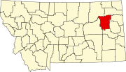
List of lakes of McCone County, Montana
Map all coordinates using OpenStreetMap
Download coordinates as:
- KML
- GPX (all coordinates)
- GPX (primary coordinates)
- GPX (secondary coordinates)
This list is incomplete; you can help by adding missing items. (January 2011) |
There are at least 28 named lakes and reservoirs in McCone County, Montana.
Lakes
- Fort Peck Lake, 48°00′10″N 106°24′58″W / 48.00278°N 106.41611°W / 48.00278; -106.41611 (Fort Peck Lake), el. 2,313 feet (705 m)[1]
- Hedstrom Lake, 47°13′07″N 106°06′44″W / 47.21861°N 106.11222°W / 47.21861; -106.11222 (Hedstrom Lake), el. 2,562 feet (781 m)[2]
- Lake Fort Peck, 48°00′00″N 106°25′02″W / 48.00000°N 106.41722°W / 48.00000; -106.41722 (Lake Fort Peck), el. 2,247 feet (685 m)[3]
Reservoirs

- Antelope Creek Reservoir, 47°54′28″N 105°41′07″W / 47.90778°N 105.68528°W / 47.90778; -105.68528 (Antelope Creek Reservoir), el. 2,165 feet (660 m)[4]
- Beery Reservoir, 47°43′41″N 105°23′08″W / 47.72806°N 105.38556°W / 47.72806; -105.38556 (Beery Reservoir), el. 2,342 feet (714 m)[5]
- Christianson Reservoir, 47°46′54″N 105°59′56″W / 47.78167°N 105.99889°W / 47.78167; -105.99889 (Christianson Reservoir), el. 2,372 feet (723 m)[6]
- Dreyer Reservoir, 47°32′18″N 105°56′08″W / 47.53833°N 105.93556°W / 47.53833; -105.93556 (Dreyer Reservoir), el. 2,539 feet (774 m)[7]
- Dreyer Reservoir Number 2, 47°33′12″N 105°57′08″W / 47.55333°N 105.95222°W / 47.55333; -105.95222 (Dreyer Reservoir Number 2), el. 2,510 feet (770 m)[8]
- Game Reservoir, 47°49′26″N 106°05′57″W / 47.82389°N 106.09917°W / 47.82389; -106.09917 (Game Reservoir), el. 2,425 feet (739 m)[9]
- Gass Reservoir, 47°45′21″N 105°51′20″W / 47.75583°N 105.85556°W / 47.75583; -105.85556 (Gass Reservoir), el. 2,280 feet (690 m)[10]
- Goose Island Reservoir, 47°49′29″N 106°04′02″W / 47.82472°N 106.06722°W / 47.82472; -106.06722 (Goose Island Reservoir), el. 2,362 feet (720 m)[11]
- Groh Stock Reservoir, 47°26′24″N 105°44′20″W / 47.44000°N 105.73889°W / 47.44000; -105.73889 (Groh Stock Reservoir), el. 2,539 feet (774 m)[12]
- Haynie Reservoir, 47°34′37″N 105°42′45″W / 47.57694°N 105.71250°W / 47.57694; -105.71250 (Haynie Reservoir), el. 2,546 feet (776 m)[13]
- Hell Gate Reservoir, 47°47′46″N 106°03′12″W / 47.79611°N 106.05333°W / 47.79611; -106.05333 (Hell Gate Reservoir), el. 2,447 feet (746 m)[14]
- Hudiburgh Reservoir, 47°37′54″N 105°32′26″W / 47.63167°N 105.54056°W / 47.63167; -105.54056 (Hudiburgh Reservoir), el. 2,411 feet (735 m)[15]
- Jays Reservoir, 47°50′02″N 106°05′42″W / 47.83389°N 106.09500°W / 47.83389; -106.09500 (Jays Reservoir), el. 2,408 feet (734 m)[16]
- John Ball Reservoir, 47°43′18″N 106°08′20″W / 47.72167°N 106.13889°W / 47.72167; -106.13889 (John Ball Reservoir), el. 2,375 feet (724 m)[17]
- Leaky Reservoir, 47°29′51″N 106°09′52″W / 47.49750°N 106.16444°W / 47.49750; -106.16444 (Leaky Reservoir), el. 2,497 feet (761 m)[18]
- Lisk Creek Reservoir, 47°08′30″N 105°51′20″W / 47.14167°N 105.85556°W / 47.14167; -105.85556 (Lisk Creek Reservoir), el. 2,762 feet (842 m)[19]
- McCloys Reservoir, 47°16′54″N 105°33′38″W / 47.28167°N 105.56056°W / 47.28167; -105.56056 (McCloys Reservoir), el. 2,753 feet (839 m)[20]
- O'Dell Coulee Reservoir, 47°53′39″N 105°42′02″W / 47.89417°N 105.70056°W / 47.89417; -105.70056 (O'Dell Coulee Reservoir), el. 2,188 feet (667 m)[21]
- Quick Reservoir, 47°19′48″N 105°27′38″W / 47.33000°N 105.46056°W / 47.33000; -105.46056 (Quick Reservoir), el. 2,818 feet (859 m)[22]
- Quick Reservoir, 47°20′07″N 105°30′57″W / 47.33528°N 105.51583°W / 47.33528; -105.51583 (Quick Reservoir), el. 2,615 feet (797 m)[23]
- Switzer Reservoir, 47°36′55″N 105°22′42″W / 47.61528°N 105.37833°W / 47.61528; -105.37833 (Switzer Reservoir), el. 2,283 feet (696 m)[24]
- Teds Reservoir, 47°49′15″N 106°04′57″W / 47.82083°N 106.08250°W / 47.82083; -106.08250 (Teds Reservoir), el. 2,388 feet (728 m)[25]
- Tveten Reservoir, 47°49′53″N 105°43′29″W / 47.83139°N 105.72472°W / 47.83139; -105.72472 (Tveten Reservoir), el. 2,238 feet (682 m)[26]
- Upper O'Dell Coulee Reservoir, 47°53′58″N 105°42′32″W / 47.89944°N 105.70889°W / 47.89944; -105.70889 (Upper O'Dell Coulee Reservoir), el. 2,205 feet (672 m)[27]
- Waters Reservoir, 47°52′31″N 105°15′38″W / 47.87528°N 105.26056°W / 47.87528; -105.26056 (Waters Reservoir), el. 2,152 feet (656 m)[28]
See also
Notes
- ^ "Fort Peck Lake". Geographic Names Information System. United States Geological Survey, United States Department of the Interior.
- ^ "Hedstrom Lake". Geographic Names Information System. United States Geological Survey, United States Department of the Interior.
- ^ "Lake Fort Peck". Geographic Names Information System. United States Geological Survey, United States Department of the Interior.
- ^ "Antelope Creek Reservoir". Geographic Names Information System. United States Geological Survey, United States Department of the Interior.
- ^ "Beery Reservoir". Geographic Names Information System. United States Geological Survey, United States Department of the Interior.
- ^ "Christianson Reservoir". Geographic Names Information System. United States Geological Survey, United States Department of the Interior.
- ^ "Dreyer Reservoir". Geographic Names Information System. United States Geological Survey, United States Department of the Interior.
- ^ "Dreyer Reservoir Number 2". Geographic Names Information System. United States Geological Survey, United States Department of the Interior.
- ^ "Game Reservoir". Geographic Names Information System. United States Geological Survey, United States Department of the Interior.
- ^ "Gass Reservoir". Geographic Names Information System. United States Geological Survey, United States Department of the Interior.
- ^ "Goose Island Reservoir". Geographic Names Information System. United States Geological Survey, United States Department of the Interior.
- ^ "Groh Stock Reservoir". Geographic Names Information System. United States Geological Survey, United States Department of the Interior.
- ^ "Haynie Reservoir". Geographic Names Information System. United States Geological Survey, United States Department of the Interior.
- ^ "Hell Gate Reservoir". Geographic Names Information System. United States Geological Survey, United States Department of the Interior.
- ^ "Hudiburgh Reservoir". Geographic Names Information System. United States Geological Survey, United States Department of the Interior.
- ^ "Jays Reservoir". Geographic Names Information System. United States Geological Survey, United States Department of the Interior.
- ^ "John Ball Reservoir". Geographic Names Information System. United States Geological Survey, United States Department of the Interior.
- ^ "Leaky Reservoir". Geographic Names Information System. United States Geological Survey, United States Department of the Interior.
- ^ "Lisk Creek Reservoir". Geographic Names Information System. United States Geological Survey, United States Department of the Interior.
- ^ "McCloys Reservoir". Geographic Names Information System. United States Geological Survey, United States Department of the Interior.
- ^ "O'Dell Coulee Reservoir". Geographic Names Information System. United States Geological Survey, United States Department of the Interior.
- ^ "Quick Reservoir". Geographic Names Information System. United States Geological Survey, United States Department of the Interior.
- ^ "Quick Reservoir". Geographic Names Information System. United States Geological Survey, United States Department of the Interior.
- ^ "Switzer Reservoir". Geographic Names Information System. United States Geological Survey, United States Department of the Interior.
- ^ "Teds Reservoir". Geographic Names Information System. United States Geological Survey, United States Department of the Interior.
- ^ "Tveten Reservoir". Geographic Names Information System. United States Geological Survey, United States Department of the Interior.
- ^ "Upper O'Dell Coulee Reservoir". Geographic Names Information System. United States Geological Survey, United States Department of the Interior.
- ^ "Waters Reservoir". Geographic Names Information System. United States Geological Survey, United States Department of the Interior.
- v
- t
- e
Municipalities and communities of McCone County, Montana, United States
County seat: Circle
‡This populated place also has portions in an adjacent county or counties
- Montana portal
- United States portal


