Los Naranjos, Chiriquí
Corregimiento in Chiriquí, Panama
Los Naranjos | |
|---|---|
Corregimiento | |
| Country |  Panama Panama |
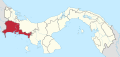
| Province | Chiriquí |
| District | Boquete |
| Established | July 29, 1998[1] |
| Area | |
| • Land | 98.9 km2 (38.2 sq mi) |
| Population (2010)[1] | |
| • Total | 4,596 |
| • Density | 46.5/km2 (120/sq mi) |
| Population density calculated based on land area. | |
| Time zone | UTC−5 (EST) |
Los Naranjos is a corregimiento in Boquete District, Chiriquí Province, Panama. It has a land area of 98.9 square kilometres (38.2 sq mi) and had a population of 4,596 as of 2010, giving it a population density of 46.5 inhabitants per square kilometre (120/sq mi).[1] It was created by Law 58 of July 29, 1998, owing to the Declaration of Unconstitutionality of Law 1 of 1982.[1] Its population as of 2000 was 4,455.[1]
References
- ^ a b c d e f "Cuadro 11 (Superficie, población y densidad de población en la República...)" [Table 11 (Area, population, and population density in the Republic...)] Archived 2016-03-04 at the Wayback Machine (.xls). In "Resultados Finales Básicos" [Basic Final Results] (in Spanish). National Institute of Statistics and Census of Panama. Archived from the original on July 10, 2015. Retrieved May 26, 2015.
- v
- t
- e

Capital: David
- Alanje
- Canta Gallo
- Divalá
- El Tejar
- Guarumal
- Nuevo México
- Palo Grande
- Querévalo
- Santo Tomás
- Alto Boquete
- Bajo Boquete
- Caldera
- Jaramillo
- Los Naranjos
- Palmira
8°47′34″N 82°26′41″W / 8.7928°N 82.4446°W / 8.7928; -82.4446
This article about the geography of Chiriquí Province is a stub. You can help Wikipedia by expanding it. |
- v
- t
- e


