Mylopotamos, Crete
Municipality in Greece
Mylopotamos Μυλοπόταμος | |
|---|---|
| 35°22′N 24°45′E / 35.367°N 24.750°E / 35.367; 24.750 | |
| Country | Greece |
| Administrative region | Crete |
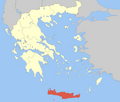
| Regional unit | Rethymno |
| Area | |
| • Municipality | 360.7 km2 (139.3 sq mi) |
| Population (2021)[1] | |
| • Municipality | 12,820 |
| • Density | 36/km2 (92/sq mi) |
| Time zone | UTC+2 (EET) |
| • Summer (DST) | UTC+3 (EEST) |
Mylopotamos (Greek: Μυλοπόταμος) is a municipality in Rethymno regional unit, on Crete, southern Greece. The seat of the municipality is the village Perama.[2] The municipal unit has an area of 360.703 km2 (139.268 sq mi).[3]
Municipality
The municipality Mylopotamos was formed at the 2011 local government reform by the merger of the following 3 former municipalities, which became municipal units:[2]
- Geropotamos
- Kouloukonas
- Zoniana
- Anogia
Former Province
The province of Mylopotamos (Greek: Επαρχία Μυλοποτάμου) was one of the provinces of Rethymno Prefecture. Its territory corresponded with that of the current municipalities Mylopotamos and Anogeia.[4] It was abolished in 2006.
Ecclesiastical history
Modern Lefterna was the seat since 1212 of a Latin Roman Catholic Diocese of Milopotamus, which was suppressed in 1669 and turned into a Latin Titular bishopric of lowest (episcopal), which had its name changed in the 20th century into titular see of Eleutherna.
See also
References
- ^ "Αποτελέσματα Απογραφής Πληθυσμού - Κατοικιών 2021, Μόνιμος Πληθυσμός κατά οικισμό" [Results of the 2021 Population - Housing Census, Permanent population by settlement] (in Greek). Hellenic Statistical Authority. 29 March 2024.
- ^ a b "ΦΕΚ A 87/2010, Kallikratis reform law text" (in Greek). Government Gazette.
- ^ "Population & housing census 2001 (incl. area and average elevation)" (PDF) (in Greek). National Statistical Service of Greece., former municipalities Geropotamos and Kouloukonas and municipal departments Axos and Zoniana from Anogeia.
- ^ "Detailed census results 1991" (PDF). (39 MB) (in Greek and French)
- v
- t
- e
Administrative division of the Crete Region
- Agios Vasileios
- Amari
- Anogeia
- Mylopotamos
- Rethymno
- Regional governor
- Stavros Arnaoutakis (reelected 2014)
- Decentralized Administration
- Crete


