O'Fallon, St. Louis
Neighborhood of St. Louis in Missouri, United States
O'Fallon | |
|---|---|
Neighborhood of St. Louis | |
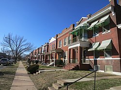 Houses in O'Fallon, January 2013 | |
 Location (red) of O'Fallon within St. Louis | |
| Country | United States |
| State | Missouri |
| City | St. Louis |
| Wards | 21 |
| Government | |
| • Aldermen | John Collins-Muhammad, II |
| Area | |
| • Total | 0.59 sq mi (1.5 km2) |
| Population (2020)[1] | |
| • Total | 4,342 |
| • Density | 7,400/sq mi (2,800/km2) |
| ZIP code(s) | Parts of 63107, 63115 |
| Area code(s) | 314 |
| Website | stlouis-mo.gov |
O'Fallon is a neighborhood of St. Louis, Missouri. The neighborhood is located on the north side of the City of St. Louis, nestled between O'Fallon Park and Fairground Park. It is bounded by West Florissant, Harris Avenue, Algernon Street and Adelaide on the north, Pope Avenue on the northwest, Kossuth and Natural Bridge Avenues on the south via Fair Avenue, Warne on the east, and Newstead on the west. The O'Fallon neighborhood is located in the 21st Ward which is currently represented by Alderman John Collins-Muhammad.
Characteristics
The O'Fallon neighborhood is anchored by two major public parks, O'Fallon Park and Fairground Park. The area is primarily a residential neighborhood with streets lined with brick and frame single-family homes, two-family homes, and a few multi-family buildings. Many of the housing units are owner-occupied, but there is a visibly large amount of abandoned, crumbling buildings and vacant lots. Ones that have been maintained are pleasant brick homes with well-tended porches. The neighborhood has not remained relatively stable thanks to many multi-generation residents in social gridlock and a high percentage of African Americans under the poverty line.[2]
Demographics
| Census | Pop. | Note | %± |
|---|---|---|---|
| 1990 | 8,901 | — | |
| 2000 | 7,151 | −19.7% | |
| 2010 | 5,791 | −19.0% | |
| 2020 | 4,342 | −25.0% | |
| Sources:[3][4] | |||
In 2020 the racial makeup of O'Fallon was 95.2% Black, 1.3% White, 0.5% Asian, 0.3% Native American, 2.5% Two or More Races, and 0.6% Some Other Race. 0.8% of the population was of Hispanic or Latino origin.[5]
See also
- John O'Fallon
References
- v
- t
- e
Neighborhoods of St. Louis
- Academy
- Baden
- Benton Park
- Benton Park West
- Bevo Mill
- Botanical Heights
- Boulevard Heights
- Carondelet
- Carr Square
- Central West End
- Cheltenham
- Chinatown (defunct since 1966)
- Clayton/Tamm
- Clifton Heights
- College Hill
- Columbus Square
- Compton Heights
- Covenant Blu Grand Center
- DeBaliviere Place
- "Dogtown"
- Downtown
- Downtown West
- Dutchtown
- Ellendale
- Fairground
- Forest Park Southeast
- Fountain Park
- Fox Park
- Franz Park
- Gate District
- Gravois Park
- Greater Ville
- Hamilton Heights
- The Hill
- Hi-Pointe
- Holly Hills
- Hyde Park
- JeffVanderLou
- Kings Oak
- Kingsway East
- Kingsway West
- Kosciusko
- Lafayette Square
- LaSalle Park
- Lewis Place
- Lindenwood Park
- Marine Villa
- Mark Twain
- Mark Twain/I-70 Industrial
- McKinley Heights
- Midtown
- Mill Creek Valley (defunct since 1960s)
- Mount Pleasant
- Near North Riverfront
- Northampton
- North Point
- North Riverfront
- O'Fallon
- Old North St. Louis
- Patch
- Peabody–Darst–Webbe
- Penrose
- Princeton Heights
- Riverview
- Shaw
- Skinker DeBaliviere
- Soulard
- Southampton
- Southwest Garden
- St. Louis Hills
- St. Louis Place
- Tiffany
- Tower Grove East
- Tower Grove South
- Vandeventer
- The Ville
- Visitation Park
- Walnut Park East
- Walnut Park West
- Wells/Goodfellow
- West End
- Wydown/Skinker
38°40′23″N 90°13′39″W / 38.6730°N 90.2275°W / 38.6730; -90.2275
 | This St. Louis location article is a stub. You can help Wikipedia by expanding it. |
- v
- t
- e


 O'Fallon,_St._Louis