Parachute, Colorado
Town in Colorado, United States
Town in Colorado, United States
39°27′06″N 108°03′06″W / 39.45167°N 108.05167°W / 39.45167; -108.05167 (2020)[6]
81635, 81636 (PO Box)
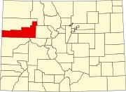
The Town of Parachute is a home rule municipality in Garfield County, Colorado, United States. The population was 1,390 at the 2020 census.[6]
The town is the birthplace of Willard Libby, recipient of the 1960 Nobel Prize in Chemistry.
Etymology
The town's name comes from Parachute Creek which runs through the township, before it merges with the Colorado River. The Ute people originally called the creek Pahchouc (meaning twins), with early settlers mispronouncing the word as parachute. In 1908 the town was renamed Grand Valley, but in the 1980s was changed back to Parachute.[8]
Geography
Parachute is on the northwest side of the Colorado River where it is joined by Parachute Creek. Interstate 70 passes through the town, with access from Exit 75. I-70 leads east 42 miles (68 km) to Glenwood Springs, the county seat, and southwest 44 miles (71 km) to Grand Junction. Parachute is bordered to the southeast across the Colorado River by the unincorporated community of Battlement Mesa.
According to the United States Census Bureau, the town has a total area of 1.67 square miles (4.32 km2), of which 1.61 square miles (4.16 km2) is land and 0.062 square miles (0.16 km2), or 3.70%, is water.[9]
Climate
This climatic region is typified by large seasonal temperature differences, with warm to hot (and often humid) summers and cold (sometimes severely cold) winters. According to the Köppen Climate Classification system, Parachute has a humid continental climate, abbreviated "Dfb" on climate maps.[10]
| Climate data for Parachute | |||||||||||||
|---|---|---|---|---|---|---|---|---|---|---|---|---|---|
| Month | Jan | Feb | Mar | Apr | May | Jun | Jul | Aug | Sep | Oct | Nov | Dec | Year |
| Mean daily maximum °C (°F) | 3 (38) | 8 (46) | 13 (56) | 18 (64) | 24 (76) | 31 (88) | 34 (94) | 34 (93) | 28 (82) | 19 (66) | 11 (51) | 5 (41) | 19 (66) |
| Mean daily minimum °C (°F) | −12 (11) | −7 (19) | −2 (29) | 1 (33) | 6 (43) | 10 (50) | 14 (58) | 14 (57) | 9 (48) | 2 (35) | −3 (27) | −8 (18) | 2 (36) |
| Average precipitation mm (inches) | 18 (0.7) | 18 (0.7) | 46 (1.8) | 43 (1.7) | 30 (1.2) | 25 (1) | 38 (1.5) | 23 (0.9) | 36 (1.4) | 51 (2) | 43 (1.7) | 30 (1.2) | 400 (15.8) |
| Source: Weatherbase [11] | |||||||||||||
Demographics
| Census | Pop. | Note | %± |
|---|---|---|---|
| 1910 | 268 | — | |
| 1920 | 228 | −14.9% | |
| 1930 | 209 | −8.3% | |
| 1940 | 230 | 10.0% | |
| 1950 | 296 | 28.7% | |
| 1960 | 245 | −17.2% | |
| 1970 | 270 | 10.2% | |
| 1980 | 338 | 25.2% | |
| 1990 | 658 | 94.7% | |
| 2000 | 1,006 | 52.9% | |
| 2010 | 1,085 | 7.9% | |
| 2020 | 1,390 | 28.1% | |
| U.S. Decennial Census | |||
Infrastructure
Transportation
Parachute is part of Bustang's West Line that connects Grand Junction to Denver.[12]
See also
 Colorado portal

References
- ^ a b "Active Colorado Municipalities". State of Colorado, Department of Local Affairs. Archived from the original on December 12, 2009. Retrieved September 1, 2007.
- ^ "Town of Parachute official website". Archived from the original on September 3, 2014. Retrieved January 11, 2008.
- ^ "Colorado Municipal Incorporations". State of Colorado, Department of Personnel & Administration, Colorado State Archives. December 1, 2004. Retrieved December 2, 2007.
- ^ "2019 U.S. Gazetteer Files". United States Census Bureau. Retrieved July 1, 2020.
- ^ a b U.S. Geological Survey Geographic Names Information System: Parachute, Colorado
- ^ a b United States Census Bureau. "Parachute town; Colorado". Retrieved April 24, 2023.
- ^ "ZIP Code Lookup". United States Postal Service. Archived from the original (JavaScript/HTML) on January 1, 2008. Retrieved December 2, 2007.
- ^ "Parachute, Colorado". Uncover Colorado. Retrieved February 6, 2022.
- ^ "Geographic Identifiers: 2010 Demographic Profile Data (G001): Parachute town, Colorado". American Factfinder. U.S. Census Bureau. Retrieved November 16, 2016.[dead link]
- ^ Climate Summary for Parachute, Colorado
- ^ "Weatherbase.com". Weatherbase. 2013. Retrieved on August 7, 2013.
- ^ "Bustang Schedules". RideBustang. CDOT.
External links
Wikimedia Commons has media related to Parachute, Colorado.
- Town of Parachute official website
- CDOT map of the Town of Parachute
- v
- t
- e
Municipalities and communities of Garfield County, Colorado, United States
County seat: Glenwood Springs
- Carbonate
- Carbondale
- New Castle
- Parachute
- Silt
communities
- Colorado portal
- United States portal
| Authority control databases: Geographic |
|
|---|


