Sabanalarga, Atlántico
Municipality and town in Atlántico Department, Colombia

Flag

Seal
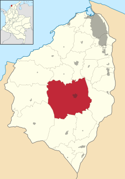
Location of the municipality and town of Sabanalarga, Atlántico in the Atlántico Department of Colombia
 Colombia
 (2020 est.)[1]
Sabanalarga (Spanish pronunciation: [saβanaˈlaɾɣa], Spanish for "Long Plain") is a municipality in the Atlántico Department, Colombia. Founded in 1620 by Lucas Dionisio Tesillo y Diego and Marceliano de Jesús Almanza. It became a municipality in 1680.
Geography
Sabanalarga is located in the middle of the Atlántico Department. It is surrounded to the north by the municipalities of Usiacurí, Baranoa, and Polonuevo; to the east by the municipality of Ponedera; to the south by the municipalities of Candelaria, and Manatí; to the southwest by the municipality of Repelón and to the west by the municipalities of Luruaco and Piojó.
Notable people
- Juana de J. Sarmiento (1899-1979), politician, activist
- Mauro Manotas (1995-) Football player for Tijuana
References
- ^ Citypopulation.de Population of Sabanalarga municipality
External links
- (in Spanish) Sabanalarga official website
- (in Spanish) Gobernacion del Atlantico - Sabanalarga

6°51′N 75°49′W / 6.850°N 75.817°W / 6.850; -75.817
Authority control databases | |
|---|---|
| International |
|
| National |
|
 | This Colombian location article is a stub. You can help Wikipedia by expanding it. |
- v
- t
- e


