Semboku, Akita
City in Tōhoku, Japan
Semboku  Flag  Seal | |
|---|---|
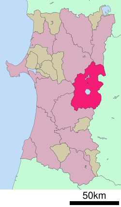
 Location of Semboku in Akita Prefecture | |
 | |
| Symbols | |
| Bird | Golden eagle |
| Flower | Hydrangea |
| Tree | Beech |

Semboku (仙北市, Semboku-shi) is a city located in Akita Prefecture, Japan. As of 31 January 2023[update], the city had an estimated population of 24,045 in 10,398 households,[1] and a population density of 22 persons per km2. The total area of the city is 1,093.56 square kilometers (422 sq mi).
Geography
Semboku is located in the mountains of east-central Akita Prefecture, bordering on Iwate Prefecture and the Ōu Mountains on the east. Lake Tazawa, the deepest lake in Japan, is located in the center of the city borders. Parts of the city are within the borders of the Towada-Hachimantai National Park.
Neighboring municipalities
Akita Prefecture
- Akita
- Kitaakita
- Kazuno
- Daisen
Iwate Prefecture
- Hachimantai
- Shizukuishi
- Nishiwaga
Climate
Semboku has a Humid continental climate (Köppen climate classification Dfa) with large seasonal temperature differences, with warm to hot (and often humid) summers and cold (sometimes severely cold) winters. Precipitation is significant throughout the year, but is heaviest from August to October. The average annual temperature in Semboku is 9.7 °C (49.5 °F). The average annual rainfall is 2,180.4 mm (85.84 in) with July as the wettest month. The temperatures are highest on average in August, at around 23.1 °C (73.6 °F), and lowest in January, at around −2.6 °C (27.3 °F).[2]
| Climate data for Tazawako, Semboku (1991−2020 normals, extremes 1976−present) | |||||||||||||
|---|---|---|---|---|---|---|---|---|---|---|---|---|---|
| Month | Jan | Feb | Mar | Apr | May | Jun | Jul | Aug | Sep | Oct | Nov | Dec | Year |
| Record high °C (°F) | 10.9 (51.6) | 16.8 (62.2) | 18.1 (64.6) | 29.4 (84.9) | 32.3 (90.1) | 32.6 (90.7) | 35.8 (96.4) | 36.5 (97.7) | 33.3 (91.9) | 27.9 (82.2) | 23.2 (73.8) | 15.4 (59.7) | 36.5 (97.7) |
| Mean daily maximum °C (°F) | 0.4 (32.7) | 1.5 (34.7) | 5.3 (41.5) | 12.8 (55.0) | 19.2 (66.6) | 23.2 (73.8) | 26.2 (79.2) | 27.8 (82.0) | 23.7 (74.7) | 17.1 (62.8) | 9.9 (49.8) | 3.1 (37.6) | 14.2 (57.5) |
| Daily mean °C (°F) | −2.6 (27.3) | −2.1 (28.2) | 1.0 (33.8) | 7.2 (45.0) | 13.6 (56.5) | 18.1 (64.6) | 21.9 (71.4) | 23.1 (73.6) | 18.7 (65.7) | 12.0 (53.6) | 5.4 (41.7) | −0.1 (31.8) | 9.7 (49.4) |
| Mean daily minimum °C (°F) | −6.0 (21.2) | −5.9 (21.4) | −3.1 (26.4) | 1.8 (35.2) | 8.1 (46.6) | 13.5 (56.3) | 18.3 (64.9) | 19.3 (66.7) | 14.5 (58.1) | 7.2 (45.0) | 1.2 (34.2) | −3.2 (26.2) | 5.5 (41.9) |
| Record low °C (°F) | −17.6 (0.3) | −17.1 (1.2) | −16.1 (3.0) | −8.0 (17.6) | −2.0 (28.4) | 3.8 (38.8) | 9.6 (49.3) | 9.0 (48.2) | 2.2 (36.0) | −2.2 (28.0) | −8.2 (17.2) | −14.2 (6.4) | −17.6 (0.3) |
| Average precipitation mm (inches) | 132.4 (5.21) | 118.0 (4.65) | 149.1 (5.87) | 153.0 (6.02) | 165.9 (6.53) | 161.7 (6.37) | 290.5 (11.44) | 280.8 (11.06) | 193.2 (7.61) | 179.5 (7.07) | 190.1 (7.48) | 166.0 (6.54) | 2,180.4 (85.84) |
| Average precipitation days (≥ 1.0 mm) | 19.5 | 17.0 | 17.0 | 14.6 | 13.0 | 11.4 | 15.0 | 12.6 | 13.5 | 14.6 | 18.1 | 20.3 | 186.6 |
| Mean monthly sunshine hours | 41.6 | 60.2 | 94.5 | 137.4 | 178.2 | 165.7 | 136.3 | 162.3 | 133.2 | 125.4 | 78.6 | 44.9 | 1,358.1 |
| Source: Japan Meteorological Agency[2][3] | |||||||||||||
| Climate data for Kakunodate, Semboku (1991−2020 normals, extremes 1976−present) | |||||||||||||
|---|---|---|---|---|---|---|---|---|---|---|---|---|---|
| Month | Jan | Feb | Mar | Apr | May | Jun | Jul | Aug | Sep | Oct | Nov | Dec | Year |
| Record high °C (°F) | 10.0 (50.0) | 13.7 (56.7) | 19.7 (67.5) | 30.4 (86.7) | 33.3 (91.9) | 34.5 (94.1) | 37.8 (100.0) | 37.7 (99.9) | 35.8 (96.4) | 29.5 (85.1) | 24.3 (75.7) | 17.8 (64.0) | 37.8 (100.0) |
| Mean daily maximum °C (°F) | 1.5 (34.7) | 2.7 (36.9) | 6.9 (44.4) | 14.7 (58.5) | 21.1 (70.0) | 25.2 (77.4) | 28.1 (82.6) | 29.7 (85.5) | 25.5 (77.9) | 18.7 (65.7) | 11.1 (52.0) | 4.1 (39.4) | 15.8 (60.4) |
| Daily mean °C (°F) | −1.6 (29.1) | −1.1 (30.0) | 2.1 (35.8) | 8.5 (47.3) | 14.8 (58.6) | 19.4 (66.9) | 23.0 (73.4) | 24.1 (75.4) | 19.7 (67.5) | 12.9 (55.2) | 6.3 (43.3) | 0.8 (33.4) | 10.7 (51.3) |
| Mean daily minimum °C (°F) | −4.9 (23.2) | −4.7 (23.5) | −2.1 (28.2) | 2.9 (37.2) | 9.2 (48.6) | 14.6 (58.3) | 19.0 (66.2) | 19.8 (67.6) | 15.2 (59.4) | 8.1 (46.6) | 2.2 (36.0) | −2.1 (28.2) | 6.4 (43.6) |
| Record low °C (°F) | −16.3 (2.7) | −16.7 (1.9) | −12.9 (8.8) | −8.8 (16.2) | −0.5 (31.1) | 5.3 (41.5) | 10.8 (51.4) | 11.3 (52.3) | 3.4 (38.1) | −0.9 (30.4) | −8.2 (17.2) | −13.0 (8.6) | −16.7 (1.9) |
| Average precipitation mm (inches) | 171.6 (6.76) | 140.5 (5.53) | 135.7 (5.34) | 129.1 (5.08) | 148.7 (5.85) | 152.3 (6.00) | 273.6 (10.77) | 254.9 (10.04) | 180.5 (7.11) | 171.5 (6.75) | 202.5 (7.97) | 197.8 (7.79) | 2,158.4 (84.98) |
| Average snowfall cm (inches) | 218 (86) | 175 (69) | 95 (37) | 7 (2.8) | 0 (0) | 0 (0) | 0 (0) | 0 (0) | 0 (0) | 0 (0) | 12 (4.7) | 130 (51) | 630 (248) |
| Average precipitation days (≥ 1.0 mm) | 22.3 | 19.6 | 18.0 | 13.9 | 13.0 | 11.2 | 14.2 | 12.5 | 13.3 | 15.2 | 18.8 | 21.8 | 193.8 |
| Average snowy days (≥ 3 cm) | 20.1 | 17.2 | 11.4 | 0.9 | 0 | 0 | 0 | 0 | 0 | 0 | 1.5 | 11.9 | 63 |
| Mean monthly sunshine hours | 50.9 | 69.1 | 108.3 | 155.9 | 187.9 | 176.8 | 149.0 | 183.4 | 150.3 | 135.9 | 90.7 | 54.0 | 1,512.2 |
| Source: Japan Meteorological Agency[4][5] | |||||||||||||
Demographics
Per Japanese census data,[6] the population of Semboku peaked in the early 1960s and has since declined to pre-1920 levels.
|
| |||||||||||||||||||||||||||||||||||||||
| ||||||||||||||||||||||||||||||||||||||||
History
The area of present-day Semboku was part of ancient Dewa Province. During the Edo period, the area came under the control of the Satake clan, who had been relocated to Kubota Domain from their former holdings in Hitachi Province. After the start of the Meiji period, the area became part of Semboku District, Akita Prefecture in 1878. The town of Kakunodate was established on April 1, 1889 with the establishment of the modern municipalities system.
The city of Semboku was established on March 22, 2005, from the merger of the towns of Kakunodate and Tazawako, and the village of Nishiki (all from Semboku District).
Government
Semboku has a mayor-council form of government with a directly elected mayor and a unicameral city legislature of 18 members. The city contributes one member to the Akita Prefectural Assembly. In terms of national politics, the city is part of the Akita 3rd District of the lower house of the Diet of Japan.
Economy
The economy of Semboku is based on agriculture, forestry and seasonal tourism. The city is a noted producer of craft beer, soy sauce and miso.
One event that attracts many tourists is the Rokugō Kamakura Festival, which is held each February 11 to 15.[7]
Education
Semboku has seven public elementary schools and five public middle schools operated by the city government and one public high school operated by the Akita Prefectural Board of Education. The prefecture also operates a special education school for the handicapped.
Transportation
Railway
![]() East Japan Railway Company - Akita Shinkansen
East Japan Railway Company - Akita Shinkansen
![]() East Japan Railway Company - Tazawako Line
East Japan Railway Company - Tazawako Line
- Tazawako - Sashimaki - Jindai - Shōden - Kakunodate
Akita Nairiku Jūkan Railway - Akita Nairiku Line
- Tozawa - Kami-Hinokinai - Sadōri - Ugo-Nakazato - Matsuba - Ugo-Nagatoro - Akita - Saimyoji - Ugo-Ōta - Kakunodate
Highway


Local attractions
-
 Buke-yashiki (samurai residences) street, Kakunodate
 -


- Tamagawa Hot Spring has the highest flow rate of any hot spring in Japan at 150 liters/second, which feeds a 3 meter wide stream with a temperature of 98 degrees C. The water from Tamagawa Hot Spring is also very acidic.[citation needed]
- Towada-Hachimantai National Park
- Lake Tazawa – the deepest lake in Japan
- Ōfuka Onsen
- Kakunodate samurai residences
International relations
Twin towns — Sister cities
Semboku is twinned with:
 Ōmura, Nagasaki, Japan, since July 18, 1979
- Sanuki, Kagawa, Japan, since September 28, 1996
- Shinjō, Yamagata, Japan, since July 27, 1996
- Takahagi, Ibaraki, Japan, since July 27, 1996
- Hitachiōta, Ibaraki, Japan, since November 21, 1998

Noted people from Semboku
- Ayako Fuji, musician
- Norihisa Satake, politician
- Shigehiro Taguchi, basketball player
- Yasuhiko Takahashi, wheel gymnastics acrobat
References
- ^ "Semboku city official statistics" (in Japanese). Japan.
- ^ a b 気象庁 / 平年値(年・月ごとの値). JMA. Retrieved May 29, 2022.
- ^ 観測史上1~10位の値(年間を通じての値). JMA. Retrieved May 29, 2022.
- ^ 気象庁 / 平年値(年・月ごとの値). JMA. Retrieved May 29, 2022.
- ^ 観測史上1~10位の値(年間を通じての値). JMA. Retrieved May 29, 2022.
- ^ Semboku population statistics
- ^ "The Rokugō Kamakura Festival" 六郷のカマクラ [Rokugō no kamakura] (in Japanese). Misato Township. Archived from the original on January 1, 2019.
External links
Wikimedia Commons has media related to Semboku, Akita.
- Official Website (in Japanese)
- Semboku Sightseeing Info Website


Authority control databases | |
|---|---|
| International |
|
| National |
|
| Geographic |
|


