Shahpura, Jabalpur
City in Madhya Pradesh, India
23°08′N 79°40′E / 23.13°N 79.67°E / 23.13; 79.67 India
India (2011)
Shahpura or Shahpura Bhitoni is a town and a nagar panchayat in Jabalpur district in the Indian state of Madhya Pradesh.
Geography
Shahpura is located at 23°08′N 79°40′E / 23.13°N 79.67°E / 23.13; 79.67.[1] It has an average elevation of 381 metres (1249 feet).
Demographics
As of 2001[update] India census,[2] Shahpura had a population of 13,601. Males constitute 52% of the population and females 48%. Shahpura has an average literacy rate of 72%, higher than the national average of 59.5%: male literacy is 77%, and female literacy is 67%. In Shahpura, 14% of the population is under 6 years of age.[3]
Economy
The Narmada river bringing in freshwater from the Vindyachal Ranges has developed Shahpura into an agrarian economy. The land of the Narmada basin with its fertile alluvial soil gives good yields of sorghum, wheat, rice, and millet in the villages around Shahpura. Important among commercial crops are pulses, oilseeds, cotton, sugar cane.[4]
Temples
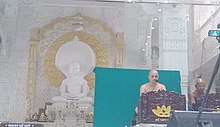
There are seven Jain temples in Shahpura. Many tourist place loceted around Shahpura.
- Bhedaghat, 18 KM away
Transportation
Shahpura is connected by railway and roadway . NH 45 is passed from Shahpura.Daily buses runs from here.
Bhitoni railway station[5] give service to Shahpura town many train halts from here.
References
- ^ Falling Rain Genomics, Inc - Shahpura
- ^ "Census of India 2001: Data from the 2001 Census, including cities, villages and towns (Provisional)". Census Commission of India. Archived from the original on 16 June 2004. Retrieved 1 November 2008.
- ^ https://www.census2011.co.in/data/town/802359-shahpura-madhya-pradesh.html
- ^ https://www.kisanupaj.com/MandiBhav/mp/Jabalpur/Shahpura%20(Bhitoni)-mandi-bhav
- ^ https://indiarailinfo.com/station/map/bhitoni-bhtn/2664
- v
- t
- e
Cities and towns in Jabalpur division
- Chichli
- Tendu Kheda
- Bohani
- Saikhera
- Gadarwara
- Kareli
- Narsinghpur
in other divisions
- Bhopal
- Chambal
- Gwalior
- Indore
- Narmadapuram
- Rewa
- Sagar
- Shahdol
- Ujjain
 | This article related to a location in Madhya Pradesh is a stub. You can help Wikipedia by expanding it. |
- v
- t
- e


