Shiroishi, Miyagi
City in Tōhoku, Japan
Shiroishi  Flag  Emblem | |
|---|---|
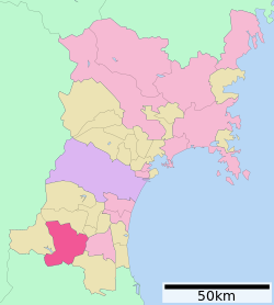 Location of Shiroishi in Miyagi Prefecture | |
| Symbols | |
| Bird | Japanese bush-warbler |
| Flower | Kerria |
| Tree | Japanese beech |

Shiroishi (白石市, Shiroishi-shi) is a city in Miyagi Prefecture, Japan. As of 31 May 2020[update], the city had an estimated population of 33,330 and a population density of 120 persons per km2 in 14,242 households.[1] The total area of the city is 286.48 square kilometres (110.61 sq mi).
Geography
Shiroishi is in southern Miyagi Prefecture, in the Tōhoku region of northern Japan, bordered by Fukushima Prefecture to the south. The southern peak of Mount Zaō is within the city borders.

Neighboring municipalities
Miyagi Prefecture
- Kakuda
- Shichikashuku
- Zaō
- Ōgawara
- Marumori
Fukushima Prefecture
- Fukushima
- Date
- Kunimi
- Koori
Climate
Shiroishi has a humid climate (Köppen climate classification Cfa) characterized by mild summers and cold winters. The average annual temperature in Shiroishi is 12.1 °C (53.8 °F). The average annual rainfall is 1,327.2 mm (52.25 in) with September as the wettest month. The temperatures are highest on average in August, at around 23.7 °C (74.7 °F), and lowest in January, at around 1.2 °C (34.2 °F).[2]
| Climate data for Shiroishi (1991−2020 normals, extremes 1976−present) | |||||||||||||
|---|---|---|---|---|---|---|---|---|---|---|---|---|---|
| Month | Jan | Feb | Mar | Apr | May | Jun | Jul | Aug | Sep | Oct | Nov | Dec | Year |
| Record high °C (°F) | 16.3 (61.3) | 20.6 (69.1) | 23.4 (74.1) | 30.1 (86.2) | 33.0 (91.4) | 34.6 (94.3) | 36.9 (98.4) | 36.7 (98.1) | 35.2 (95.4) | 30.3 (86.5) | 24.5 (76.1) | 19.5 (67.1) | 36.9 (98.4) |
| Mean daily maximum °C (°F) | 5.2 (41.4) | 6.2 (43.2) | 9.9 (49.8) | 16.0 (60.8) | 21.0 (69.8) | 23.6 (74.5) | 26.8 (80.2) | 28.3 (82.9) | 24.8 (76.6) | 19.7 (67.5) | 14.0 (57.2) | 8.1 (46.6) | 17.0 (62.5) |
| Daily mean °C (°F) | 1.2 (34.2) | 1.7 (35.1) | 4.7 (40.5) | 10.2 (50.4) | 15.5 (59.9) | 19.0 (66.2) | 22.5 (72.5) | 23.7 (74.7) | 20.1 (68.2) | 14.5 (58.1) | 8.6 (47.5) | 3.6 (38.5) | 12.1 (53.8) |
| Mean daily minimum °C (°F) | −2.7 (27.1) | −2.6 (27.3) | −0.3 (31.5) | 4.6 (40.3) | 10.5 (50.9) | 15.0 (59.0) | 19.1 (66.4) | 20.2 (68.4) | 16.2 (61.2) | 9.9 (49.8) | 3.6 (38.5) | −0.7 (30.7) | 7.7 (45.9) |
| Record low °C (°F) | −11.2 (11.8) | −11.6 (11.1) | −8.0 (17.6) | −5.0 (23.0) | 1.7 (35.1) | 6.3 (43.3) | 10.4 (50.7) | 11.2 (52.2) | 6.0 (42.8) | −0.8 (30.6) | −5.2 (22.6) | −11.6 (11.1) | −11.6 (11.1) |
| Average precipitation mm (inches) | 50.8 (2.00) | 36.6 (1.44) | 71.0 (2.80) | 96.0 (3.78) | 99.3 (3.91) | 146.6 (5.77) | 188.2 (7.41) | 186.0 (7.32) | 197.0 (7.76) | 146.1 (5.75) | 59.7 (2.35) | 50.2 (1.98) | 1,327.2 (52.25) |
| Average snowfall cm (inches) | 43 (17) | 33 (13) | 16 (6.3) | 1 (0.4) | 0 (0) | 0 (0) | 0 (0) | 0 (0) | 0 (0) | 0 (0) | 0 (0) | 15 (5.9) | 109 (43) |
| Average precipitation days (≥ 1.0 mm) | 7.8 | 6.5 | 8.9 | 8.4 | 9.3 | 12.2 | 14.4 | 12.4 | 12.7 | 9.3 | 7.4 | 8.7 | 118 |
| Average snowy days (≥ 3 cm) | 5.3 | 4.0 | 1.7 | 0.1 | 0 | 0 | 0 | 0 | 0 | 0 | 0 | 2.1 | 13.2 |
| Mean monthly sunshine hours | 142.6 | 154.7 | 178.6 | 193.6 | 195.2 | 142.6 | 123.3 | 140.6 | 121.9 | 141.7 | 146.8 | 135.3 | 1,818.6 |
| Source: Japan Meteorological Agency[3][2] | |||||||||||||
Demographics
Per Japanese census data,[4] the population of Shiroishi peaked around the year 1990 and has declined since.
| Year | Pop. | ±% |
|---|---|---|
| 1920 | 31,285 | — |
| 1930 | 34,051 | +8.8% |
| 1940 | 34,796 | +2.2% |
| 1950 | 44,871 | +29.0% |
| 1960 | 43,911 | −2.1% |
| 1970 | 40,886 | −6.9% |
| 1980 | 41,725 | +2.1% |
| 1990 | 42,262 | +1.3% |
| 2000 | 40,793 | −3.5% |
| 2010 | 37,422 | −8.3% |
| 2020 | 32,758 | −12.5% |
History
The area of present-day Shiroishi was part of ancient Mutsu Province and was under control of the Date clan of Sendai Domain during the Edo period, under the Tokugawa shogunate. During the Boshin War of the Meiji Restoration, Shiroishi Castle was the site of a battle between the pro-imperial and pro-Tokugawa forces of the Ōuetsu Reppan Dōmei. After the end of the Boshin War, the Nambu clan of Morioka Domain was briefly relocated to a reduced domain centered on Shiroishi by the Meiji government.
The town of Shiroishi was established on June 1, 1889 with the establishment of the post-Meiji restoration modern municipalities system. The villages of Odaira, Otakasawa, Kosugo, Saikawa, Shirakawa and Fukuoka merged with Shiroishi on April 1, 1954, which was then raised to city status. The village of Obara was annexed to Shiroishi on March 31, 1957.[5]
Government
Shiroishi has a mayor-council form of government with a directly elected mayor and a unicameral city legislature of 18 members.[6] Shiroishi, collectively with the towns of Zaō and Shichikashuku, contributes two seats to the Miyagi Prefectural legislature. In terms of national politics, the city is part of Miyagi 3rd district of the lower house of the Diet of Japan.
Economy
Shiroishi has a mixed economy, dominated by light manufacturing of electronics, automotive components and food processing. Agriculture is dominated by rice cultivation on the flatlands and horticulture in more hilly areas.
Education
Shiroishi has nine public elementary schools and five public junior high schools operated by the city government and two public high schools operated by the Miyagi Prefectural Board of Education. The prefecture also operates two special education schools.
Transportation
Railway
![]() East Japan Railway Company (JR East) - Tōhoku Shinkansen
East Japan Railway Company (JR East) - Tōhoku Shinkansen
![]() East Japan Railway Company (JR East) - Tōhoku Main Line
East Japan Railway Company (JR East) - Tōhoku Main Line
- Kosugō - Shiroishi - Higashi-Shiroishi - Kita-Shirakawa
Highways
 Tōhoku Expressway - Shiroishi IC
 National Route 4
 National Route 113
 National Route 457


Local attractions
- Shiroishi Castle: restored in 1995 after its destruction in 1875.[7] The castle has also become a tourist spot for "contents tourism" related to the video game Sengoku BASARA2.[8]
- Miyagi Zao Fox Village: Filled with real wild foxes[9]
Sister city relations
 – (formerly) Hurstville, New South Wales, Australia.[10] The sister city relationship has been discontinued following the council amalgamations of Hurstville and Kogarah to form the merged Georges River Council.
 – Noboribetsu, Hokkaido, Japan [11]
- – Ebina, Kanagawa, Japan [12]


Noted people from Shiroishi
- Ōzutsu Man'emon – sumo wrestler
- Tetsuya Endo, Japanese professional wrestler
References
- ^ Shiroish city official statistics (in Japanese)
- ^ a b 気象庁 / 平年値(年・月ごとの値). JMA. Retrieved March 23, 2022.
- ^ 観測史上1~10位の値(年間を通じての値). JMA. Retrieved March 23, 2022.
- ^ Shiroishi population statistics
- ^ Shiroishi home page
- ^ Shioishi City Council home page(in Japanese)
- ^ "Cultural attractions- shiroishi". Archived from the original on 2011-05-16. Retrieved 2010-12-17.
- ^ Yamamura, Takayoshi (2018). "Pop culture contents and historical heritage: case of heritage revitalization through 'contents tourism' in Shiroishi city". Contemporary Japan. 30 (2): 144–163. doi:10.1080/18692729.2018.1460049.
- ^ "Zao Fox Village - Miyagi - Japan Travel".
- ^ "International Exchange". List of Affiliation Partners within Prefectures. Council of Local Authorities for International Relations (CLAIR). Archived from the original on 22 December 2015. Retrieved 21 November 2015.
- ^ "Sister cities− shiroishi". Archived from the original on 2013-02-08. Retrieved 2014-08-21. Shiroishi home page
- ^ "Sister cities− shiroishi". Archived from the original on 2013-02-08. Retrieved 2014-08-21. Shiroishi home page
External links
Wikimedia Commons has media related to Shiroishi, Miyagi.
- Official Website (in Japanese)
- v
- t
- e

| Wards |
|---|
Authority control databases | |
|---|---|
| International |
|
| National |
|
| Geographic |
|


