Steensel
Village in North Brabant, Netherlands
51°23′N 5°21′E / 51.383°N 5.350°E / 51.383; 5.350 Netherlands
 North Brabant
 Eersel
 (2021)[1]
5524[1]
Steensel is a village on the Gender stream in the municipality of Eersel, North Brabant, the Netherlands. Steensel is part of the Acht Zaligheden (Eight Beatitudes), along with Eersel, Knegsel, Duizel, Wintelre, Netersel, Hulsel en Reusel.
The name Steensel appeared first in a document from 1224,[3] in which a certain Henricus and Marcelis were mentioned as knights of Steensel. In 1688, Steensel was plundered and destroyed by French soldiers. In 1810, Steensel became part of the municipality of Duizel and Steensel. Steensel was home to 282 people in 1840. In 1922, this municipality then merged into the municipality of Eersel.[4]
Gallery
-
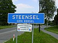 Entrance to Steensel
 -
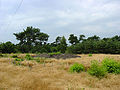 Burial mound
 -
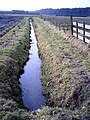 Headwaters of the Gender stream near Steensel


References
- ^ a b c "Kerncijfers wijken en buurten 2021". Central Bureau of Statistics. Retrieved 16 April 2022.
- ^ "Postcodetool for 5524AA". Actueel Hoogtebestand Nederland (in Dutch). Het Waterschapshuis. Retrieved 16 April 2022.
- ^ "Steensel - (geografische naam)". Etymologiebank (in Dutch). Retrieved 16 April 2022.
- ^ "Steensel". Plaatsengids (in Dutch). Retrieved 16 April 2022.
Wikimedia Commons has media related to Steensel.
| Authority control databases |
|
|---|
 | This North Brabant location article is a stub. You can help Wikipedia by expanding it. |
- v
- t
- e


