Tranoroa
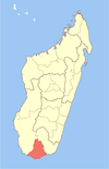
Place in Androy, Madagascar
24°42′S 45°4′E / 24.700°S 45.067°E / -24.700; 45.067 Madagascar
[1]
(2001)[2]
609
Tranoroa is a rural municipality in Madagascar. It belongs to the district of Beloha, which is a part of Androy Region. It is situated at the Menarandra River and the National road 10. The population of the commune was estimated to be approximately 18,000 in 2001.[2]
Primary and junior level secondary education are available in town. It is also a site of industrial-scale mining. Farming and raising livestock provides employment for 45% and 45% of the working population. The most important crops are maize and peanuts; also cassava is an important agricultural product. Industry and services provide employment for 2% and 8% of the population, respectively.[2]
References and notes
- ^ Estimated based on DEM data from Shuttle Radar Topography Mission
- ^ a b c "ILO census data". Cornell University. 2002. Retrieved 2008-05-02.
- v
- t
- e
Communes in the Androy Region of the Republic of MadagascarCapital: Ambovombe-Androy
- Ambahita
- Ambatomainty, Androy
- Ambatosola
- Anivorano Mitsinjo
- Anja Nord
- Ankaranabo Nord
- Antsakoamaro
- Bekitro
- Bekily Centre
- Belindo Mahasoa
- Beraketa
- Besakoa
- Beteza
- Bevitiky
- Manakompy
- Maroviro
- Morafeno Bekily
- Tanambao Tsirandrana
- Tanandava
- Tsikolaky
- Vohimanga
- Anjapaly
- Antaritarika
- Faux Cap
- Imongy
- Nikoly
- Marovato
- Tsiombe
- Ampamata
- Ambinany
- Andraivo
- Antanimora Sud
- Andalatanosy
- Befeno
- Imanombo
- Jafaro
- Sihanamaro.[1]
4 districts; 56 communes
24°42′S 45°4′E / 24.700°S 45.067°E / -24.700; 45.067
 | This Androy location article is a stub. You can help Wikipedia by expanding it. |
- v
- t
- e
- ^ antanimora-sud-demande un district


