Barellan

Cet article est une ébauche concernant une localité australienne et la Nouvelle-Galles du Sud.

Vous pouvez partager vos connaissances en l’améliorant (comment ?) selon les recommandations des projets correspondants.

Consultez la liste des tâches à accomplir en page de discussion.

Si ce bandeau n'est plus pertinent, retirez-le. Cliquez ici pour en savoir plus.

Certaines informations figurant dans cet article ou cette section devraient être mieux reliées aux sources mentionnées dans les sections « Bibliographie », « Sources » ou « Liens externes » ().

Vous pouvez améliorer la vérifiabilité en associant ces informations à des références à l'aide d'appels de notes.

Barellan
Barellan
La rue principale de Barellan
Administration
Pays Drapeau de l'Australie Australie
État Nouvelle-Galles du Sud
Zone Narrandera
Code postal NSW 2665
Démographie
Population 459 hab. (2021)
Densité 0,46 hab./km2
Géographie
Coordonnées 34° 17′ 00″ sud, 146° 34′ 00″ est
Superficie 988,821 km2 [1]
Localisation
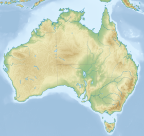
Géolocalisation sur la carte : Australie
Voir sur la carte topographique d'Australie
Barellan
Géolocalisation sur la carte : Nouvelle-Galles du Sud
Voir sur la carte topographique de Nouvelle-Galles du Sud
Barellan
modifier Consultez la documentation du modèle
L'hôtel de Barellan

Barellan est un village australien situé dans la zone d'administration locale de Narrendera, en Nouvelle-Galles du Sud.

Géographie

Le village est établi dans la Riverina, au sud de la Nouvelle-Galles du Sud, à 520 km au sud-ouest de Sydney et à 52 km de Griffith.

Histoire

Le village est créé au début du XXe siècle. Son nom d'origine aborigène signifie : « lieu où se rencontrent les eaux »[2]. Il est le village d'enfance d'Evonne Goolagong, née à Griffith, joueuse de tennis.

Démographie

Année Population
2016 538[3]
2021 459[4]

Références

  1. « Map of Barellan, Australia »
  2. (en) « Barellan, NSW », sur Aussie Towns
  3. (en) Barellan 2016 Census All persons QuickStats, Bureau australien des statistiques
  4. (en) Barellan 2021 Census All persons QuickStats, Bureau australien des statistiques

Sur les autres projets Wikimedia :

  • Barellan, sur Wikimedia Commons
v · m
Villes principales
Villes, villages & hameaux
  • Adjungbilly
  • Alfredtown
  • Alma Park
  • Ardlethan
  • Ariah Park
  • Ashmont
  • Ballbank
  • Balldale
  • Balranald
  • Barellan
  • Barham
  • Barnes
  • Barooga
  • Batlow
  • Beckom
  • Beelbangera
  • Beggan Beggan
  • Berrigan
  • Bethungra
  • Bidgeemia
  • Bilbul
  • Binya
  • Birrego
  • Blighty
  • Book Book
  • Bookham
  • Booligal
  • Booroorban
  • Borambola
  • Boree Creek
  • Bowna
  • Brawlin
  • Brocklesby
  • Brookdale
  • Brungle
  • Brushwood
  • Bulgandry
  • Bullenbung
  • Bundure
  • Bungowannah
  • Bunnaloo
  • Buraja
  • Burraboi
  • Burrandana
  • Burrinjuck
  • Burrumbuttock
  • Caldwell
  • Carabost
  • Carrathool
  • Cavan
  • Coleambally
  • Collingullie
  • Colinroobie
  • Combaning
  • Conargo
  • Condoulpe
  • Cookardinia
  • Coolac
  • Coolamon
  • Cootamundra
  • Coree
  • Coreen
  • Corobimilla
  • Corowa
  • Cowabbie
  • Culcairn
  • Cunninyeuk
  • Currawarna
  • Darbalara
  • Darlington Point
  • Daysdale
  • Deniliquin
  • Dilpurra
  • Dirnaseer
  • Downside
  • Euberta
  • Eurongilly
  • Euston
  • Ferndale
  • Finley
  • Frampton
  • French Park
  • Galore
  • Ganmain
  • Gerogery
  • Gidginbung
  • Glenroy
  • Gobarralong
  • Gocup
  • Gogeldrie
  • Goolgowi
  • Goorawin
  • Grahamstown
  • Greenvale
  • Grong Grong
  • Gulpa
  • Gunbar
  • Gundagai
  • Hanwood
  • Harefield
  • Hatfield
  • Hay
  • Henty
  • Hillston
  • Holbrook
  • Hopefield
  • Howlong
  • Humula
  • Illabo
  • Illilliwa
  • Jerilderie
  • Jindera
  • Jingellic
  • Jugiong
  • Junee
  • Junee Reefs
  • Kamarah
  • Khancoban
  • Koraleigh
  • Kyalite
  • Kyeamba
  • Kywong
  • Lacmalac
  • Ladysmith
  • Langtree
  • Lankeys Creek
  • Laurel Hill
  • Leeton
  • Little Billabong
  • Lockhart
  • Lowesdale
  • Mairjimmy
  • Malebo
  • Mangoplah
  • Mannus
  • Marrar
  • Mathoura
  • Matong
  • Maude
  • Mayrung
  • Merriwagga
  • Merungle Hill
  • Methul
  • Milbrulong
  • Millwood
  • Mirrool
  • Mitta Mitta
  • Moama
  • Moira
  • Moolpa
  • Moombooldool
  • Morago
  • Morundah
  • Morven
  • Moulamein
  • Mullengandra
  • Mulwala
  • Mundarlo
  • Munderoo
  • Murrami
  • Muttama
  • Nangus
  • Narrandera
  • Niemur
  • Nyora
  • Oaklands
  • Oberne
  • Old Junee
  • One Tree
  • Osborne
  • Oura
  • Ournie
  • Oxley
  • Penarie
  • Perekerten
  • Pleasant Hills
  • Pretty Pine
  • Pulletop
  • Rand
  • Rankins Springs
  • Rannock
  • Rennie
  • Rosewood
  • Ryan
  • Sandigo
  • Sangar
  • Savernake
  • Sebastopol
  • Springdale
  • Stanbridge
  • Stockinbingal
  • Stony Crossing
  • Stony Point
  • Tabbita
  • Table Top
  • Talbingo
  • Talmalmo
  • Talmo
  • Tantonan
  • Tarcutta
  • Temora
  • The Rock
  • Tocumwal
  • Tooleybuc
  • Tooma
  • Tootool
  • Tullakool
  • Tumbarumba
  • Tumblong
  • Tumut
  • Tuppal
  • Urana
  • Urangeline
  • Urangeline East
  • Uranquinty
  • Waddi
  • Wakool
  • Walbundrie
  • Walla Walla
  • Wallendbeen
  • Walleroobie
  • Wamoon
  • Wanganella
  • Wantabadgery
  • Warburn
  • Warragoon
  • Wee Jasper
  • Welaregang
  • Westby
  • Whitton
  • Widgelli
  • Widgiewa
  • Willbriggie
  • Womboota
  • Wondalga
  • Woodend
  • Woolgarlo
  • Woomargama
  • Wymah
  • Yalgogrin South
  • Yallakool
  • Yanco
  • Yenda
  • Yerong Creek
  • Yoogali
  • Yuluma
Parcs Nationaux
  • icône décorative Portail de la géographie
  • icône décorative Portail de la Nouvelle-Galles du Sud