Tarcutta

Cet article est une ébauche concernant une localité australienne et la Nouvelle-Galles du Sud.

Vous pouvez partager vos connaissances en l’améliorant (comment ?) selon les recommandations des projets correspondants.

Tarcutta
Tarcutta
Le mémorial aux camionneurs.
Administration
Pays Drapeau de l'Australie Australie
État Nouvelle-Galles du Sud
Zone Wagga Wagga
Code postal NSW 2650
Démographie
Population 425 hab. (2021)
Géographie
Coordonnées 35° 17′ 00″ sud, 147° 44′ 00″ est
Altitude 307 m
Localisation
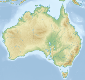
Géolocalisation sur la carte : Australie
Voir sur la carte topographique d'Australie
Tarcutta
Géolocalisation sur la carte : Nouvelle-Galles du Sud
Voir sur la carte topographique de Nouvelle-Galles du Sud
Tarcutta
modifier Consultez la documentation du modèle

Tarcutta est un village australien situé dans la zone d'administration locale de Wagga Wagga, en Nouvelle-Galles du Sud.

Géographie

Le village est établi dans la Riverina, dans le sud de la Nouvelle-Galles du Sud, à 438 km de Sydney.

Une voie de chemin de fer la reliant à Wagga Wagga a été définitivement fermée en 1987.

L'économie du village est basée sur l'élevage des ovins et des bovins et par le fait de sa situation sur la grand route (la Hume Highway) reliant Sydney et Melbourne, d'hébergement pour les routiers qui relient les deux villes.

Le village abrite un monument à la mémoire des chauffeurs tués au volant de leurs camions.

Démographie

Évolution démographique
2006 2016 2021
440446425[1]

Notes et références

  1. (en) Tarcutta 2021 Census All persons QuickStats

Lien externe

  • Ressource relative à la géographieVoir et modifier les données sur Wikidata :
    • Geographical Names Board of New South Wales
v · m
Banlieues
  • Ashmont
  • Bomen
  • Bourkelands
  • Boorooma
  • Cartwrights Hill
  • Charles Sturt University
  • East Wagga Wagga
  • Estella
  • Eunanoreenya
  • Forest Hill
  • Glenfield Park
  • Gregadoo
  • Gumly Gumly
  • Kapooka
  • Kooringal
  • Lake Albert
  • Lloyd
  • Moorong
  • Mount Austin
  • North Wagga Wagga
  • San Isidore
  • Tatton
  • Tolland
  • Turvey Park
  • Wagga Wagga
Villes, villages & hameaux
  • Alfredtown
  • Burrandana
  • Collingullie
  • Currawarna
  • Galore
  • Humula
  • Ladysmith
  • Mangoplah
  • Oura
  • Tarcutta
  • Uranquinty
v · m
Villes principales
Villes, villages & hameaux
  • Adjungbilly
  • Alfredtown
  • Alma Park
  • Ardlethan
  • Ariah Park
  • Ashmont
  • Ballbank
  • Balldale
  • Balranald
  • Barellan
  • Barham
  • Barnes
  • Barooga
  • Batlow
  • Beckom
  • Beelbangera
  • Beggan Beggan
  • Berrigan
  • Bethungra
  • Bidgeemia
  • Bilbul
  • Binya
  • Birrego
  • Blighty
  • Book Book
  • Bookham
  • Booligal
  • Booroorban
  • Borambola
  • Boree Creek
  • Bowna
  • Brawlin
  • Brocklesby
  • Brookdale
  • Brungle
  • Brushwood
  • Bulgandry
  • Bullenbung
  • Bundure
  • Bungowannah
  • Bunnaloo
  • Buraja
  • Burraboi
  • Burrandana
  • Burrinjuck
  • Burrumbuttock
  • Caldwell
  • Carabost
  • Carrathool
  • Cavan
  • Coleambally
  • Collingullie
  • Colinroobie
  • Combaning
  • Conargo
  • Condoulpe
  • Cookardinia
  • Coolac
  • Coolamon
  • Cootamundra
  • Coree
  • Coreen
  • Corobimilla
  • Corowa
  • Cowabbie
  • Culcairn
  • Cunninyeuk
  • Currawarna
  • Darbalara
  • Darlington Point
  • Daysdale
  • Deniliquin
  • Dilpurra
  • Dirnaseer
  • Downside
  • Euberta
  • Eurongilly
  • Euston
  • Ferndale
  • Finley
  • Frampton
  • French Park
  • Galore
  • Ganmain
  • Gerogery
  • Gidginbung
  • Glenroy
  • Gobarralong
  • Gocup
  • Gogeldrie
  • Goolgowi
  • Goorawin
  • Grahamstown
  • Greenvale
  • Grong Grong
  • Gulpa
  • Gunbar
  • Gundagai
  • Hanwood
  • Harefield
  • Hatfield
  • Hay
  • Henty
  • Hillston
  • Holbrook
  • Hopefield
  • Howlong
  • Humula
  • Illabo
  • Illilliwa
  • Jerilderie
  • Jindera
  • Jingellic
  • Jugiong
  • Junee
  • Junee Reefs
  • Kamarah
  • Khancoban
  • Koraleigh
  • Kyalite
  • Kyeamba
  • Kywong
  • Lacmalac
  • Ladysmith
  • Langtree
  • Lankeys Creek
  • Laurel Hill
  • Leeton
  • Little Billabong
  • Lockhart
  • Lowesdale
  • Mairjimmy
  • Malebo
  • Mangoplah
  • Mannus
  • Marrar
  • Mathoura
  • Matong
  • Maude
  • Mayrung
  • Merriwagga
  • Merungle Hill
  • Methul
  • Milbrulong
  • Millwood
  • Mirrool
  • Mitta Mitta
  • Moama
  • Moira
  • Moolpa
  • Moombooldool
  • Morago
  • Morundah
  • Morven
  • Moulamein
  • Mullengandra
  • Mulwala
  • Mundarlo
  • Munderoo
  • Murrami
  • Muttama
  • Nangus
  • Narrandera
  • Niemur
  • Nyora
  • Oaklands
  • Oberne
  • Old Junee
  • One Tree
  • Osborne
  • Oura
  • Ournie
  • Oxley
  • Penarie
  • Perekerten
  • Pleasant Hills
  • Pretty Pine
  • Pulletop
  • Rand
  • Rankins Springs
  • Rannock
  • Rennie
  • Rosewood
  • Ryan
  • Sandigo
  • Sangar
  • Savernake
  • Sebastopol
  • Springdale
  • Stanbridge
  • Stockinbingal
  • Stony Crossing
  • Stony Point
  • Tabbita
  • Table Top
  • Talbingo
  • Talmalmo
  • Talmo
  • Tantonan
  • Tarcutta
  • Temora
  • The Rock
  • Tocumwal
  • Tooleybuc
  • Tooma
  • Tootool
  • Tullakool
  • Tumbarumba
  • Tumblong
  • Tumut
  • Tuppal
  • Urana
  • Urangeline
  • Urangeline East
  • Uranquinty
  • Waddi
  • Wakool
  • Walbundrie
  • Walla Walla
  • Wallendbeen
  • Walleroobie
  • Wamoon
  • Wanganella
  • Wantabadgery
  • Warburn
  • Warragoon
  • Wee Jasper
  • Welaregang
  • Westby
  • Whitton
  • Widgelli
  • Widgiewa
  • Willbriggie
  • Womboota
  • Wondalga
  • Woodend
  • Woolgarlo
  • Woomargama
  • Wymah
  • Yalgogrin South
  • Yallakool
  • Yanco
  • Yenda
  • Yerong Creek
  • Yoogali
  • Yuluma
Parcs Nationaux
  • icône décorative Portail de la géographie
  • icône décorative Portail de la Nouvelle-Galles du Sud