Silloth
| Silloth | |
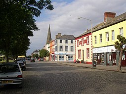 Criffel Street | |
| Land |  Storbritannien Storbritannien |
|---|---|
| Riksdel | England |
| Grevskap | Cumbria |
| Enhetskommun | Cumberland |
| Civil parish | Silloth-on-Solway |
| Koordinater | 54°52′07″N 3°23′21″V / 54.8685°N 3.3892°V / 54.8685; -3.3892 |
| Folkmängd | 2 932 (2001) |
| Tidszon | UTC (UTC+0) |
| - sommartid | BST (UTC+1) |
| Geonames | 2637836 |
  Läge i Storbritannien | |
Silloth[1] är en stad i civil parish Silloth-on-Solway, i distriktet Cumberland, i grevskapet Cumbria, i England. Orten hade 2 932 invånare år 2001.[2] Den har en kyrka.[3][4]
| |||||


