Bishopton, County Durham
Human settlement in England
- Darlington
- County Durham
- North East
- Sedgefield
- List of places
- UK
- England
- County Durham
Bishopton is a village in the borough of Darlington and the ceremonial county of County Durham, England. It is situated to the west of Stockton-on-Tees. It originated as a farming community with rows of cottages and several farms forming a long wide village street, with an adjacent green. St Peter's Church stands at the centre of the village. The hamlet of Little Stainton and the village of Great Stainton were formerly part of the parish of Bishopton.
Castle Hill
The earthworks of a motte-and-bailey fortification known as Castle Hill are situated 400m south of the village and west of Bishopton Beck which flows west of the village. The fortification, which is a Scheduled Ancient Monument,[2] dates back to at least the 12th century, with a licence to crenellate having been granted in 1143 during the time of The Anarchy.
Education
As of 2011 Bishopton Redmarshall CofE Primary School, which is situated in the north-west of the village, had 106 pupils, aged 4–11.[3] In October 2006 Ofsted judged the school to be good and this rating was maintained in the June 2010 interim inspection.[4] In August 2011 the school reopened as an Academy.[5] As of September 2007 the school has been in a federation with Heighington CE Primary School.[6][7]
Religious sites
St Peter's Church, Bishopton, is an active Anglican parish church in the deanery of Stockton, the archdeaconry of Auckland, and the diocese of Durham.[8] The church has been designated by English Heritage as a Grade II listed building.[9]
Sport
South of the village there is a lake which was a former gravel pit[10] and is now used as a windsurfing centre.[11]
Gallery
-

-
 Bishopton/Redmarshall CofE Primary School
 -
 The village hall
 -
 The local garage
 -
 The Talbot
 -
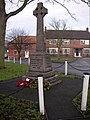 The Great War Memorial
 -
 The bus stop, near to the church
 -
 The bus stop bench and sign


References
- ^ "Parish population 2011". Archived from the original on 26 July 2015. Retrieved 25 July 2015.
- ^ Historic England. "Motte and Bailey Castle, Bishopton (1008668)". National Heritage List for England. Retrieved 20 September 2012.
- ^ "Department of Education School Statistics". Retrieved 20 September 2012.
- ^ "Ofsted Inspection Report". Archived from the original on 2 May 2014. Retrieved 11 September 2012.
- ^ "Department of Education School Statistics". Retrieved 20 September 2012.
- ^ "Heighington CE Primary School". Archived from the original on 27 June 2013.
- ^ "The Federation of Bishopton, Redmarshall and Heighington CE Primary Schools". Darlington Borough Council.
- ^ St Peter, Bishopton, Church of England, retrieved 21 June 2010
- ^ Historic England. "Church of St Peter, Bishopton (1185897)". National Heritage List for England. Retrieved 29 May 2012.
- ^ "Bishopton Windsurfing Centre". Retrieved 20 September 2012.
- ^ "Bishopton Lake". Retrieved 20 September 2012.[permanent dead link]
External links
Wikimedia Commons has media related to Bishopton, County Durham.
- Bishopton Village Website
- An england.net site
- Village Hall
- History
- Village Notes
- v
- t
- e
- including Stockton-on-Tees (north of the river)
- Parishes
- Archdeacon Newton
- Barmpton
- Bishopton
- Brafferton
- Coatham Mundeville
- Denton
- East and West Newbiggin
- Great Burdon
- Great Stainton
- Heighington
- High Coniscliffe
- Houghton le Side
- Hurworth
- Killerby
- Little Stainton
- Low Coniscliffe and Merrybent
- Middleton St. George
- Morton Palms
- Neasham
- Piercebridge
- Sadberge
- Summerhouse
- Walworth
- Whessoe
- Unparished areas
- The former Darlington County Borough
- Towns
- Barnard Castle
- Bishop Auckland
- Chilton
- Ferryhill
- Great Aycliffe
- Greater Willington
- Peterlee
- Seaham
- Sedgefield
- Shildon
- Spennymoor
- Stanley
- Tow Law
- Parishes
- Barforth
- Barningham
- Bearpark
- Belmont
- Bishop Middleham
- Bolam
- Boldron
- Bournmoor
- Bowes
- Bradbury and the Isle
- Brancepeth
- Brandon and Byshottles
- Brignall
- Burnhope
- Cassop-cum-Quarrington
- Castle Eden
- City of Durham
- Cleatlam
- Cockfield
- Cornforth
- Cornsay
- Cotherstone
- Coxhoe
- Croxdale and Hett
- Dalton-le-Dale
- Dene Valley
- Easington Colliery
- Easington Village
- Edmondbyers
- Edmondsley
- Eggleston
- Egglestone Abbey
- Eldon
- Esh
- Etherley
- Evenwood and Barony
- Fishburn
- Forest and Frith
- Framwellgate Moor
- Gainford
- Gilmonby
- Great Lumley
- Greencroft
- Hamsterley
- Hamsterley Common
- Haswell
- Hawthorn
- Headlam
- Healeyfield
- Hedleyhope
- Hilton
- Holwick
- Hope
- Horden
- Hunderthwaite
- Hunstanworth
- Hutton Henry and Station Town
- Hutton Magna
- Ingleton
- Kelloe
- Kimblesworth and Plawsworth
- Lanchester
- Langleydale and Shotton
- Langton
- Lartington
- Little Lumley
- Lunedale
- Lynesack and Softley
- Marwood
- Mickleton
- Middleton in Teesdale
- Middridge
- Monk Hesleden
- Mordon
- Morton Tinmouth
- Muggleswick
- Murton
- Nesbitt
- Newbiggin
- North Lodge
- Ouston
- Ovington
- Pelton
- Pittington
- Raby with Keverstone
- Rokeby
- Romaldkirk
- Sacriston
- Satley
- Scargill
- Seaton with Slingley
- Shadforth
- Sheraton with Hulam
- Sherburn Village
- Shincliffe
- Shotton
- South Bedburn
- South Hetton
- Staindrop
- Stanhope
- Startforth
- Streatlam and Stainton
- Thornley
- Toft Hill
- Trimdon
- Trimdon Foundry
- Urpeth
- Waldridge
- Wackerfield
- Weather Hill Wood
- West Auckland
- West Rainton and Leamside
- Westwick
- Wheatley Hill
- Whorlton
- Windlestone
- Wingate
- Winston
- Witton Gilbert
- Witton-le-Wear
- Wolsingham
- Wolsingham Park Moor
- Woodland
- Wycliffe with Thorpe
- Unparished areas
- The former Chester le Street Urban District
- Consett
- Parts of the former Durham Municipal Borough
- Parts of the former Bishop Auckland Urban District
- Crook and Willington Urban District
- Stanley Urban District
- Towns
- Headland
- Parishes
- Brierton
- Claxton
- Dalton Piercy
- Elwick
- Greatham
- Hart
- Newton Bewley
- Wynyard
- Unparished areas
- Part of the former Hartlepool County Borough
- Towns
- Billingham
- Parishes
- Aislaby
- Carlton
- Egglescliffe
- Elton
- Grindon and Thorpe Thewles
- Longnewton
- Newsham
- Preston-on-Tees
- Redmarshall
- Stillington and Whitton
- Wolviston
- Wynyard
- Unparished areas
- Part of the former Teesside County Borough
- For further information about the above parishes, see List of civil parishes in County Durham.
- For the part of Stockton-on-Tees (borough) south of the River Tees, see List of civil parishes in North Yorkshire.
| Authority control databases: National |
|
|---|
 | This County Durham location article is a stub. You can help Wikipedia by expanding it. |
- v
- t
- e


