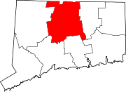
Broad Brook, Connecticut
Broad Brook is a neighborhood[1] and census-designated place (CDP) in the town of East Windsor, Hartford County, Connecticut, United States. As of the 2010 census, the CDP population was 4,069.[2]
Geography
The Broad Brook CDP occupies most of the east-central part of the town of East Windsor. It is bordered to the east by the town of Ellington in Tolland County, to the south by Chamberlain Road and Ketch Brook, to the west by the Scantic River, and to the north by Connecticut Route 140 and a portion of Broad Brook, the community's namesake waterway.
The community is 11 miles (18 km) north of East Hartford and 7 miles (11 km) south of Thompsonville.
According to the United States Census Bureau, the CDP has a total area of 5.9 square miles (15.4 km2), of which 5.9 square miles (15.3 km2) is land and 0.039 square miles (0.1 km2), or 0.58%, is water.[2]
Demographics
As of the census[3] of 2000, there were 3,469 people, 1,433 households, and 932 families residing in the CDP. The population density was 586.2 inhabitants per square mile (226.3/km2). There were 1,589 housing units at an average density of 268.5 per square mile (103.7/km2). The racial makeup of the CDP was 91.76% White, 4.44% African American, 1.53% Asian, 1.04% from other races, and 1.24% from two or more races. Hispanic or Latino of any race were 2.16% of the population.
There were 1,433 households, out of which 33.4% had children under the age of 18 living with them, 51.2% were married couples living together, 10.3% had a female householder with no husband present, and 34.9% were non-families. 28.3% of all households were made up of individuals, and 9.6% had someone living alone who was 65 years of age or older. The average household size was 2.42 and the average family size was 3.00.
In the CDP, the population was spread out, with 45.5% under the age of 18, 6.7% from 18 to 24, 34.4% from 25 to 44, 21.5% from 45 to 64, and 11.6% who were 65 years of age or older. The median age was 37 years. For every 100 females, there were 93.5 males. For every 100 females age 18 and over, there were 89.5 males.
The median income for a household in the CDP was $50,417, and the median income for a family was $58,138. Males had a median income of $38,222 versus $32,250 for females. The per capita income for the CDP was $23,244. About 3.5% of families and 4.6% of the population were below the poverty line, including 4.0% of those under age 18 and 7.6% of those age 65 or over.
Notable residents
- Jerry Marquis, NASCAR 2000 Featherlite Modified champion
References
- ^ "Principal Communities in Connecticut". CT Department of Economic and Community Development. Retrieved November 29, 2012.
- ^ a b "Geographic Identifiers: 2010 Demographic Profile Data (G001): Broad Brook CDP, Connecticut". U.S. Census Bureau, American Factfinder. Archived from the original on February 12, 2020. Retrieved November 29, 2012.
- ^ "U.S. Census website". United States Census Bureau. Retrieved January 31, 2008.
- v
- t
- e
- Index
- Constitution
- Delegations
- Elections
- Geography
- Government
- History
- Images
- People
- Symbols
- Tourist attractions
- Andover
- Ansonia
- Ashford
- Avon
- Barkhamsted
- Beacon Falls
- Berlin
- Bethany
- Bethel
- Bethlehem
- Bloomfield
- Bolton
- Bozrah
- Branford
- Bridgeport
- Bridgewater
- Bristol
- Brookfield
- Brooklyn
- Burlington
- Canaan
- Canterbury
- Canton
- Chaplin
- Cheshire
- Chester
- Clinton
- Colchester
- Colebrook
- Columbia
- Cornwall
- Coventry
- Cromwell
- Danbury
- Darien
- Deep River
- Derby
- Durham
- East Granby
- East Haddam
- East Hampton
- East Hartford
- East Haven
- East Lyme
- East Windsor
- Eastford
- Easton
- Ellington
- Enfield
- Essex
- Fairfield
- Farmington
- Franklin
- Glastonbury
- Goshen
- Granby
- Greenwich
- Griswold
- Groton
- Guilford
- Haddam
- Hamden
- Hampton
- Hartford
- Hartland
- Harwinton
- Hebron
- Hartford
- Kent
- Killingly
- Killingworth
- Lebanon
- Ledyard
- Lisbon
- Litchfield
- Lyme
- Madison
- Manchester
- Mansfield
- Marlborough
- Meriden
- Middlebury
- Middlefield
- Middletown
- Milford
- Monroe
- Montville
- Morris
- Naugatuck
- New Britain
- New Canaan
- New Fairfield
- New Hartford
- New Haven
- New London
- New Milford
- Newington
- Newtown
- Norfolk
- North Branford
- North Canaan
- North Haven
- North Stonington
- Norwalk
- Norwich
- Old Lyme
- Old Saybrook
- Orange
- Oxford
- Plainfield
- Plainville
- Plymouth
- Pomfret
- Portland
- Preston
- Prospect
- Putnam
- Redding
- Ridgefield
- Rocky Hill
- Roxbury
- Salem
- Salisbury
- Scotland
- Seymour
- Sharon
- Shelton
- Sherman
- Simsbury
- Somers
- South Windsor
- Southbury
- Southington
- Sprague
- Stafford
- Stamford
- Sterling
- Stonington
- Stratford
- Suffield
- Thomaston
- Thompson
- Tolland
- Torrington
- Trumbull
- Union
- Vernon
- Voluntown
- Wallingford
- Warren
- Washington
- Waterbury
- Waterford
- Watertown
- West Hartford
- West Haven
- Westbrook
- Weston
- Westport
- Wethersfield
- Willington
- Wilton
- Winchester
- Windham
- Windsor
- Windsor Locks
- Wolcott
- Woodbridge
- Woodbury
- Woodstock
- Boroughs
- Villages
- Historic Places
- Geography
 Connecticut portal


