Western Connecticut Planning Region, Connecticut
Planning region in Connecticut
Logo

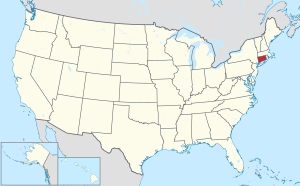
Location within the U.S. state of Connecticut
Connecticut's location within the U.S.
 United States
 Connecticut
 (2020)

Interactive map of the Western Connecticut Planning Region
The Western Connecticut Planning Region is a planning region and county-equivalent in Connecticut. It is served by the coterminous Western Connecticut Council of Governments (WestCOG), one of nine regional councils of governments in Connecticut. Within the region, there are two Metropolitan Planning Organizations, South Western CT MPO and the Housatonic Valley MPO.
The region includes the Connecticut Panhandle, Greater Danbury, and the Gold Coast. In 2022, planning regions were approved to replace Connecticut's counties as county-equivalents for statistical purposes, with full implementation occurring by 2024.[1][2]
Demographics
| Census | Pop. | Note | %± |
|---|---|---|---|
| 2020 | 620,549 | — | |
| 2022 (est.) | 623,690 | [3] | 0.5% |
| U.S. Decennial Census[2] | |||
As of the 2020 United States census, there were 620,549 people living in the Western Connecticut Planning Region, making it the second most populated region in the state behind the Capitol Planning Region.
Municipalities

The following municipalities are members of the Western Connecticut Region:[4]
Cities
Towns
- Bethel
- Bridgewater
- Brookfield
- Darien
- Greenwich
- New Canaan
- New Fairfield
- New Milford
- Newtown
- Redding
- Ridgefield
- Sherman
- Weston
- Westport
- Wilton
References
- ^ "Governor Lamont Announces U.S. Census Bureau Approves Proposal for Connecticut's Planning Regions To Become County Equivalents". CT.gov. Retrieved March 24, 2023.
- ^ a b "Change to County-Equivalents in the State of Connecticut". Federal Register. June 6, 2022. Retrieved March 24, 2023.
- ^ "U.S. Census Bureau QuickFacts: Western Connecticut Planning Region, Connecticut; United States". www.census.gov. Retrieved May 13, 2023.
- ^ "About". Western Connecticut Council of Governments. Retrieved March 24, 2023.
External links
Wikimedia Commons has media related to Western Connecticut Planning Region, Connecticut.
- Western Connecticut Council of Governments
- v
- t
- e
Municipalities and communities of Western Connecticut Planning Region, Connecticut, United States

- Connecticut portal
- United States portal


