Cascavel, Ceará
You can help expand this article with text translated from the corresponding article in Portuguese. (April 2012) Click [show] for important translation instructions.
- View a machine-translated version of the Portuguese article.
- Machine translation, like DeepL or Google Translate, is a useful starting point for translations, but translators must revise errors as necessary and confirm that the translation is accurate, rather than simply copy-pasting machine-translated text into the English Wikipedia.
- Consider adding a topic to this template: there are already 1,519 articles in the main category, and specifying
|topic=will aid in categorization. - Do not translate text that appears unreliable or low-quality. If possible, verify the text with references provided in the foreign-language article.
- You must provide copyright attribution in the edit summary accompanying your translation by providing an interlanguage link to the source of your translation. A model attribution edit summary is
Content in this edit is translated from the existing Portuguese Wikipedia article at [[:pt:Cascavel (Ceará)]]; see its history for attribution. - You should also add the template
{{Translated|pt|Cascavel (Ceará)}}to the talk page. - For more guidance, see Wikipedia:Translation.
Municipality in Nordeste, Brazil
Flag

Seal
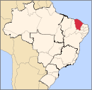
 Brazil
 (2020 [1])
Cascavel is a municipality in the state of Ceará in the Northeast region of Brazil.[2][3][4][5]
See also
References
- ^ IBGE 2020
- ^ "Divisão Territorial do Brasil" (in Portuguese). Divisão Territorial do Brasil e Limites Territoriais, Instituto Brasileiro de Geografia e Estatística (IBGE). July 1, 2008. Retrieved December 17, 2009.
- ^ "Estimativas da população para 1º de julho de 2009" (PDF) (in Portuguese). Estimativas de População, Instituto Brasileiro de Geografia e Estatística (IBGE). August 14, 2009. Retrieved December 17, 2009.
- ^ "Ranking decrescente do IDH-M dos municípios do Brasil" (in Portuguese). Atlas do Desenvolvimento Humano, Programa das Nações Unidas para o Desenvolvimento (PNUD). 2000. Archived from the original on October 3, 2009. Retrieved December 17, 2009.
- ^ "Produto Interno Bruto dos Municípios 2002-2005" (PDF) (in Portuguese). Instituto Brasileiro de Geografia e Estatística (IBGE). December 19, 2007. Archived from the original (PDF) on October 2, 2008. Retrieved December 17, 2009.
- v
- t
- e

Capital: Fortaleza
Centro-Sul Cearense | |||||||
|---|---|---|---|---|---|---|---|
| |||||||
Jaguaribe | |||||||||
|---|---|---|---|---|---|---|---|---|---|
| |||||||||
Metropolitana de Fortaleza | |||||
|---|---|---|---|---|---|
| |||||
Noroeste Cearense | |||||||||||||||
|---|---|---|---|---|---|---|---|---|---|---|---|---|---|---|---|
| |||||||||||||||
Norte Cearense | |||||||||||||||||
|---|---|---|---|---|---|---|---|---|---|---|---|---|---|---|---|---|---|
| |||||||||||||||||
Sertoes Cearenses | |||||||||
|---|---|---|---|---|---|---|---|---|---|
| |||||||||
Sul Cearense | |||||||||||
|---|---|---|---|---|---|---|---|---|---|---|---|
| |||||||||||
| Authority control databases: National |
|
|---|
4°07′51″S 38°14′09″W / 4.13083°S 38.2358°W / -4.13083; -38.2358
 | This Ceará, Brazil location article is a stub. You can help Wikipedia by expanding it. |
- v
- t
- e


