Salitre, Ceará
Municipality in Northeast, Brazil
Salitre | |
|---|---|
Municipality | |
| The Municipality of Salitre | |
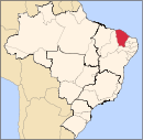
 Location of Salitre in the State of Ceará | |
| Country |  Brazil Brazil |
| Region | Northeast |
| State |  Ceará Ceará |
| Founded | June 30, 1988 |
| Government | |
| • Mayor | Agenor Manoel Ribeiro (PT) |
| Area | |
| • Total | 899.824 km2 (347.424 sq mi) |
| Elevation | 230 m (740 ft) |
| Population (2020 [1]) | |
| • Total | 16,635 |
| • Density | 18/km2 (48/sq mi) |
| Time zone | UTC−3 (BRT) |
| HDI (2000) | 0.558 – medium[2] |
| Website | www.Salitre.ce.gov.br |
Salitre is a municipality of the Northeastern state of Ceará in Brazil. It is located in the southwest corner of the state, being the only municipality to have boundaries with both Piauí and Bahia states.
References
- v
- t
- e
Capital: Fortaleza
Centro-Sul Cearense | |||||||
|---|---|---|---|---|---|---|---|
| |||||||
Jaguaribe | |||||||||
|---|---|---|---|---|---|---|---|---|---|
| |||||||||
Metropolitana de Fortaleza | |||||
|---|---|---|---|---|---|
| |||||
Noroeste Cearense | |||||||||||||||
|---|---|---|---|---|---|---|---|---|---|---|---|---|---|---|---|
| |||||||||||||||
Norte Cearense | |||||||||||||||||
|---|---|---|---|---|---|---|---|---|---|---|---|---|---|---|---|---|---|
| |||||||||||||||||
Sertoes Cearenses | |||||||||
|---|---|---|---|---|---|---|---|---|---|
| |||||||||
Sul Cearense | |||||||||||
|---|---|---|---|---|---|---|---|---|---|---|---|
| |||||||||||
Authority control databases | |
|---|---|
| International |
|
| National |
|
7°17′02″S 40°27′38″W / 7.28389°S 40.46056°W / -7.28389; -40.46056
 | This Ceará, Brazil location article is a stub. You can help Wikipedia by expanding it. |
- v
- t
- e


