Chandrapura Junction railway station

Railway station in Jharkhand, India

23°45′19″N 86°07′11″E / 23.7554°N 86.1197°E / 23.7554; 86.1197Elevation227 metres (745 ft)Owned byIndian RailwaysOperated byEast Central RailwayLine(s)Gomoh–Barkakana branch line
Chandrapura–Muri branch line Mahuda–Adra–Kharagpur Railways in Jharia CoalfieldPlatforms3Tracks6ConstructionStructure typeStandard (on ground station)ParkingYesBicycle facilitiesNoOther informationStatusFunctioningStation codeCRP Zone(s) East Central Railway zone Division(s) DhanbadHistoryOpened1913; 111 years ago (1913)Rebuilt1927Electrified1986–89Services
Preceding station Indian Railways Following station
Telo
towards ?
East Central Railway zone Bhandaridah
towards ?
Jamuniatand
towards ?
East Central Railway zone
Chandrapura–Muri branch line Dhanbad-Chandrapura line
Rajabera
towards ?
Location
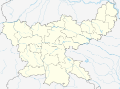
Chandrapura Junction is located in Jharkhand
Chandrapura Junction
Location in Jharkhand
Show map of Jharkhand
Chandrapura Junction is located in India
Chandrapura Junction
Location in India
Show map of India

Chandrapura Junction Railway Station is a railway junction station at the junction of Gomoh–Barkakana branch line and Chandrapura–Muri branch line mainly a part of Railways in Jharia Coalfield. It is located in Bokaro district in the Indian state of Jharkhand.

History

In 1913, Chandrapura was connected to Mahuda and merged to Gomoh–Mahuda–Adra–Kharagpur (BNR) line and then became a Railways in Jharia Coalfield. In 1927, the Central India Coalfields Railway opened the Gomoh–Barkakana line. Later, the line was amalgamated with East Indian Railway.[1] The construction of the 143 kilometres (89 mi) long Chandrapura–Muri–Ranchi–Hatia line started in 1957 and was completed in 1961.[2]

Electrification

Railway lines in the Chandrapura area (including Bokaro Steel City Yard) were electrified in 1986–89.[3]

References

  1. ^ "Indian Railway History Timeline". Archived from the original on 29 February 2012. Retrieved 26 August 2008.
  2. ^ Moonis Raza & Yash Aggarwal (1986). Transport Geography of India: Commodity Flow and the Regional Structure of Indian Economy. Concept Publishing Company, A-15/16 Commercial Block, Mohan Garden, New Delhi – 110059. ISBN 81-7022-089-0. Retrieved 20 April 2013. {{cite book}}: |work= ignored (help)
  3. ^ "History of Electrification". IRFCA. Retrieved 20 April 2013.

External links

  • Trains at Chandrapura
  • v
  • t
  • e
ERTooltip Eastern Railway zone
Asansol
Howrah
Malda
ECRTooltip East Central Railway zone
Dhanbad
SERTooltip South Eastern Railway zone
Adra
Chakradharpur
Ranchi
  • v
  • t
  • e
General
Districts
Sub-divisions
Bokaro
Chatra
Giridih
Koderma
Hazaribagh
Ramgarh
Community development
blocks
Bokaro
Chatra
Dhanbad
  • Baghmara
  • Baliapur
  • Dhanbad
  • Govindpur
  • Jharia
  • Nirsa
  • Purbi Tundi
  • Topchanchi
  • Tundi
Giridih
Hazaribagh
  • Barhi
  • Barkagaon
  • Barkatha
  • Bishnugarh
  • Chalkusha
  • Chauparan
  • Churchu
  • Dadi
  • Daru
  • Ichak
  • Katkamdag
  • Katkamsandi
  • Keredari
  • Padma
  • Sadar, Hazaribagh
  • Tati Jhariya
Koderma
  • Chandwara
  • Domchanch
  • Jainagar
  • Koderma
  • Markacho
  • Satgawan
Ramgarh
  • Chitarpur
  • Dulmi
  • Gola
  • Mandu
  • Patratu
  • Ramgarh
Rivers, waterfalls, dams
Languages, people
Transport
Railway stations
Coalfields and
coal companies
Institutes of higher learning
Lok Sabha constituencies
  • Chatra
  • Dhanbad
  • Giridih
  • Hazaribagh
  • Kodarma
Vidhan Sabha
constituencies
Chatra
  • Chatra
  • Simaria
Dhanbad
  • Bokaro
  • Sindri
  • Nirsa
  • Dhanbad
  • Jharia
  • Chandankiyari
Giridih
  • Giridih
  • Dumri
  • Gomia
  • Bermo
  • Tundi
  • Baghmara
Hazaribagh
  • Barhi
  • Barkagaon
  • Ramgarh
  • Mandu
  • Hazaribagh
Kodarma
  • Kodarma
  • Barkatha
  • Dhanwar
  • Bagodar
  • Jamua
  • Gandey
See also
  • Cities and towns in North Chotanagpur Division
  • Villages in Bokaro district
  • Villages in Dhanbad district
  • Villages in Giridih district
  • Villages in Hazaribagh district
  • Damodar Basin
Other divisions
  • South Chotanagpur
  • Kolhan
  • Palamu
  • Santhal Pargana


Stub icon

This article about a railway station in the Indian state of Jharkhand is a stub. You can help Wikipedia by expanding it.

  • v
  • t
  • e