Driefontein is the Driefontein Mine in the West Witwatersrand Basin (West Wits) mining field. The West Wits field was discovered in 1931 and commenced operations with Venterspost Gold Mine in 1939. In 1952, the West Driefontein mine is opened. In 1968, Kloof mine commences operations. In 1972, East Driefontein opens. In 1981, consolidation starts. In 1999, Gold Fields took control of the combined East and West Driefontein mines and merged them starting 2000 with Venterspost, Libanon, Leuudoorn and Kloof mines . In 2010, the current Kloof-Driefontein Complex, comprising KDC East and KDC West, is formed.
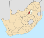
The place is situated in Merafong City local municipality, West Rand district, Gauteng province, South Africa. Similar[how?] census locations are East Driefontein (also/officially East Driefontein Mine) and West Driefontein, also Eastdriefontein and Westdriefontein. Similar names in Afrikaans: Oos Driefontein and Wes Driefontein, Oosdriefontein and Wesdriefontein.
The seat of the district is Randfontein. Part of the West Rand 1886 Witwatersrand Gold Rush region, although to the west-southwest of Johannesburg itself, it is part of the Johannesburg conurbation.
It does not seem[clarification needed] the place after which the Battle of Driefontein (Second Boer War, 10 March 1900) was named. That place is described as 6 miles (10 km) south of Abraham's Kraal (or Abrams Kraal or Abramskraal).
External links
- "Traveling Luck for Oos-Driefontein Gauteng, South Africa". travelingluck.com. Retrieved 7 November 2023.
- "Kloof-Driefontein Complex (KDC) Technical Short Form Report 21 December 2011" (PDF). goldfields.co.za. 21 December 2011. Archived from the original (PDF) on 15 July 2013. Retrieved 7 November 2023.
Greater Johannesburg
Natural environment |
|---|
| Geology | |
|---|
| Topography | |
|---|
Rivers and
wetlands | |
|---|
| Climate | |
|---|
Cradle of
Humankind | |
|---|
| Biodiversity | | Vegetation types | - Andesite Mountain Bushveld
- Carletonville Dolomite Grassland
- Eastern Highveld Grassland
- Eastern Temperate Freshwater Wetlands
- Egoli Granite Grassland
- Gauteng Shale Mountain Bushveld
- Gold Reef Mountain Bushveld
- Highveld Alluvial Vegetation
- Moot Plains Bushveld
- Rand Highveld Grassland
- Soweto Highveld Grassland
- Tsakane Clay Grassland
- Urban woodland
|
|---|
| Parks and gardens | |
|---|
| Nature reserves | |
|---|
|
|---|
| Human impact | |
|---|
|
|
|
Cityscape |
|---|
| Landmarks | | Public art | |
|---|
Civic
buildings | |
|---|
Office
buildings | |
|---|
Residential
buildings | |
|---|
| Structures | |
|---|
|
|---|
| Urban planning | |
|---|
|
|
|
Politics |
|---|
| Governing parties | |
|---|
Political organisations
and parties based in
Greater Johannesburg | | Political parties | |
|---|
| Trade unions | |
|---|
Other political
organisations | |
|---|
|
|---|
|
|
|
|---|
| Fortifications | |
|---|
Monuments
and memorials | |
|---|
| Cemeteries | |
|---|
Historical
sites | |
|---|
Historical
companies and
organisations | | Companies | |
|---|
Political
organisations | |
|---|
| Other organisations | |
|---|
|
|---|
| Events | |
|---|
|
|
|
|---|
| Cultural heritage | |
|---|
| Performance art | | Musical ensembles | |
|---|
| Theatres | |
|---|
|
|---|
| Events and festivals | |
|---|
Museums and art
galleries | |
|---|
| Clubs and societies | |
|---|
|
|
Religion |
|---|
- SACC
- Anglican
- Catholic
- Protestant
- Jewish
- Islamic
Places of
worship | | Churches | |
|---|
| Synagogues | |
|---|
| Mosques | |
|---|
| Hindu temples | |
|---|
| Scientology centres | |
|---|
|
|---|
|
|
Media |
|---|
| Mass media | | Magazines | |
|---|
| Newspapers | | Defunct | - New Age
- The New Age
- The World
|
|---|
|
|---|
| Radio stations | |
|---|
| Television channels | |
|---|
| Film studios | |
|---|
| Record labels | |
|---|
| Game studios | |
|---|
|
|---|
| Cultural references | |
|---|
|
|
|
|---|
| Companies | |
|---|
Diversified
conglomerates | |
|---|
| Airlines | |
|---|
Construction
and engineering | |
|---|
| Energy | |
|---|
Financial
| |
|---|
| Hospitality | |
|---|
| ICT | |
|---|
| Legal | |
|---|
| Manufacturing | |
|---|
| Media | |
|---|
| Mining | |
|---|
Retail and
marketing | |
|---|
Restaurant
franchises | |
|---|
| Services | |
|---|
| Transport | |
|---|
State-owned
enterprises | |
|---|
 Companies based in Ekurhuleni Companies based in Ekurhuleni- Companies based in Johannesburg
|
|
|---|
Professional
associations | |
|---|
| Mining | |
|---|
| Shopping centres | |
|---|
| Hotels and resorts | |
|---|
| Venues | |
|---|
Restaurants,
bars and cafés | |
|---|
| Tourism | |
|---|
|
|
|
|
|---|
Sports governing
bodies based in
Greater Johannesburg | |
|---|
| Teams | | Soccer | |
|---|
| Rugby | |
|---|
| Cricket | |
|---|
| Basketball | |
|---|
|
|---|
| Equestrian sports | |
|---|
| Sports events | |
|---|
| Sports venues | Stadia and
arenas | |
|---|
| Golf courses | |
|---|
Equestrian
venues | |
|---|
Motorsports
venues | |
|---|
|
|---|
|
|
|
|---|
| Libraries | |
|---|
| Universities | |
|---|
Other tertiary
institutions | | Business schools | |
|---|
| Religious institutions | |
|---|
|
|---|
| State schools | |
|---|
| Private schools | |
|---|
| Alternative schools | |
|---|
| International schools | |
|---|
|
|
Services |
|---|
| Hospitals | |
|---|
Water supply
and sanitation | |
|---|
| Electricity supply | |
|---|
Law enforcement and
emergency services | |
|---|
| Charities and NGOs | |
|---|
|
|
Military units and formations |
|---|
|
|
- Category
- Johannesburg
|
26°23′12″S 27°29′48″E / 26.3866°S 27.4968°E / -26.3866; 27.4968
 | This Gauteng location article is a stub. You can help Wikipedia by expanding it. |