Hebersham, New South Wales
Suburb of Sydney, New South Wales, Australia
| Hebersham Sydney, New South Wales | |||||||||||||||
|---|---|---|---|---|---|---|---|---|---|---|---|---|---|---|---|
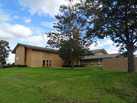 LDS Church on Pringle Road | |||||||||||||||
 | |||||||||||||||
| Population | 5,685 (2016 census)[1] | ||||||||||||||
| Postcode(s) | 2770 | ||||||||||||||
| Elevation | 60 m (197 ft) | ||||||||||||||
| Location | 47 km (29 mi) W of Sydney CBD | ||||||||||||||
| LGA(s) | City of Blacktown | ||||||||||||||
| State electorate(s) | Mount Druitt | ||||||||||||||
| Federal division(s) | Chifley | ||||||||||||||
| |||||||||||||||
Hebersham is a suburb of Sydney, in the state of New South Wales, Australia. Hebersham is located 47 kilometres west of the Sydney central business district, in the local government area of the City of Blacktown and is part of the Greater Western Sydney region.
History
Hebersham was coined to honour the Anglican Bishop Reginald Heber of Calcutta whose diocese included New South Wales. In 1829 the Trustees of the Clergy and Schools Lands in New South Wales planned to establish a village named Hebersham on the Western Highway, west of Eastern Creek. This never happened, but the name was used for this present day suburb.[2]
Population
According to the 2016 census of Population, there were 5,685 people in Hebersham.
- Aboriginal and Torres Strait Islander people made up 6.4% of the population.
- 58.1% of people were born in Australia. The next most common countries of birth were Philippines 4.7%, Fiji 4.3%, New Zealand 4.3%, Pakistan 2.2% and England 1.9%.
- 59.2% of people spoke only English at home. Other languages spoken at home included Hindi 4.4%, Arabic 4.1%, Samoan 3.6%, Urdu 3.5% and Tagalog 3.3%.
- The most common responses for religion were Catholic 26.7%, No Religion 17.7%, Anglican 11.7% and Islam 11.4%.[1]
Education
Hebersham is also home to Hebersham Public School, a primary school founded in 1972.[3]
References
- ^ a b Australian Bureau of Statistics (27 June 2017). "Hebersham (State Suburb)". 2016 Census QuickStats. Retrieved 8 June 2019.

 Material was copied from this source, which is available under a Creative Commons Attribution 4.0 International License.
 - ^ The Book of Sydney Suburbs, Compiled by Frances Pollen, Angus & Robertson Publishers, 1990, Published in Australia ISBN 0-207-14495-8
- ^ "School History – Hebersham Public School". Retrieved 11 April 2012.
33°45′10″S 150°59′00″E / 33.7527°S 150.9833°E / -33.7527; 150.9833
- v
- t
- e
Suburbs within Blacktown City Council, Greater Western Sydney
- Acacia Gardens
- Angus
- Arndell Park
- Bidwill
- Blackett
- Blacktown
- Bungarribee
- Colebee
- Dean Park
- Dharruk
- Doonside
- Eastern Creek
- Emerton
- Glendenning
- Glenwood
- Grantham Farm
- Hassall Grove
- Hebersham
- Huntingwood
- Kellyville Ridge
- Kings Langley
- Kings Park
- Lalor Park
- Lethbridge Park
- Marayong
- Marsden Park
- Melonba
- Minchinbury
- Mount Druitt
- Nirimba Fields
- Oakhurst
- Parklea
- Plumpton
- Prospect
- Quakers Hill
- Richards
- Riverstone
- Rooty Hill
- Ropes Crossing
- Rouse Hill
- Schofields
- Seven Hills
- Shalvey
- Shanes Park
- Stanhope Gardens
- Tallawong
- Toongabbie
- The Ponds
- Tregear
- Vineyard
- Whalan
- Willmot
- Woodcroft
 | This article related to the geography of Sydney is a stub. You can help Wikipedia by expanding it. |
- v
- t
- e


